Start free trial

Start free for 3 days on any yearly plan — nothing charged until the trial ends.

Open the map

Pricing

Two tiers. Every gold state.

Every gold state, no per-state charges. Explorer gets you on the ground with both modes — Gold Maps and Coin & Relic; Pro adds LiDAR, property boundaries, PLSS sections and claim alerts.

Explorer

Get on the ground.

$7.99/ month USD
3-day free trial
$59.99/ year USD

$5.00/mo — billed yearly

About 16c a day.

  • Historic gold workings + goldfield layers
  • Both modes included — Gold + Coin & Relic
  • Base map + core mapping tools
  • Offline maps in the field
  • 9,500+ historical maps to overlay
  • Georeference your own maps — 10 uploads
  • Community feed + waypoint sync

LiDAR, property boundaries, PLSS sections & claim alerts live in Pro.

See everything included
Get Explorer

billed monthly — cancel anytime

Start free trial

3-day trial, then $59.99/yr — cancel anytime

Built for serious prospectors

Pro

The full toolkit, unlocked.

$11.99/ month USD
3-day free trial
$99.99/ year USD

$8.33/mo — billed yearly

About 27c a day.

  • Everything in Explorer
  • Advanced LiDAR hillshade
  • Property boundaries + land access
  • PLSS sections on the map
  • Frequent alerts on claim changes
  • Unlimited georeference uploads
  • Full desktop web app
See everything included
Get Pro

billed monthly — cancel anytime

Start free trial

3-day trial, then $99.99/yr — cancel anytime

From the community feed

Real members. Real finds.
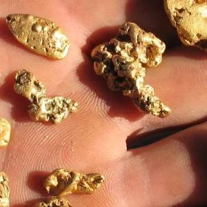
Find photo shared in the Detector Maps community feed
22g+ · WvhillbillyUnited States · Mar 2026
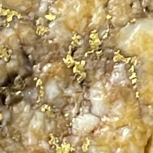
Find photo shared in the Detector Maps community feed
5.4 oz · KenoAustralia · May 2026
Find photo shared in the Detector Maps community feed
3.6g · English prospectorScotland, UK · 2025
LiDAR · in Pro

1-metre LiDAR, in Pro.

Bare-earth LiDAR hillshade from USGS 3DEP — rendered eight ways with slope and elevation tints — comes with Pro, with no separate add-on. Coverage depends on what’s been publicly flown in your area.

Included — no add-on

Why subscribe?

Layers that find ground

Claims, geology, geochemistry and a century of old workings — stacked on one map.

Built for offline

Download before you leave. GPS keeps working with zero bars — the maps are already on the phone.

Three devices

Web for the planning nights, iOS and Android in the field. One subscription covers all three.

A community that shares

A live finds feed, a monthly find competition and community maps you can load into your own.

FAQ

The questions we get most.

If yours isn’t here, email [email protected] — we read every one.

Start free for 3 days on any yearly plan — nothing charged until the trial ends.

Yes. The 3-day trial on the yearly plan takes a card up front, but nothing charges until the trial ends — cancel before then and you pay nothing. Cancelling is two taps: Settings → Subscription → Cancel.
Two tiers. Explorer is $7.99/mo or $59.99/yr and includes both modes — Gold Maps and Coin & Relic — with historic gold workings, offline maps, 9,500+ historical maps and 10 georeference uploads. Pro is $11.99/mo or $99.99/yr and adds property boundaries, PLSS sections, claim-change alerts, advanced LiDAR hillshade, unlimited uploads and the full desktop web app.
Yes. In the US, 1-metre LiDAR bare-earth hillshade — rendered eight ways with slope and elevation tints — comes with Pro — no separate add-on. Coverage depends on what’s been publicly flown in your area.
Active BLM and USGS mining claims with government record links, USGS geochemistry, bedrock geology, historic gold workings and occurrences, an AI gold-prospectivity layer, and public & private land boundaries — all on one map, online or offline.
From the app or the web — Settings → Subscription → Cancel. No phone call, no retention queue, no questions. Access stays live until the end of the period you’ve paid for.

Join the prospectors reading the ground.

Start free trial

Start free for 3 days on any yearly plan — nothing charged until the trial ends.