DETECTOR MAPSone map · one account · one subscription
MAPSWAYPOINTSBREADCRUMBS
One account · live sync
Add it on the web. Hunt it on your phone.
Georeference a map on the desktop web app (Pro) or in the field — it lands in My Maps on both. Your waypoints and breadcrumbs ride the same account, so the line you walked on the laptop map is under your boots on Saturday.
app.detectormaps.com
WEBPro · the research desk
MOBILEthe same map, 17 m walked
One map · two centuries
Five ways to find where history happened
Live map — Coin & Relic USA
Where did everyone go?
Skip the hunted-out parks
The park is pounded; the 1880s fairground isn't. Ghost towns and vanished places, era-dated, all 50 states.
USGS GNIS — the national place recordWhere's productive ground?
Hunt the abandoned
Towns, churches and fairgrounds coloured by era, with an abandoned-only filter — the map of places people forgot.
Era slider — Pre-1800 → 1925–50What did it look like then?
Stand in 1898
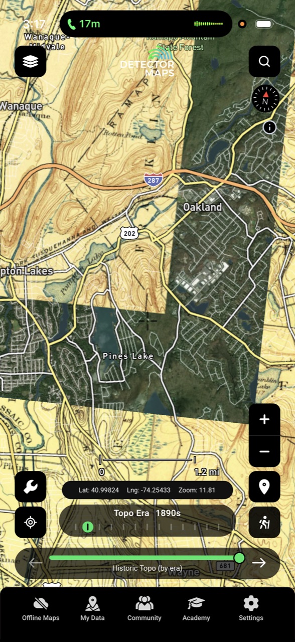
Slide through decade-by-decade USGS topos, 1870s to 2000s, and watch your town before the parking lots arrived.
14 decades — 1870s → 2000sWhere did history happen?
Respect the lines
Battlefield layers are reference only — protected sites are off-limits. Context for researching the private ground around them.
Surface management, refuges, military ground — checked before you leave. Then every layer downloads; you're the blue dot, no bars.
Protected areas — check before you knock
Six problems · one map
Every layer a relic hunter could ask for.
Each card is a problem US detectorists know by heart — and the layer that ends it, running live.
LIVE · GNIS OVER SATELLITE
Pounded ground
The good ground fell off the map
The park has been hit weekly since the 1970s. The ground nobody's swung is the ground that fell off the map — the fairground missing from every modern map, the crossing that died with the railroad. Detector Maps plots vanished and historic places from USGS GNIS across all 50 states — era-dated, with a decade slider and an abandoned-only filter.
USGS GNIS — all 50 statesEra-dated placesDecade sliderAbandoned-only filter
Included in Explorer
Old maps, new ground
The 1887 atlas, lined up with today
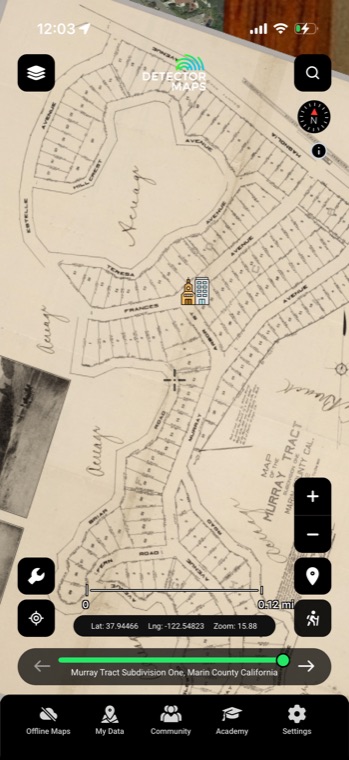
You found the schoolhouse on the 1887 county atlas. So where is it today? Detector Maps carries 9,500+ historic maps already georeferenced to the modern ground — search by region, era or type, slide the opacity, watch the old lane cross today's bean field. Got your own scan? Georeference it in-app: 10 uploads on Explorer, unlimited on Pro.
9,500+ georeferenced mapsSearch region · era · typeOpacity overlayImport your own
Explorer includes the full catalogue and 10 uploads of your own; Pro makes uploads unlimited. Courtesy of the David Rumsey Map Collection.
LIVE · GPS OVER AN 1890s SHEET
No signal at the site
Your research rides in your pocket
Printouts on the dash. One bar at the gate. The detail you need is on the laptop at home. Take every layer offline and walk the site as a blue dot moving across the 1892 map — live GPS, zero signal required. Plan the hunt on the full desktop web app with Pro, then carry the whole file cabinet into the field.
Full offline downloadsLive GPS blue dotDesktop web app — Pro
Offline + GPS on Explorer. Desktop web app on Pro.
LIVE · 100 YEARS ON ONE SLIDER
Research eats the week
Ten tabs become one map
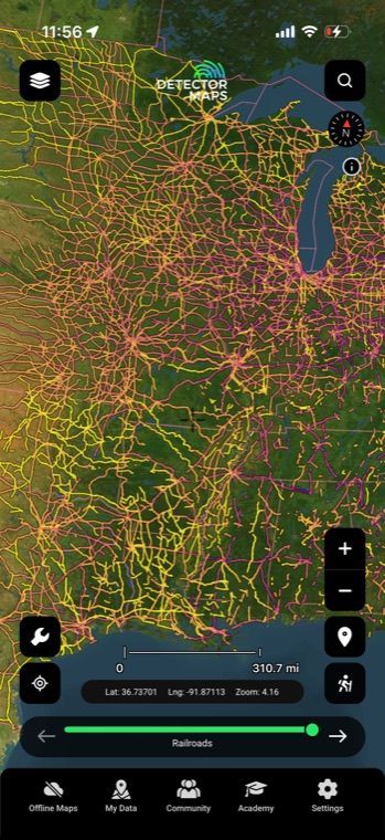
You know the drill: a clunky USGS viewer in one tab, GNIS in another, the county atlas in a library basement across town. Detector Maps stacks decade-by-decade USGS topos from the 1870s to the 2000s — plus Civil War, Revolutionary and 1812 battlefields, nine NPS historic trails and historic railroads — as reference layers on one map. Tuesday nights are yours again.
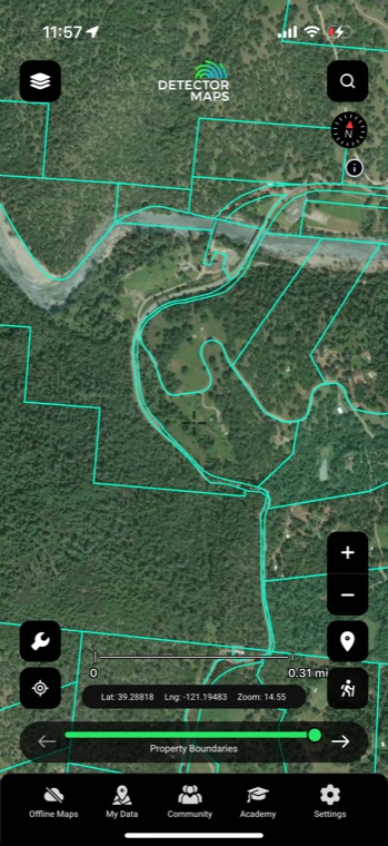
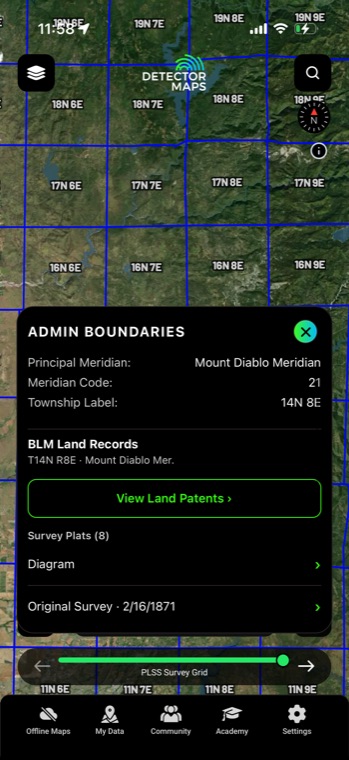
The number-one fear isn't the skunk — it's being where you shouldn't be. Pro draws parcel boundaries with owner names, so the knock on the door has a name behind it. PLSS sections and GLO patents show who proved up the ground in the 1800s. Managed and protected-land layers show what's federal and what's off-limits before you leave the driveway.
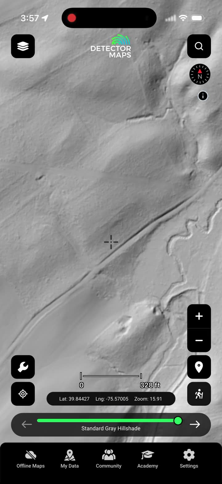
You didn't buy the machine to become an archivist. Open the app where you stand and the history is already there — the vanished town, the 1890s topo, the parcel line. When leaves hide everything, Pro's advanced LiDAR hillshade reads the ground itself: cellar holes, earthworks, roads that closed a century ago. You do the part you love.
Advanced LiDAR hillshadeCellar holes & earthworksOld roads under canopy
Advanced LiDAR is a Pro layer
SHIPWRECKSNOAA charts · coastal & inland
BATTLEFIELDSreference only — protected sites are off-limits
HISTORIC RAILROADSdepots, sidings & lost lines
Data lineage
Real records. Named sources.
No mystery layers. Every overlay on the map traces to a primary archive you can name — the same records historians and land offices use.
USGS GNIS GAZETTEERGhost towns & historic placesNationwide · all 50 states
DAVID RUMSEY COLLECTION9,500+ georeferenced mapsSearch by region, era & type
USGS HISTORIC TOPODecade-by-decade base maps1870s → 2000s
BLM GLO ARCHIVELand patents & 1800s platsThe property’s paper trail
PARCEL & COUNTY RECORDSBoundaries + owner namesZoom 14+ · Pro
Historical map imagery courtesy of the David Rumsey Map Collection
Four centuries deep
This is what’s still in the ground.
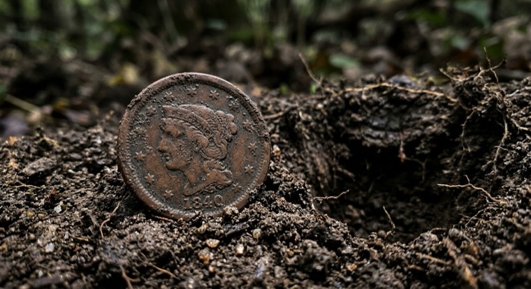
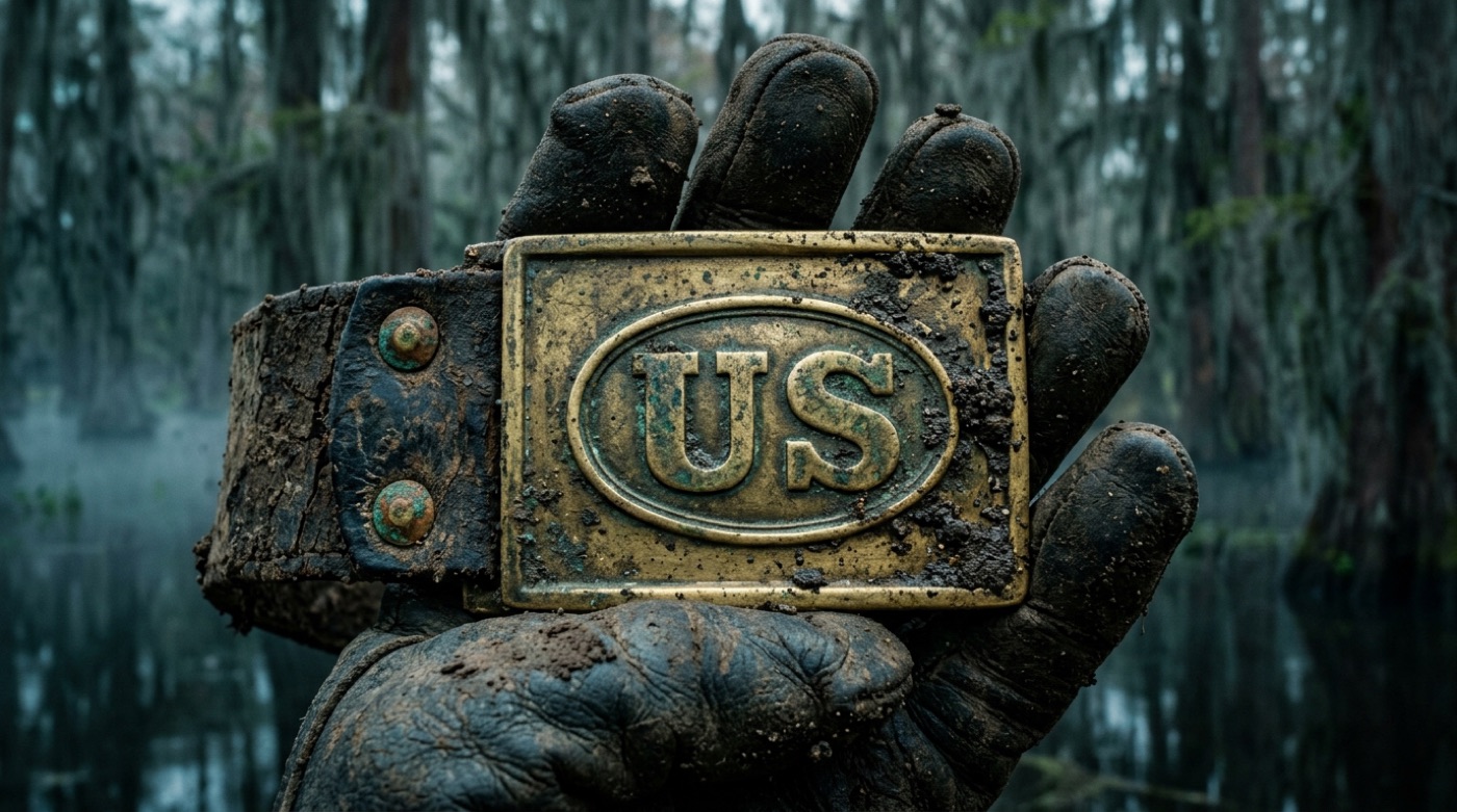
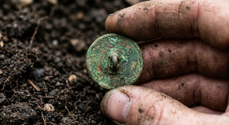
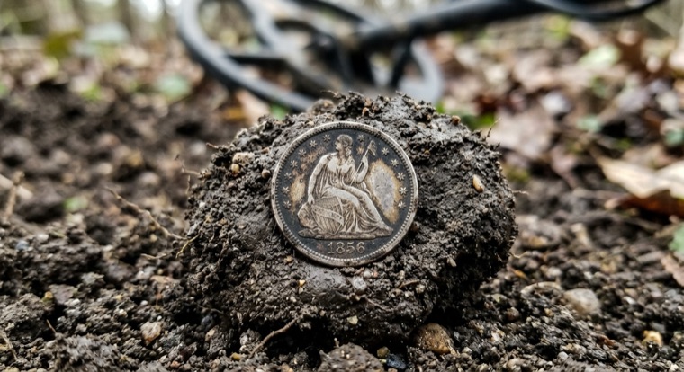
Two-piece plates, large cents, colonial buttons, seated silver — the American past didn’t leave. It’s under the topsoil where the research points. See what detectorists are pulling up in the community feed.
LARGE CENT1840s copperUS BELT PLATECivil War brassMILITARY BUTTONColonial, verdigrisSEATED DIME1850s silver
You don’t pick a state and pay extra. The whole country’s history is on one map the day you start — from the first colonial settlements to the towns that vanished last century.
50states, coast to coastEvery one has a past under the topsoil
9,500+historical mapsGeoreferenced to the modern ground
1600s→ todayColonial cellar holes to Cold-War topos
For the ones who research like it’s the job. Three tools the base layers don’t have — each one about being on the right ground, legally, before you dig.
Advanced LiDAR hillshade
Bare-earth relief pulls cellar holes, earthworks and roads that closed a century ago out from under the trees.
Property boundaries + owner names
Parcel lines with the owner behind them — so the knock on the door has a name, and you know the line before you cross it.
Land records: PLSS + GLO patents
Tap a section to pull the original 1800s survey plat and the patent that first took the ground out of federal hands.
Swap research with detectorists working the same old ground. Show off your best coin, buckle or button — the most-liked find each month wins prizes from real detecting brands.
No. Laws differ by state, county and land manager, and private land always needs the owner's permission. Detector Maps shows boundaries, ownership and protected-area layers to sharpen your research, but you are responsible for permissions and local rules — and protected sites are never to be detected.
Can I detect on the battlefields shown in the app?
No — the battlefield layers are reference only — protected sites are off-limits. They exist for historical context: understanding routes and camps helps you research the surrounding private ground, where you still need the owner's permission.
What do Explorer and Pro each include?
Explorer covers ghost towns and GNIS places, decade-by-decade topos, battlefield, trail and railroad reference layers, all 9,500+ Rumsey maps, 10 uploads of your own, and full offline use with GPS — in both Coin & Relic and Gold Maps modes. Pro adds property boundaries with owner names, PLSS sections and GLO patents, advanced LiDAR hillshade, unlimited uploads and the full desktop web app.
Does the app work with no cell signal?
Yes. Every layer — including the historic overlays — downloads for offline use, and your live GPS position keeps working without a signal. Download at home on Wi-Fi, then hunt the dead zones.
How much does it cost, and how does the trial work?
Explorer is $7.99/mo or $59.99/yr and includes both Coin & Relic and Gold Maps modes. Pro is $11.99/mo or $99.99/yr. Yearly plans come with a 3-day free trial — a card is required, and nothing is charged until the trial ends.
Will the app tell me where to dig?
No — and be skeptical of anything that says it will. Detector Maps puts the primary sources on one map: GNIS places, historic topos, 9,500+ georeferenced maps, land records. Where you swing, and what permissions you secure, is still your call — this just gives your research a head start.
Real support
Talk to a real person.
The Detector Maps inbox is staffed by Matt and Tom — the two brothers who built it. Email us and you’ll get a reply from one of us, usually the same day.