
Release · Matt and Tom
Detector Maps 6: see what was always there
Our biggest update yet. Dynamic LiDAR draws the ground under the bush in nine looks, Terrain+ raises your patch in 3D, your map now rides on the car’s screen, and every Trail can be replayed. Here’s everything new since July, region by region.
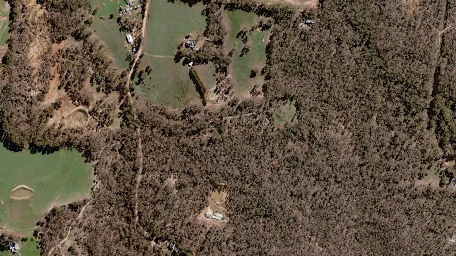
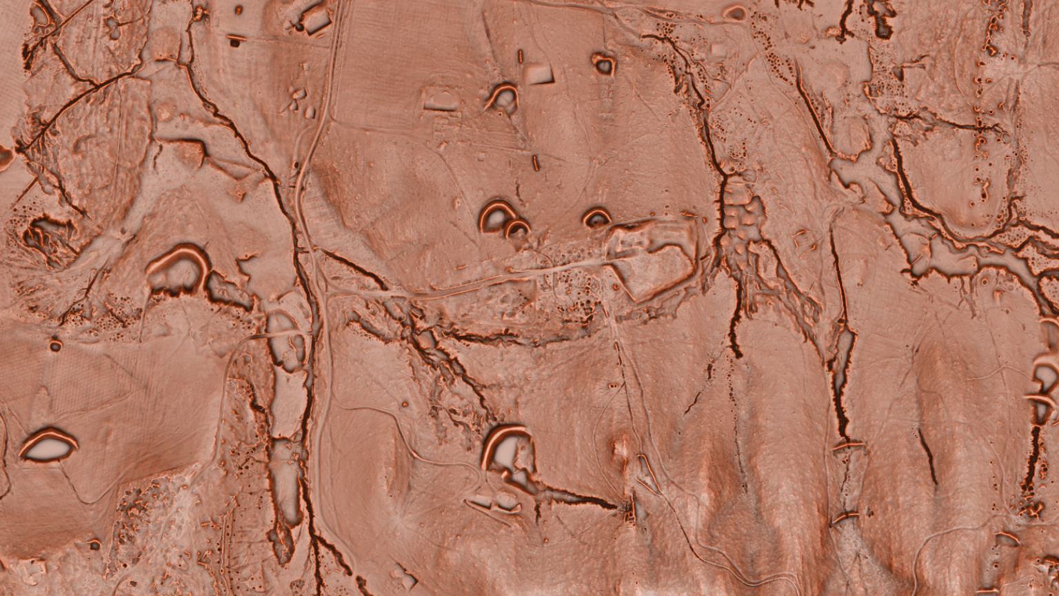 Dynamic LiDARSatelliteWattle Gully, near Castlemaine VIC
Dynamic LiDAR™: nine ways to read the same ground
LiDAR is now drawn live on your phone from the 1-metre survey, not as fixed pictures. Switch between nine looks, move the light, change the colours, and save the look you like. It rides along with your offline areas, so it works with no bars.
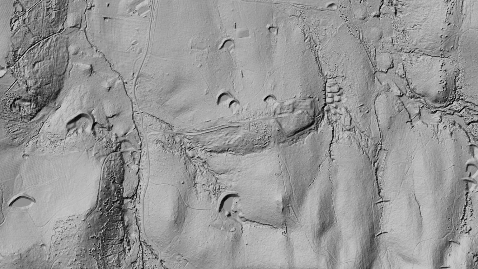
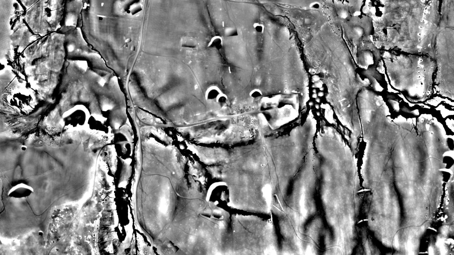
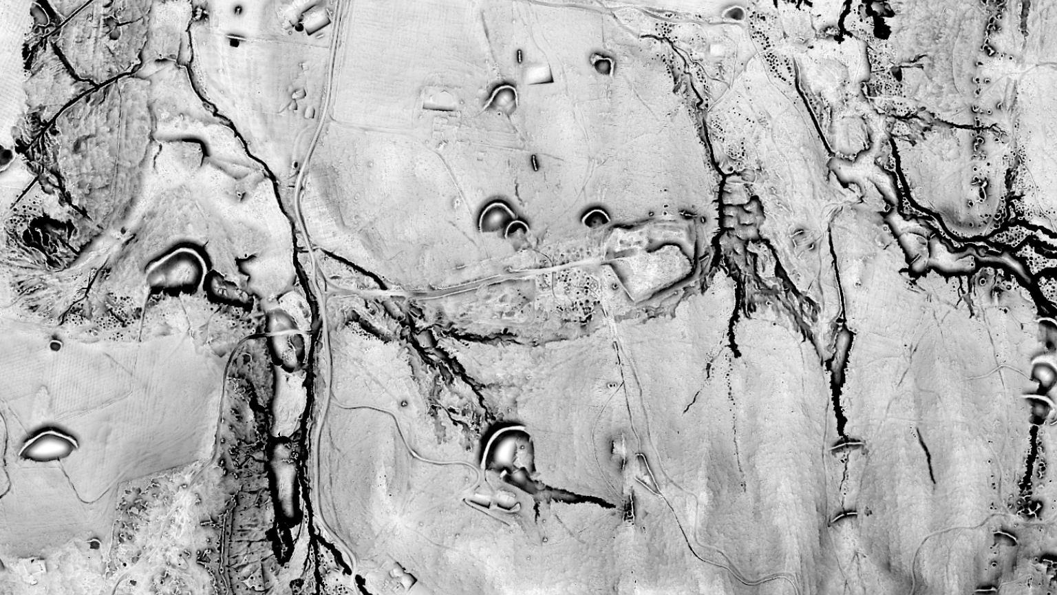
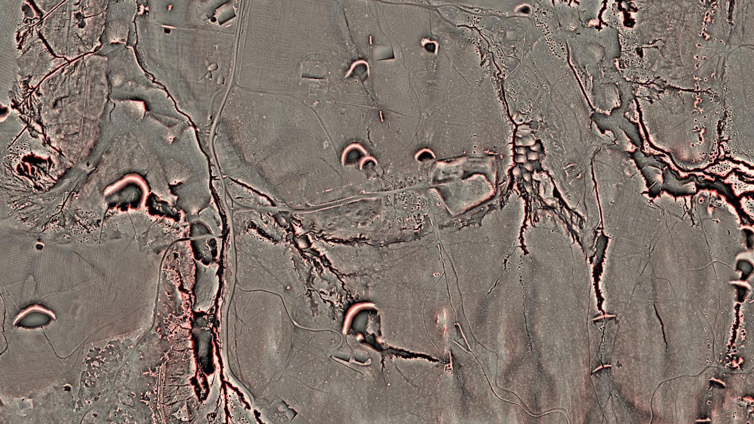
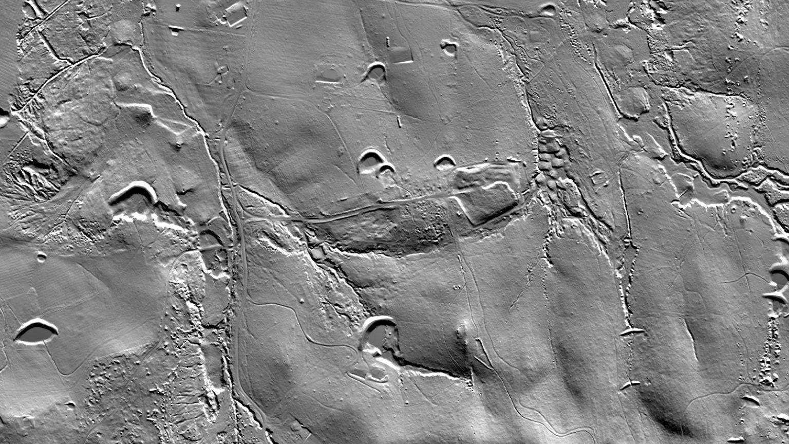 SVF/LRM
Australia: included with Explorer in NSW, QLD and TAS; Victoria with the LiDAR add-on, now A$39.99 a year. England and Scotland: any paid plan. USA: part of Pro. Wales: on the web app now, in the phone app next update.
Terrain+™: draw around it, raise it in 3D
Outline a patch and it rises as a 3D model you can turn, tilt and raise until every bench and race stands up. Drape any layer over it. Then let the detectors mark the ground worth a closer look: worked ground, likely shed gold and flood trap sites in Australia and the USA; earthworks, Roman camps and likely settlement in England. Models save on your phone for 30 days and open with no signal.
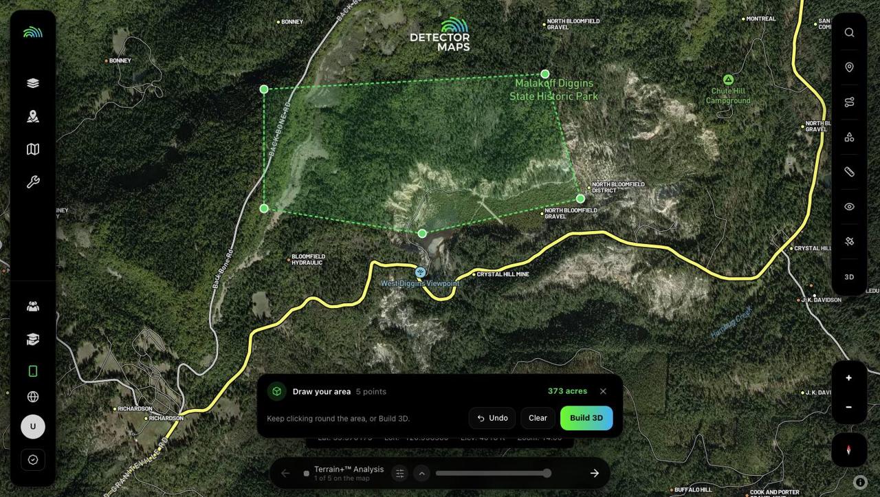


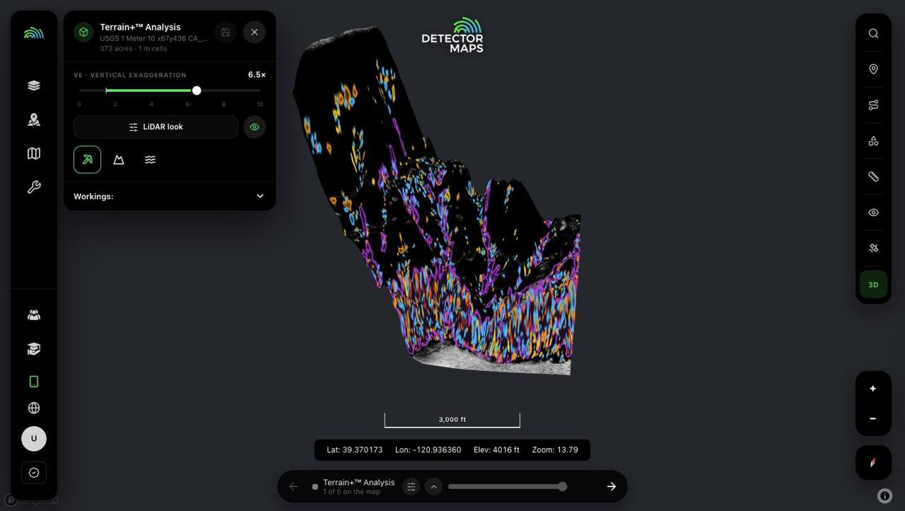
Shown: Terrain+ in the web app at Malakoff Diggins, California. Same plans as Dynamic LiDAR. Not yet in WA, SA, NT, New Zealand or Canada.
Your map, on the car’s screen
Plug in and Detector Maps comes up on CarPlay and Android Auto with your layers, waypoints and Trails. Pick a spot and it talks you in on sealed roads, then hands over to a walk for the last stretch. Mark a waypoint or record a Trail without touching the phone.
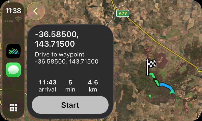
Every region. Go to and the off-road planner need Explorer.
Every Trail, replayed
Play back a hunt with your finds popping up where you logged them. See every Trail on one map, split into travelling and detecting. Trim a Trail, and share it as a video or a photo card. Your Trails back themselves up to iCloud Drive, Google Drive or a folder you pick.
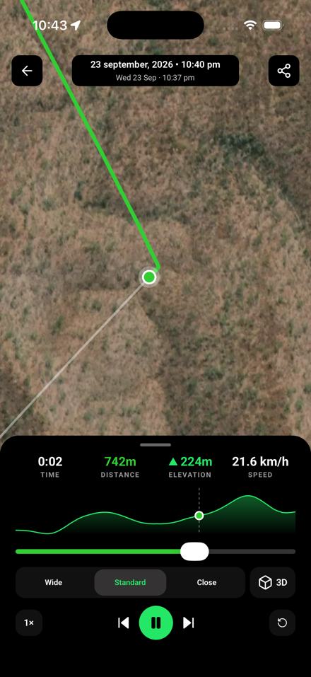
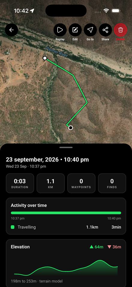
Free on every plan, in every region.
What’s new where you detect
Australia
- LiDAR included with Explorer in NSW, QLD and TAS, every view. Victoria’s LiDAR add-on is now A$39.99 a year.
- Active Fires: satellite hotspots in every state, refreshed every 10 minutes and drawn as a glow that fades with age. Explorer.
- Gold host rocks only: one switch on the geology filter hides every unit that doesn’t host gold.
- Watch an area for tenement changes (Pro), and Expiring Soon now comes with Explorer.
- Historical Maps WA and NSW Prospecting Access, plus NSW Gold Prospectivity.
USA Gold
- Alaska joins: 16 gold states.
- Detailed State Geology with a gold host rocks filter in every gold state (Nevada 1:250,000 and Utah 66k).
- Dynamic LiDAR and Terrain+ with Pro.
- Property boundaries from zoom 13 with Pro, and Explorer is now on Android.
USA Coins & Relics
- Permissions: every farm you’re allowed on, with the landowner, parking, gates, rules and the agreement, on its boundary.
- LiDAR in 3D with Pro.
- Ghost towns and old topo maps are free.
United Kingdom
- Dynamic LiDAR and Terrain+ in England and Scotland, with earthwork, Roman camp and settlement detectors in England. Wales is on the web app now and comes to the phone app in the next update.
- Field Conditions: every farm field coloured each week from satellite: freshly turned, bare, stubble, new crop or grass.
- Permissions for every farm you detect, Dynamic NDVI crop-marks (England add-on, +£50 a year) and what3words.
New Zealand
- Make LiDAR yours: colour ramps, brightness and contrast on the 1 m hillshade, included with Explorer.
- Google’s own satellite, the car, Trail replay and the new Community.
Canada (British Columbia)
- Make LiDAR yours: colour ramps, brightness and contrast on the LiDAR hillshade, included with Explorer.
- Google’s own satellite, the car, Trail replay and the new Community.
For everyone
- A new Community: levels 1 to 30 and badges, a monthly Most liked challenge, and Events you can host and join. Free accounts can read; taking part needs a paid plan.
- Location sharing with your group, which keeps sending with the phone locked (Explorer and a Community profile).
- Start free: gold records and your region’s tenements or claims are free, plus one 250 km² area with every layer except LiDAR. The web map needs no card. Yearly plans start with a 7-day free trial.
- Built for no bars: search your waypoints, coordinates and Australian place names offline; remove a block from a saved area; sign up with an email code.
- The web app now runs Dynamic LiDAR and Terrain+ in your browser, on Google’s own satellite if you like.
Also since July
- Weather on the map and on dropped pins
- LiDAR variations for VIC, NSW and QLD
- Historical Maps WA: 6,652 old plans
- NSW Gold Prospectivity
- One importer for KML, KMZ, GPX, TCX and CSV
- Import Trilobite waypoints and Trails
- Coordinate formats
- Draw polygons and lines
- Open a spot in Apple or Google Maps
- Map layers updated without an app update
Update from your app store
New to Detector Maps? Start free for 7 days on a yearly plan. Nothing is charged until it ends.
Start free for 7 daysiPhone · Android · Web