Detector Maps
Start free for 3 days on any yearly plan — nothing charged until the trial ends.
Open the mapSearch 9,500+ georeferenced maps from the David Rumsey Map Collection by region, type, and era — then lay one over the modern map with a single tap. Slide the opacity until the old streets line up under your boots.
Start free trialStart free for 3 days on any yearly plan — nothing charged until the trial ends.
Detector Maps includes 9,500+ georeferenced historical maps — county atlases, military surveys, mining maps, and old town plans — searchable by region, type, and era. Each one lays over the modern basemap with its own opacity slider, so you can see exactly where the past sits under your boots. Featured courtesy of the David Rumsey Map Collection.
Filter by region, era, and type — old towns, military, mining, roads, coastal charts, surveys. 9,500+ georeferenced historical maps from the David Rumsey Map Collection, all searchable right in the app.
Courtesy of the David Rumsey Map Collection.

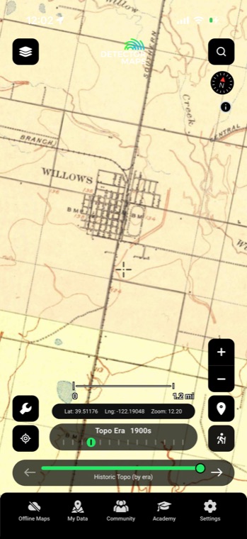
Tap a map and it drapes over the modern basemap, already lined up. Each overlay gets its own opacity control — fade between then and now until vanished streets, homesites, and rail spurs sit right under your cursor.
Got a county atlas scan or plat book the collection doesn't cover? Upload JPEG, PNG, TIFF, PDF, or JP2, then drag, resize, and rotate it into place. It becomes a live tiled overlay in My Maps, synced across mobile and web.

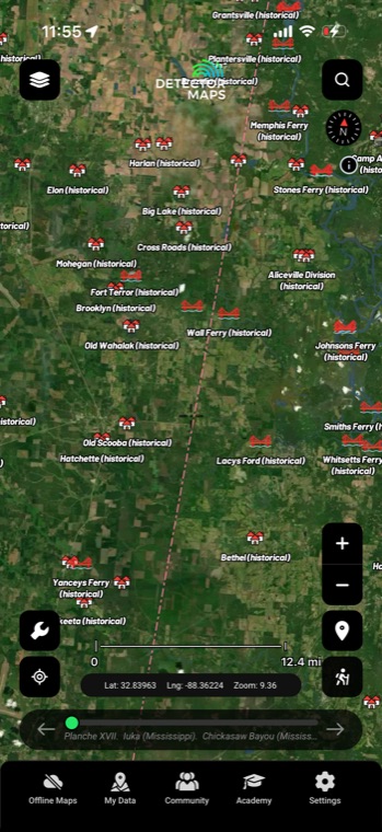
Filter the catalogue to military surveys, mining maps, or old town plans — whichever matches the kind of ground you hunt. Stack a type filter with your region and era and you shortlist the useful maps in minutes instead of scrolling thousands.
Drop any map over the modern basemap and slide the opacity until old and new line up. Fading between the two is the quickest way to spot what changed — and what quietly disappeared.
Old town plans show streets, squares, and lots that no longer exist on the ground. Because the map is georeferenced under your GPS dot, you can stand on a street that was platted in the 1850s and erased a century ago.
Add the maps you actually plan to hunt over to My Maps so they're one tap away in the field. Do the desk research on the big screen, then carry the same overlays out on your phone.
It's one of the largest private map collections in the world — David Rumsey spent decades collecting and digitising historical maps and made them available online. Detector Maps features 9,500+ of them, georeferenced so they sit correctly on a modern basemap, courtesy of the David Rumsey Map Collection.
Good enough to put you on the right block, not always the exact fencepost. Surveying in the 1800s wasn't GPS-grade and paper stretches over time, so alignment tends to be tighter in town centres and looser out at the edges. Sanity-check the fit with the opacity slider against a road or river that still exists before you trust a spot.
You can filter by region, map type, and era, and search the catalogue directly. So if you hunt Civil War-era ground in Virginia, you'd filter to military maps from the 1860s in your region and browse from there.
They show where things used to stand — old streets, homesteads, mills, camps — which is exactly the starting point good research runs on. What they can't tell you is who owns that land today or whether it's open to detecting, so cross-check against the property boundaries layer and always get permission first.
Start free for 3 days on any yearly plan — nothing charged until the trial ends.
Prospect smarter, not harder. .
Trip reports, layer updates, the occasional gold-find email. No spam.
© 2026 Gold Discovery Solutions Pty Ltd