Historic Established Places — USA

Hunt the abandoned. Era by era.

Towns, schools, churches, post offices, and cemeteries, colored by the era they were established — with one switch to show only what's been abandoned. Old home site research that used to take weekends now takes minutes.

Start free trial

Start free for 3 days on any yearly plan — nothing charged until the trial ends.

FILEESTABLISHED PLACES
SOURCEFEDERAL PLACE RECORDS
ERASPRE-1800 → 1925–50
TIEREXPLORER
What it is

Every historic place, filtered by era and status

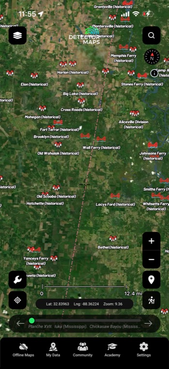
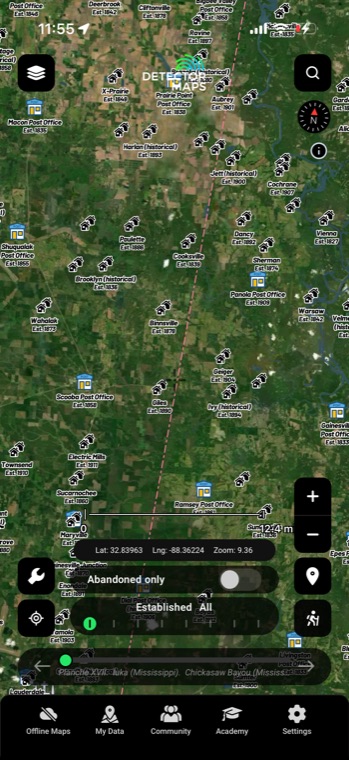
Historic Established Places puts towns, post offices, churches, schools, cemeteries and mines on your map nationwide, each one colored by the era it dates from. A 25-year era slider runs from Pre-1800 to 1925–50, and an Abandoned-only switch hides everything still in use — leaving just the places that closed, moved or faded away.

The era slider

A century of settlement, colored by era

Historic Established Places maps towns, post offices, churches, schools, cemeteries, and mines — each colored by the era it was established. Drag the 25-year time slider from Pre-1800 through 1925–50 and watch settlement sweep across your county.
TownsPost officesChurchesSchoolsCemeteriesMines
EST. PLACESERA SLIDER · MISSISSIPPI
Abandoned only

One switch isolates the abandoned

The Abandoned only switch strips the map back to discontinued places: post offices that closed, schools that emptied, churches that faded off the modern map. Stack it with Ghost Towns — historic towns and populated places from the USGS GNIS gazetteer — and the empty spots start making sense.

Discontinued placesClosed post officesGhost Towns layerGNIS gazetteer
GHOST TOWNSLIVE · GNIS OVER SATELLITE
Prove it existed

Cross-check it on the historic topo

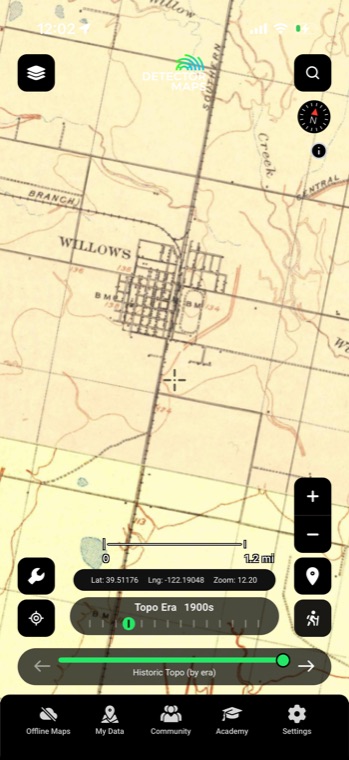
Found a promising abandoned school? Step the entire basemap back through the decades with Historic USGS Topo — 1870s to 2000s — and see what the surveyors mapped there before it disappeared. If the old topo agrees, your research just got a lot stronger.

Decade slider1870s–2000sWhole-basemap swapUSGS topo
HISTORIC TOPOLIVE · 100 YEARS ON ONE SLIDER
Before you knock

Know whose land it's on

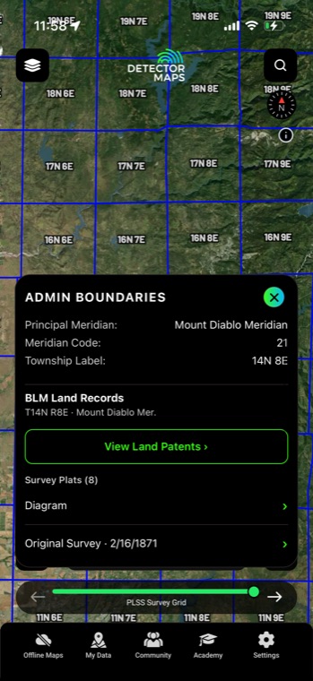
Zoom to 14+ and Property Boundaries show parcel and owner details, so your permission ask starts with a name. Everything syncs between web and mobile, and works offline in the field.

Parcel linesOwner detailsZoom 14+Offline in the field

Property boundaries and land access are included with Pro.
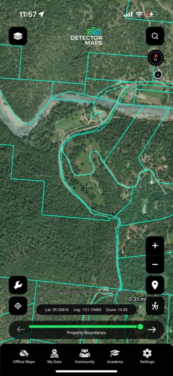
PARCELSOWNER DETAILS
Put it to work

Four ways detectorists use it

01

Isolate everything pre-1900

Drag the era slider back and the map drops anything established after your cutoff. What's left are the older places most relic hunters want to research first — early towns, churches and crossroads communities.

02

Find closed post offices and schools

Flip the Abandoned-only switch and the discontinued post offices and shuttered schools stand out from everything still operating. A closed post office marks where a whole community once collected its mail, and old schoolyards saw decades of daily foot traffic.

03

Work one 25-year window at a time

Narrow the slider to a single bucket — say 1850–75 — and study just the places from that window. It's a clean way to build a hunt list around one specific period instead of scrolling past everything at once.

04

Pair it with owner lookup

Spotted an abandoned church site on private ground? Zoom to 14+ with Property Boundaries on and you get parcel lines with owner details, so you know exactly whose door to knock on for permission.

In the app

Everything included

Era sliderSteps in 25-year buckets from Pre-1800 through 1925–50.
Abandoned-only switchOne toggle hides everything still active, leaving only discontinued places.
Six place typesTowns, post offices, churches, schools, cemeteries and mines.
Era color codingEvery marker is tinted by the era it belongs to.
Nationwide coverageThe same layer and filters work across the whole country.
FAQ

The questions we get most

What does "Abandoned" actually mean?

It means the place was discontinued — the post office closed, the school consolidated, the town lost its reason to exist. It doesn't mean the land is empty or open to detecting today, so always check ownership and get permission before you swing.

How do the era buckets work?

The slider moves in 25-year steps, from Pre-1800 up through 1925–50, and every place on the map is colored to match its bucket. That makes it easy to spot, say, an 1850–75 settlement sitting in a sea of later development.

Does this cover my state?

Yes — the layer is nationwide. Density follows settlement history, so the East runs thick with early-era places while much of the West leans toward later boom-and-bust sites, but the era slider and Abandoned-only switch work the same everywhere.

Can I see these places on period maps?

You can. Flip the basemap to Historic USGS Topo and step the decade slider to match your era bucket, or overlay one of the 9,500+ georeferenced Rumsey maps with its own opacity control. A marker sitting on a map drawn while the place was alive tells you far more than a modern basemap can.

Start hunting the places time forgot

Start free trial

Start free for 3 days on any yearly plan — nothing charged until the trial ends.