Detector Maps
Start free for 3 days on any yearly plan — nothing charged until the trial ends.
Open the mapUpload a scan, drag it into place, and hunt it as a live overlay under your feet. Every map you pin syncs across phone and web — and works offline in the field.
Start free trialStart free for 3 days on any yearly plan — nothing charged until the trial ends.
Found a county atlas page, an estate plat, or an old aerial that isn't in any app? Upload it as a JPEG, PNG, TIFF, PDF, or JP2 and pin it over today's map with drag, resize, rotate, opacity, and skew controls. It's saved as a tiled overlay in My Maps, synced between your phone and the desktop web app.
That county atlas plate, the estate plat from the courthouse, the fairgrounds photo from a local history book — upload it as JPEG, PNG, TIFF, PDF, or JP2 and it lands straight in the georeferencer. If you can get it into a file, you can get it on the map.

Grab the handles and line your map up against modern imagery — drag, resize, rotate, with an opacity slider to check the fit, plus an advanced skew mode for old surveys that never sit square. Once it locks in, it becomes a live tiled overlay in My Maps, synced across mobile and web and ready offline in the field.
Cross-platform georeferencer is a Pro feature.
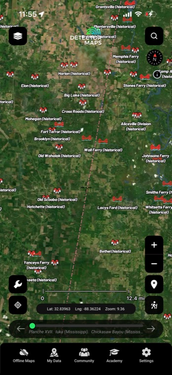
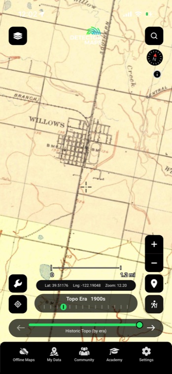
No scan of your own? Browse 9,500+ georeferenced historical maps from the David Rumsey Map Collection, searchable by region, era, and type — old town plans, military, mining, roads, coastal, and surveys. Pick one and it overlays with its own opacity control, no lining up required.
Courtesy of the David Rumsey Map Collection.

Snap or scan a page from an 1870s county atlas showing farmsteads, schoolhouses, and churches that vanished generations ago. Line up the section roads with today's map and every marked homesite becomes a spot you can actually walk to.
Photos of estate plats and courthouse records are almost never shot perfectly flat, so plain rotate-and-resize leaves them warped against the map. Skew mode lets you pull each corner independently until the boundary lines sit true.
Vintage aerial photos capture field boundaries, orchard rows, and building footprints that were leveled decades ago. Slide the opacity down and you can see exactly which modern feature sits where the old barn stood.
Do the careful positioning on the big screen at home, then open the identical overlay on your phone when you arrive on site. Uploads live in My Maps and sync across your devices — nothing gets redone in the field, and Pro adds the desktop web app.
JPEG, PNG, TIFF, PDF, and JP2 all work. That covers phone photos of atlas pages, courthouse scans, and the big JP2 files government archives often hand out. If a source gives you a choice, grab the higher-resolution version — it holds up better when you zoom in.
Find features that exist on both maps — road intersections, section corners, river bends, rail lines — then drag, resize, and rotate until two or three of them lock in. If your source is a photo taken at an angle, switch to skew mode and pull the corners until the straight lines actually run straight. The opacity slider lets you check your work as you go.
Every upload is saved as a tiled overlay in My Maps on your account, and it syncs between the mobile app and the desktop web app. You toggle it on and off like any other layer and set its opacity per map.
No — it's drag, resize, rotate, and skew with your mouse or fingers, closer to arranging a photo than running mapping software. Most people have their first atlas page positioned in a few minutes. The real skill is just spotting a couple of landmarks that appear on both the old map and the new one.
Historical map imagery courtesy of the David Rumsey Map Collection
Start free for 3 days on any yearly plan — nothing charged until the trial ends.
Prospect smarter, not harder. .
Trip reports, layer updates, the occasional gold-find email. No spam.
© 2026 Gold Discovery Solutions Pty Ltd