Coin & Relic · USA

Stand in 1898.

Historic USGS topo basemaps for every decade from the 1870s to the 2000s — one slider steps the entire map through time. Contours and LiDAR sit underneath, so the old sheets line up with the ground in front of you.

Start free trial

Start free for 3 days on any yearly plan — nothing charged until the trial ends.

FILEHISTORIC TOPO
SOURCEUSGS SURVEY SHEETS
ERAS1870s → 2000s
TIEREXPLORER
What it is

The whole basemap, rewound decade by decade

Historic USGS Topo swaps your entire basemap for original survey sheets, with an era slider stepping from the 1870s to the 2000s. Every farmhouse, schoolhouse, rail siding, and wagon road the surveyors drew sits right under your pins and layers, so you read the ground as it stood when people actually lived on it.

Era slider

Every decade, 1870s to 2000s

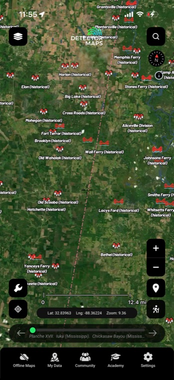
One slider steps the entire basemap through historic USGS topo maps, 1870s to 2000s. Schoolhouses, sidings, fords, and wagon roads appear on the sheets that recorded them — then vanish decade by decade as the country moved on. Pick the era your ground was busiest and read it the way the mapmakers drew it.

1870s–2000sUSGS topoEra sliderWhole-map swapNationwide
HISTORIC TOPOLIVE · 100 YEARS ON ONE SLIDER
Contours

Modern contours under old linework

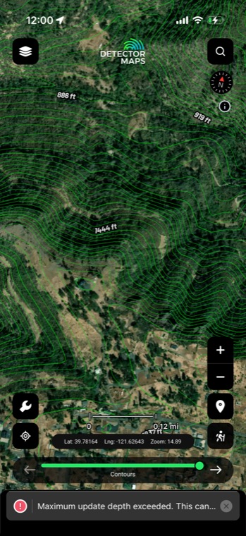
Lay contour lines over any era of the basemap and keep your bearings on sheets surveyed a century apart. Benches, terraces, and drainages stand out against the old drafting, and per-layer legends, notes, and opacity keep every overlay readable.
Contour linesAny eraPer-layer opacityLegends & notes
CONTOURSTERRAIN
LiDAR terrain

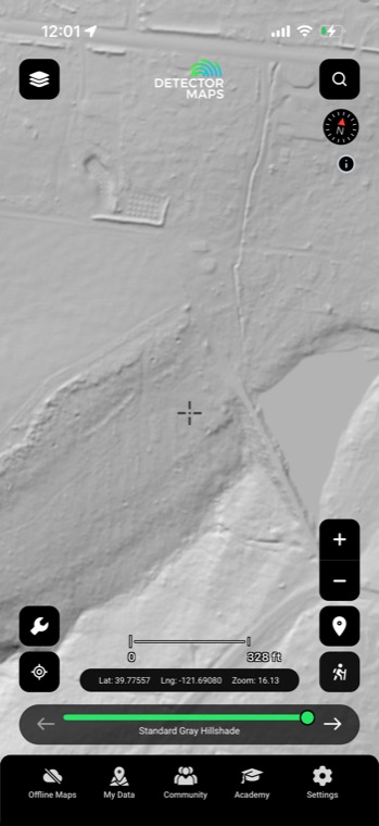
LiDAR hillshade under the 1890s sheet

Run LiDAR hillshade built on USGS 3DEP beneath the old topo — 8 presets plus a custom generator. Old roadbeds, foundations, and cut ground show in the terrain right where the historic sheet says they should be.

3DEP LiDAR8 presetsCustom generatorHillshade

Advanced LiDAR is included with Pro.

LIDAR3DEP HILLSHADE
Put it to work

Four ways detectorists use it

01

Find structures that vanished long ago

Old quads mark individual buildings as small black squares — farmhouses, schools, and churches that disappeared long before aerial photos existed. Slide to the 1900s sheet, spot a square sitting in what's an empty field today, and you've got a lead worth researching.

02

Step through decades to date sites

Flip the slider between editions and watch a structure appear on the 1890s sheet and vanish by the 1940s. That narrows the occupation window and tells you what period you're actually dealing with before you commit a day to it.

03

Pair old sheets with LiDAR

Run a hillshade preset or contour lines over the era basemap and match drawn features to what the ground still shows — cellar depressions, old road cuts, mill races. When a square on an 1890s sheet lines up with a dent in the LiDAR, you know exactly where to stand.

04

Confirm pins from other layers

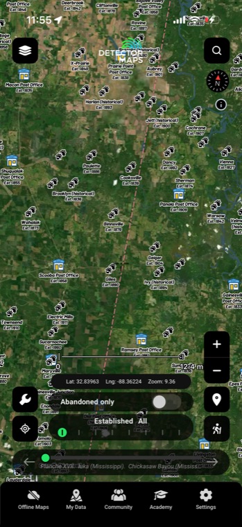
A ghost town marker or historic place pin tells you something was there; the decade sheet shows you what — how many buildings, where the roads came in, whether there was a school or a store. It turns a dot into a layout you can actually walk.

In the app

Everything included

Era sliderSteps the whole basemap decade by decade, 1870s through 2000s.
Full basemap swapThe entire map redraws as that decade's quad — no postage-stamp overlay.
LiDAR and contour pairingRun hillshade presets and contour lines over any era sheet.
Offline downloadsEra sheets keep working where there's no cell signal.
Web and mobile (Pro)Research on the desktop app, then pull up the same eras in the field.
FAQ

The questions we get most

Why does my area skip certain decades?

USGS never mapped the whole country on one schedule — some quads were surveyed in the 1880s and revised every couple of decades, while others got their first sheet around 1950. The slider only offers eras that actually exist for the ground you're looking at, so a missing decade means no map was published there, not a glitch.

How are the old sheets lined up with the modern map?

Each sheet is georeferenced — warped so its coordinates match today's map — which is why your GPS dot tracks correctly across a 130-year-old quad. That said, 1890s surveyors worked with plane tables, not satellites, so treat a drawn building as a tight search area rather than a dig-here X. Pairing with LiDAR helps close that last gap.

Does it work offline?

Yes — download your area before you head out and the era basemaps work without signal, same as the rest of your offline map. That matters because a lot of the old homesites and crossings worth walking sit well outside cell coverage.

How is this different from the Rumsey map overlays?

Historic Topo is the systematic USGS quad series — consistent, nationwide, and stepped by decade underneath everything else. The Rumsey collection is 9,500+ individual georeferenced maps — county atlases, city plans, and the like — that you search and lay over the top one at a time with its own opacity. Most good research sessions end up using both.

See what the decades erased.

Start free trial

Start free for 3 days on any yearly plan — nothing charged until the trial ends.