Coin & Relic — USA

Every ghost town. Back on the map.

Historic towns, military posts, and crossings from the USGS GNIS gazetteer, plotted nationwide in Coin & Relic mode. Pick a townsite, prove it on the old topos, and walk in knowing the layout.

Start free trial

Start free for 3 days on any yearly plan — nothing charged until the trial ends.

FILEGHOST TOWNS
SOURCEUSGS GNIS GAZETTEER
COVERAGENATIONWIDE · ALL 50 STATES
TIEREXPLORER
What it is

Vanished towns and forts, straight from the federal gazetteer

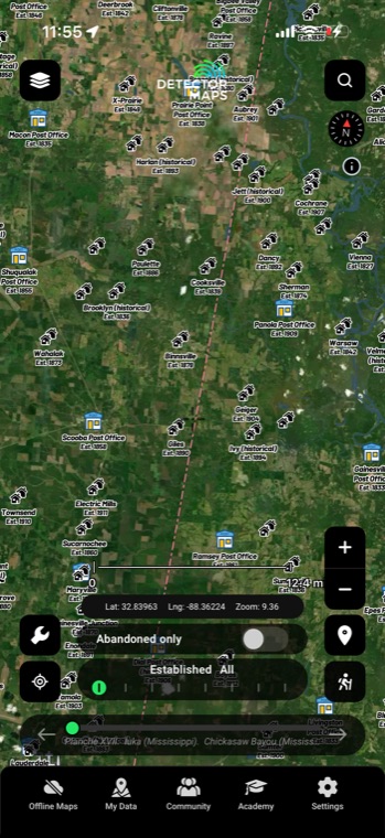
The Ghost Towns layer plots historical settlements from USGS GNIS — the federal government's official gazetteer of named places. Old townsites, military posts and river crossings each get their own symbol, so you can read a landscape's dead places at a glance. Most of them never made it onto the modern basemap, which is exactly why this layer earns its spot.

GNIS gazetteer

Ghost towns, coast to coast

Historic towns and populated places pulled from the USGS GNIS gazetteer cover the entire USA. Symbols are split by feature class — towns, military posts, and crossings — so you can tell an old settlement from a fort or a ferry landing at a glance.

TownsMilitary postsCrossingsNationwideUSGS GNIS
GHOST TOWNSLIVE · GNIS OVER SATELLITE
Historic topo

Watch the town appear on paper

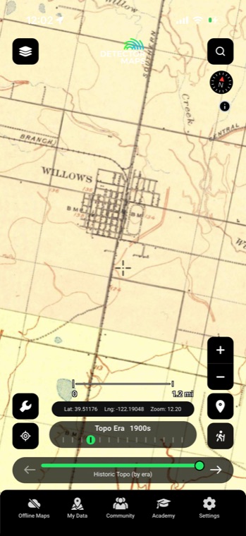
Step the whole basemap by decade with the era slider, 1870s to 2000s. See the townsite drawn on an 1880s sheet, watch it fade off later editions, and you know exactly where the buildings stood before you ever leave the house.

Era slider1870s–2000sWhole basemapDecade steps
HISTORIC TOPOLIVE · 100 YEARS ON ONE SLIDER
Historic mines

Where miners worked, towns followed

Mine and prospect symbols digitised from historic USGS topo maps flag the diggings that pulled people into the hills. A cluster of workings with no modern town nearby is a settlement worth researching.
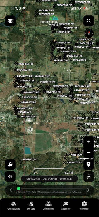
Mine symbolsProspectsHistoric toposCamp clues
MINE SYMBOLSFROM OLD TOPOS
Rumsey collection

Overlay the original town map

9,500+ georeferenced historical maps from the David Rumsey Map Collection, searchable by region, era, and type — including old towns and mining maps. Slide one over the modern basemap with its own opacity control and line up streets that no longer exist.

9,500+ mapsOld townsMining mapsOpacity control

Courtesy of the David Rumsey Map Collection.

MAP OVERLAYLIVE · GPS OVER AN 1890s SHEET
Put it to work

Four ways detectorists use it

01

Shortlist townsites worth the drive

Pan your county and let the symbols do the scouting — every marker is a named place that once had people, mail or commerce. Cross-check the promising dots against the historic topo basemap to see which ones actually grew into something.

02

Tell a fort from a ferry

Symbols are keyed to GNIS feature class, so a military post reads differently from a crossing or a townsite before you even tap it. That matters, because each type of site concentrated foot traffic in different places — a parade ground and a ferry landing are two very different hunts.

03

Date a site with the topo slider

Found a marker with no story attached? Step the historic USGS topo basemap decade by decade and watch the town appear, peak and vanish — that arc tells you which eras put the most feet on that ground.

04

Plan a full day of sites

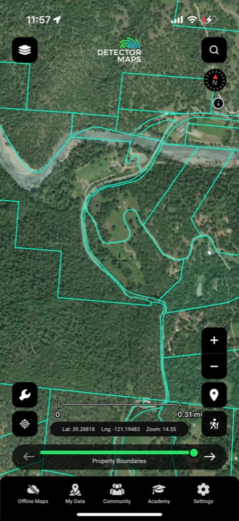
Ghost towns cluster along old rail lines and stage roads, so one good area often holds three or four markers within a short drive. Chain them into a route, then check property boundaries and owner details before you knock on any doors.

In the app

Everything included

GNIS townsitesVanished towns and settlements from the USGS federal gazetteer, plotted nationwide.
Military posts and crossingsOld forts, camps and ferry crossings mapped alongside the townsites.
Symbols by feature classEach site type gets its own marker, so you can read an area at a glance.
Historic topo by decadeStep the whole basemap from the 1870s to the 2000s to watch sites come and go.
Era-coded historic placesTowns, post offices, churches and schools colored by era, with an abandoned-only switch.
Offline accessSave your research area and take every layer beyond cell coverage.
FAQ

The questions we get most

What is GNIS, and how current is it?

GNIS is the Geographic Names Information System — the USGS's official gazetteer of named places in the United States, including thousands of settlements that no longer exist. It's a maintained federal record rather than a live survey, so treat each marker as a documented lead, then verify it against the historic topo layer and recent imagery before committing to the drive.

Does a symbol mean buildings are still standing?

No — a marker shows where a named place existed, not what's left of it. Plenty of ghost towns are now bare fields, pasture or timber with nothing above ground. Flip through the topo decades and check modern satellite imagery to gauge what you'll actually see when you pull up.

Is it legal to detect at a ghost town?

That depends entirely on who owns the ground today, and Detector Maps is a research tool — it doesn't grant access to anything. Check the property boundaries layer for the parcel and owner, and always get permission before detecting private land. On public land the rules vary widely, and protected historic sites are off-limits full stop, so confirm the status before you swing a coil.

Are ghost towns just a Western thing?

Not at all — GNIS covers the whole country, so you'll find abandoned mill villages in New England, failed rail stops across the Plains and vanished river landings in the South alongside the classic mining camps out West. Wherever people packed up and left, there's usually an entry.

Find the towns time forgot.

Start free trial

Start free for 3 days on any yearly plan — nothing charged until the trial ends.