Detector Maps
Start free for 7 days on a yearly plan — nothing charged until the trial ends.
Open the mapTap any township or section on the PLSS grid and pull the BLM GLO land patents and original survey plats tied to that exact ground — some drawn in the 1800s. No more nights lost to glorecords.blm.gov.
Start free trialStart free for 7 days on a yearly plan — nothing charged until the trial ends.
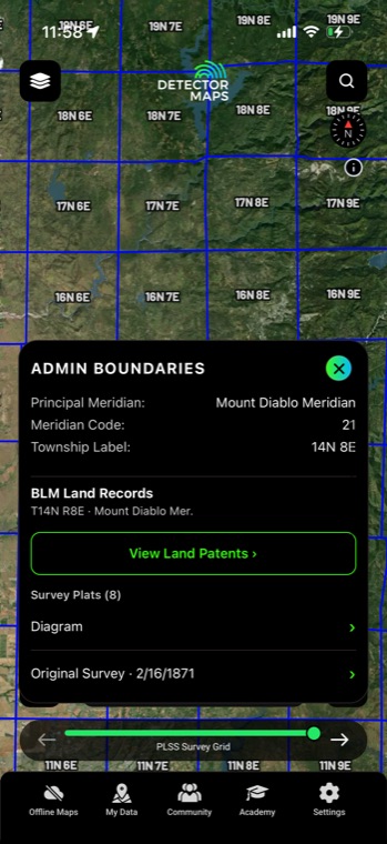
Tap any PLSS section and Detector Maps pulls up the BLM GLO land patents for that ground — the original transfers from the federal government to the first private owners, names and dates included. Alongside them sit the original survey plats, some drawn in the 1800s, showing what the surveyors actually found when they walked the lines. It's the paper trail of first settlement, without leaving the map you're already researching on.
The PLSS survey grid lays every township, range, and section over the map — the same squares federal land records have hung off since the first surveys. Tap any one of them and the government paperwork for that exact ground comes to you.
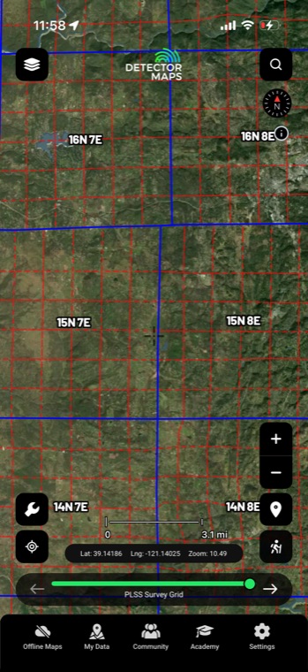
Every tap surfaces BLM GLO land patents — who first claimed the ground and when it left federal hands — alongside original survey plats, some drawn in the 1800s. What used to cost you a night on glorecords.blm.gov now happens right on the map. For a relic hunter, an early patent date is a lead worth chasing.
Sourced from official BLM General Land Office records.
Old records tell you where to look — permission gets you on it. Property boundaries with parcel and owner details appear from zoom 14, so you can trace an 1800s patent to today's landowner and knock on the right door.
Property boundaries and land access are part of Pro.
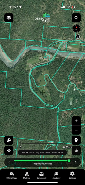
Tap a section and read who patented it and when — the first family to plow, build, and live on that land. Cross-reference the patentee name with census records or county histories and you know exactly whose homestead you're researching.
Original survey plats often mark cabins, cultivated fields, roads, and stream crossings that existed when the surveyor came through. Features that vanished a century ago are drawn right where they stood — prime starting points for a relic hunter.
Surveyors walked and monumented every section line, and settlement often followed — fences, lanes, and corners where people actually passed. With the PLSS grid on screen you can trace those lines against LiDAR and historic topos to spot where old activity concentrated.
The usual workflow means juggling township, range, and section numbers into a government search form, then squinting at results with no map context. Here it's one tap on the section you're looking at — patents and plats come to you, in place.
A land patent is the original legal document transferring a piece of public land from the federal government to its first private owner — through a cash sale, homestead claim, military bounty, or similar act. It's the very start of a property's paper trail, which is why the patentee's name and date are gold for homestead research. Everything after it (deeds, subdivisions) lives at the county level, but the patent tells you who was there first.
It's strongest wherever the Public Land Survey System runs — most of the country from Ohio west, plus the Gulf states. The original 13 colonies and a few others (like Texas and Kentucky) were surveyed under metes-and-bounds instead, so there's no PLSS grid or GLO patent record to tap there. In those states, lean on the historic topo slider and Rumsey map overlays for your early-settlement research instead.
Many are — the General Land Office surveyed most of the public domain in the 19th century, and the plats you pull up are scans of those original hand-drawn township sheets. Survey dates vary by region: parts of Ohio go back to the 1780s–1800s, while some western townships weren't platted until the early 1900s. Each plat shows its survey date, so you always know what era you're looking at.
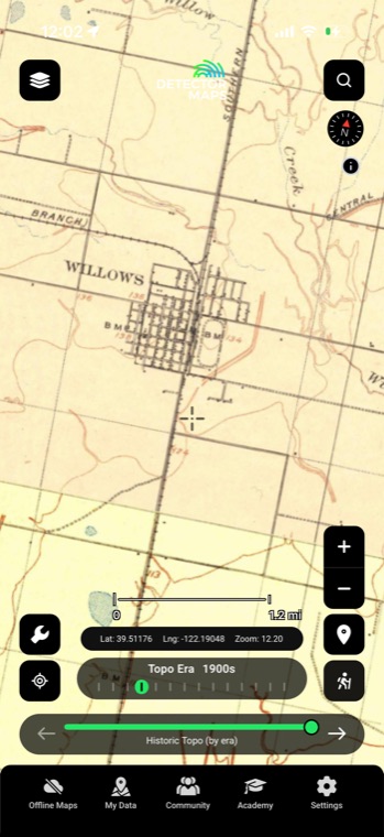
The patent gives you the legal description — say, the NE quarter of section 12 — which narrows it to a 160-acre box on the grid. From there, check the original plat for drawn structures, step the historic topo slider to the earliest decade to catch building symbols, and run LiDAR hillshade over the quarter to pick out foundation depressions and old lanes. Stacking those three layers usually shrinks 160 acres down to a few spots worth walking.
Historical map imagery courtesy of the David Rumsey Map Collection
Start free for 7 days on a yearly plan — nothing charged until the trial ends.
Prospect smarter, not harder. .
Trip reports, layer updates, the occasional gold-find email. No spam.
© 2026 Gold Discovery Solutions Pty Ltd