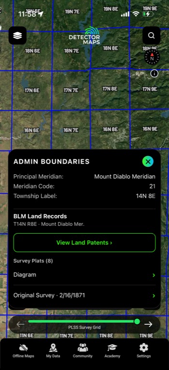
Detector Maps
Start free for 3 days on any yearly plan — nothing charged until the trial ends.
Open the mapParcel boundaries with owner details, surface management, and protected areas — nationwide. Do your permission homework from the couch and know exactly where public ground ends.
Start free trialStart free for 3 days on any yearly plan — nothing charged until the trial ends.
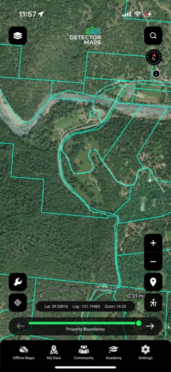
Every promising site sits on somebody's ground, and the difference between a good day and a bad one is knowing whose. Detector Maps shows parcel lines with owner details from zoom 14 up, plus Surface Management Agency and protected-area layers, so you know whether the next step is a knock on a door, a walk onto public land, or a hard pass.
Zoom past level 14 and every parcel draws its boundary, with owner details a tap away. Build your permission list from the couch — names, lot lines, and the neighboring parcels, all in one view.
Property boundaries & land access are included with Pro — $11.99/mo or $99.99/yr, 3-day free trial on yearly plans.
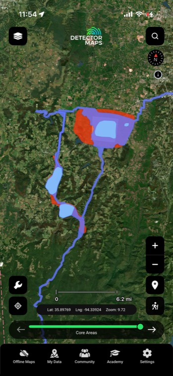
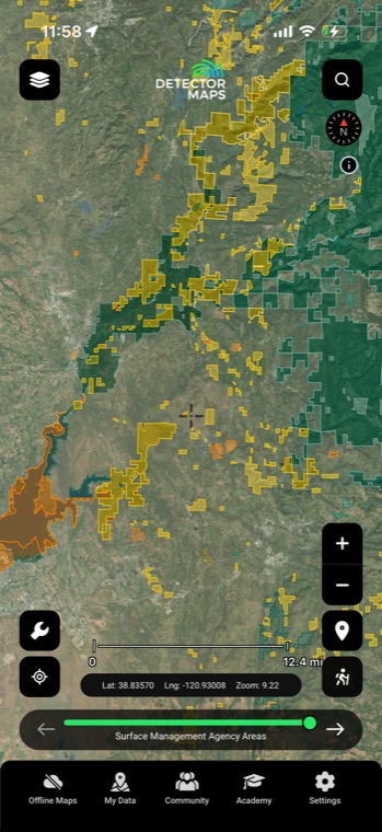
Surface Management Agency areas color the map by managing agency — BLM, Forest Service, state, and more. One glance separates open public ground from somebody's back forty, before you burn a tank of gas.
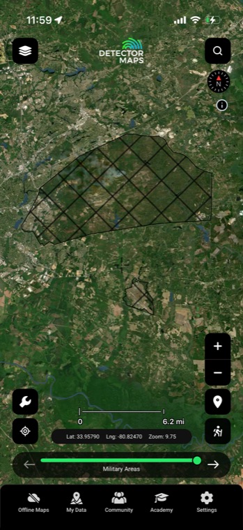
Military lands, wilderness, national monuments, wildlife refuges, and critical habitat all render as protected areas on the map. Layer in BLM recreation and admin boundaries and the picture of where you can and can't be gets sharp, fast.
Everything on web works on mobile, and it all comes with you offline in the field. Stand at a parcel corner or the edge of a wilderness boundary and see exactly where the line runs.
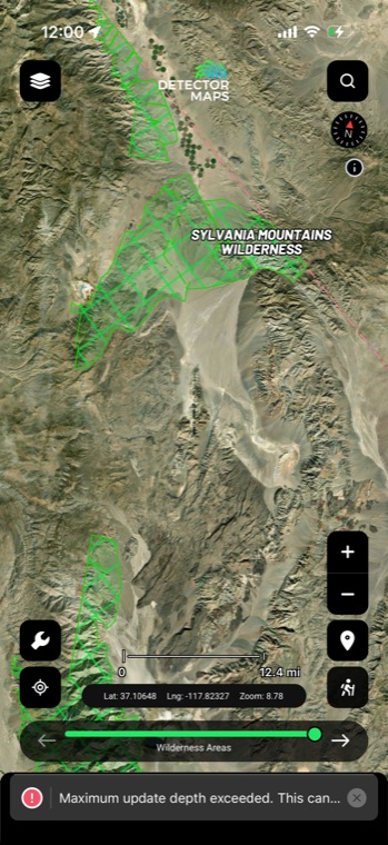
Tap the parcel over that old farmstead and the owner's details are right there on the map. A permission ask that opens with the right name lands a lot better than a cold "do you happen to know who owns this?"
Surface Management Agency coloring shows who manages the ground — federal, state, or private — before you step over. When a creek bank or two-track crosses off public land onto a parcel, you see the line on screen instead of hearing about it from an unhappy landowner.
Military land, wilderness, national monuments, wildlife refuges, and critical habitat are all layered on the map. These are reference layers for planning — protected sites are off-limits, and knowing exactly where they start keeps your hunt legal.
BLM recreation and administrative layers show the access around public ground, so you can pick a legal way in from your desk instead of guessing at the gate. Pair them with the parcel layer to make sure the two-track you're eyeing doesn't cut across private land on the way.
Owner and parcel details load from zoom 14 and closer — parcel data is dense, and drawing it at wider views would bury the map. Zoom in on the spot you're researching and the boundaries and owner details appear.
Property boundaries and the land-access layers are part of Pro, at $11.99/month or $99.99/year. If you hunt mostly on permissions, the owner details alone tend to justify the step up, and yearly plans come with a 3-day free trial so you can check coverage in your own county first.
Parcel records come from county sources and are refreshed on a rolling basis, but county data always lags real-world sales a little. If a property changed hands recently you might see the previous owner, so treat the name as a strong starting point and confirm at the door.
Boundaries come from county GIS mapping, not a licensed survey, so they can be off by a few yards in places — plenty accurate for research and permission asks, but not for settling exactly where a fence should sit. If you're working tight to a line, give it a respectful buffer or clear it with the neighbor too.
Historical map imagery courtesy of the David Rumsey Map Collection
Start free for 3 days on any yearly plan — nothing charged until the trial ends.
Prospect smarter, not harder. .
Trip reports, layer updates, the occasional gold-find email. No spam.
© 2026 Gold Discovery Solutions Pty Ltd