
Release Version 6.1.0 · Matt and Tom
Detector Maps 6.1: plan it, find it, keep it
Plan the trip with rain and storms on the map. Find it with a cleaner Terrain+ and a full screen for the drive in. Keep it in a Vault of your own. And learn to read the ground with the new Academy: 124 short lessons, free on every plan. Plus more ground in every region.
01The Vault
Your finds, kept properly
Every find has a story: where it came out, how deep, what you were swinging. Until now that lived in a camera roll and a notebook. The Vault keeps all of it together, locked, on your phone.
- A room for eachGold and coin & relic finds each get their own room, with the details that matter for what you hunt.
- Every detail of a findWeight, depth, era, catalogue number, the permission it came from, and up to six photos, front and back.
- Pick the spot on the mapSet where it came out of the ground with a crosshair on the map. Add photos from the camera, your library or a file.
- Locked to youOpen it with your PIN, Face ID, fingerprint or face unlock. It stays on your phone.
- Show it offTurn any find into a share card and post it straight to the Community.
Every region. Find it in Settings, or open it from a find’s waypoint card.
02Weather
Rain and storms on the map
Creeks rise, tracks turn to soup and storms build over open ground. Now you can see it coming before you load the car, hour by hour, right on the map you hunt from.
- Rain & Storms by HourPlay the next 7 days hour by hour. The slider is a clock, and a bolt marks a 30% or higher chance of a storm.
- Tap the rainA tap shows the forecast for that spot, along with the layer under it.
- Where to find itSwitch it on from the Weather forecast sheet or the Layers panel. The red bin on the time bar turns it off.
Every region.
03Terrain+ & Dynamic LiDAR
A cleaner Terrain+, and LiDAR in new places
The 3D model gets a screen of its own, the detectors report back at a glance, and a new colour lets low ground and raised ground read in one look.
- The new model screenThe model gets the whole screen. Height and Tilt sit on rails either side, and one LiDAR & Analysis panel holds the looks and the detectors.
- Analysis at a glancePick a detector and see what it found, with a colour key and a count for each kind.
- Copán colourA new colour for Local relief and Multi-scale: navy where the ground sits low, near white where it’s level, red where it stands up.
- Coin & relic detectors for the USAHome Sites, Walls & Roads, Military Sites and Homestead Setting, on USGS LiDAR in coin & relic mode.
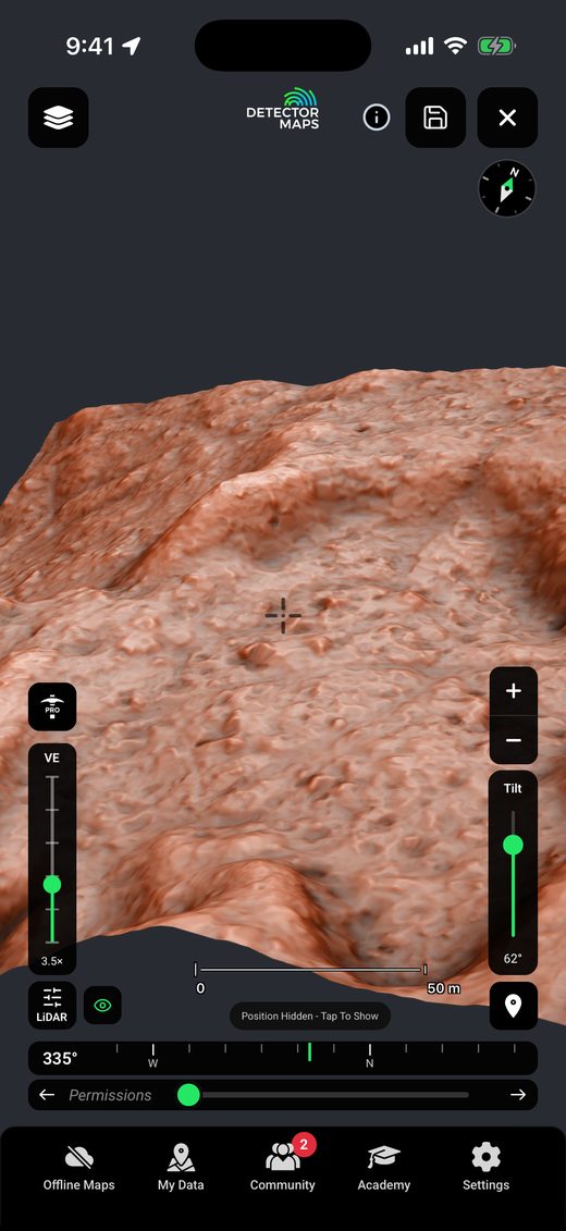
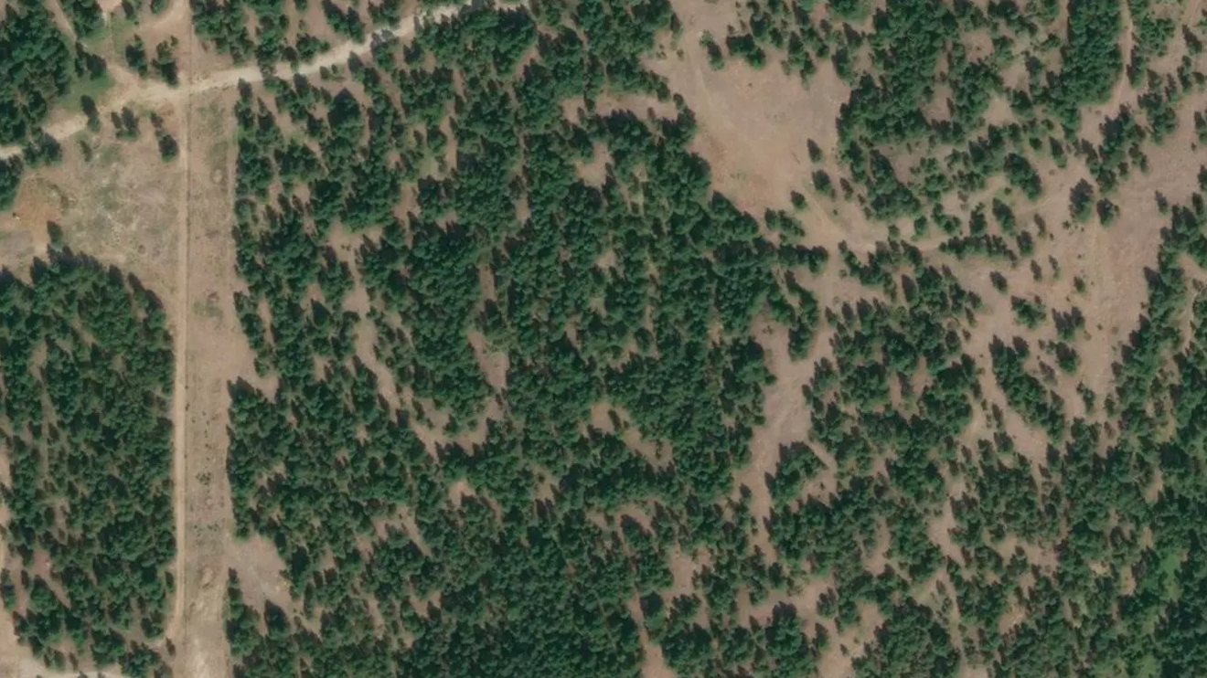
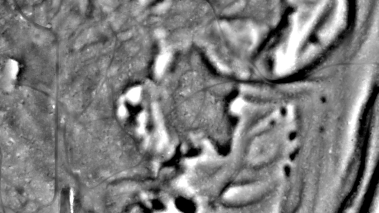 Dynamic LiDARSatelliteWildhorse River, near Fort Steele BC
- British ColumbiaTerrain+ and Dynamic LiDAR now build from British Columbia’s own 0.5 m LiDAR.
- Wales, as promisedTerrain+ and Dynamic LiDAR now build from Wales’s own 1 m LiDAR, in the phone app as well as the web.
- More of the USA, and sharperWhere a survey’s 1 m LiDAR isn’t out yet, its source data fills the gap. US LiDAR draws sharper, and first screens and pans come quicker.
Plans as before: NSW, QLD and TAS with Explorer, Victoria with the LiDAR add-on, England and Scotland on any paid plan, and the USA with Pro. Terrain+ isn’t in New Zealand yet.
04Full screen
A full screen for the drive in
Tap full screen and the map gets out of the way, with one mode for getting there and one for hunting when you arrive.
- Just the mapFull screen keeps only its own button, the compass and a one-tap waypoint.
- Navigation and huntA round button bottom left swaps between hunt mode and navigation mode, where a bearing bar takes the layer strip’s place.
- Free pan or locked onIn navigation, pan around freely, or lock on your position and the map turns with you. A green ring shows you’re locked on.
- Tilt into 3DTwo fingers tilt the map into 3D, even with 3D switched off.
- Tracks from zoom 11Tracks and service roads now show from zoom 11, from our own OpenStreetMap packs. Australia, the USA, New Zealand and Canada.
Every region. In Australia the Bush basher way on foot now goes round granted mining leases where it can (Avoid leases on its card turns it off).
05Academy
Learn to read the ground
Short lessons on geology and detecting, built for your state and the way you detect. Each one shows you first, with a moving drawing and real LiDAR, then hands you new ground and asks what you see. Every gold course covers how gold forms, how it moves and how to read the ground.
- A course for where you arePicked by your state and whether you hunt gold or coins and relics, with courses of their own for New Zealand and British Columbia.
- Up next and a weekly goalYour next lesson waits at the top, with a goal of 3 lessons a week and the whole course laid out as a path.
- BadgesFinish a unit to earn its badge, and the whole course for your Graduate badge.
- From the lesson to the mapLessons are listed by the map layer they teach, with Open on the map. The how-to videos are one tap away under App videos.
Find it on the Academy tab at the bottom of the app.
06By region
More ground where you detect
Australia
- Burnt Ground now covers 3 years in all seven states.
- New layers in every state: SA reserves, QLD stock routes and access routes, VIC 4WD seasonal closures and quartz veins, TAS magnetics, WA watercourses and more. They save offline too.
- Fossicking Areas: Queensland’s Fossicking Areas and General Permission Areas, and the NT’s declared fossicking areas. A tap links the rules.
- Live over pending in WA: green hatching shows where a live tenement lies over an application, and a tap opens the live one first and warns you.
- Tenements, fresh every night from our own nightly update, and your saved offline areas keep up with it.
- The pickaxe is back, with tenement alerts and Ground Scanner inside. With Pro.
- Geology that explains itself: NSW Structure & Lines has a legend and a tap names the line, and geochemistry filters follow each state’s own grades and colours.
USA
- US Land Access is now coloured by what you can do there: BLM, Forest, Ask first and Closed, with a red hatch where extra rules apply, such as wilderness.
- Wildfires, Satellite Fire Heat and Burned Ground have a Wildfires category of their own.
- Alaska claims: Labels and Lines on the federal and state claim rows.
- Survey plats: find PLSS plats by state, meridian, township and range.
- Geochemistry: the element picker is back on each row, showing gold first.
- Coin & relic detectors in Terrain+, and sharper LiDAR across more of the country. With Pro.
United Kingdom
- Wales: Terrain+ and Dynamic LiDAR from Wales’s own 1 m LiDAR, now in the phone app.
- Copán colour and Analysis at a glance on Terrain+ models in England.
- Permissions, your way: a Permissions switch at the top of My Data turns the layer off and on.
New Zealand
- An Academy course of its own for New Zealand.
- Tracks from zoom 11, gold occurrences in search, the Vault, weather and full screen.
Canada (British Columbia)
- Terrain+ and Dynamic LiDAR from British Columbia’s own 0.5 m LiDAR.
- An Academy course of its own for British Columbia, plus tracks from zoom 11, gold occurrences in search, the Vault, weather and full screen.
07Around the map
Small things, every day
- Gold occurrences in searchSearch finds named gold occurrences, over 100,000 names in all, offline too, with an Occurrences tab of their own.
- UTM the way you type itSearch reads a UTM position however it’s written, with or without the zone.
- My Data, tidiedFilters when deleting Trails, Export Data laid out like My Data, Shapes and Routes in one tab, and Restore from a backup file in Import.
- Permissions, your wayA Permissions switch at the top of My Data turns the layer off and on, and Permissions now work on gold maps with property boundaries too.
- CommunityUnread messages show as a count on the Community button, and post photos are square, so more of each find shows.
- The strip remembersThe layer strip under the map opens on the layer it last showed.
Steadier
- Trails keep recordingOn iPhone, Trails keep recording after you swipe the app away, with location set to Always. Only Stop ends one.
- No more white patchesZooming in on satellite no longer leaves white patches.
- Two crashes fixedOne when the app went to the background, and, on iPhone, one with CarPlay.
Update from your app store
6.1 is a free update for everyone on Detector Maps. Some of it needs a paid plan or only applies in some states. New here? Start free for 7 days on a yearly plan. Nothing is charged until it ends.
Start free for 7 daysiPhone · Android · Web
Missed the last one? Inside 6.0.1 · Detector Maps 6