See where gold was recorded.
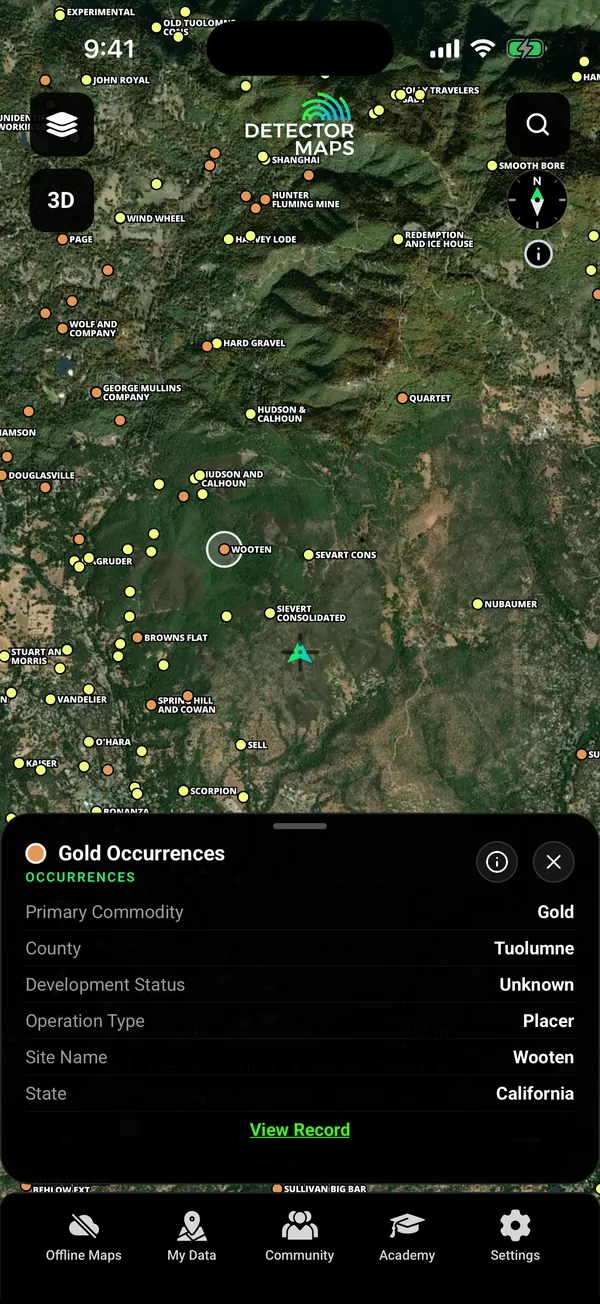
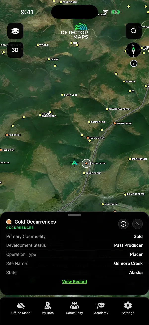
Gold records are free in every gold state. Tap one to read its record: commodity, county, status and type.
- Gold records in 16 states Free
- Alaska included Free

California. Mother Lode records.

Alaska. Records near Fox.
Free gold records in 16 states. Free BLM claims. Detailed geology on Explorer, 1 m LiDAR on Pro. Plan at home, use it with no signal.
On iPhone? Get it on the App StoreOn Android? Get it on Google Play
Free to download on iPhone and Android.
7-day free trial on yearly plans · Nothing charged until it ends · Cancel anytime.
On your phone: App Store · Google Play
7-day free trial on yearly plans · Nothing charged until it ends · Cancel anytime.
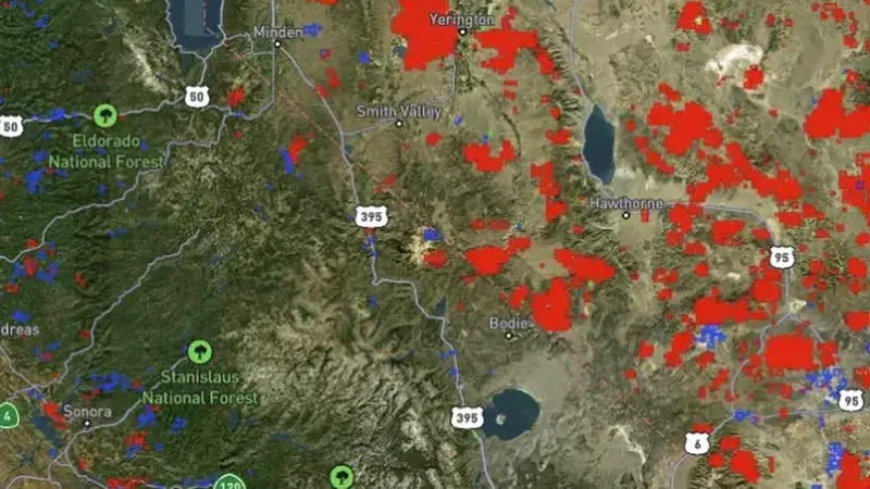
Active BLM claims · California© Mapbox, © Maxar
Active BLM mining claims over satellite imagery, California. Satellite imagery © Mapbox, © Maxar. Layer data from the sources named on each card.
Start with the free layers. Pay only if the map earns it.
Inside your free area every layer works except LiDAR.
Gold records are free in every gold state. Tap one to read its record: commodity, county, status and type.

California. Mother Lode records.

Alaska. Records near Fox.
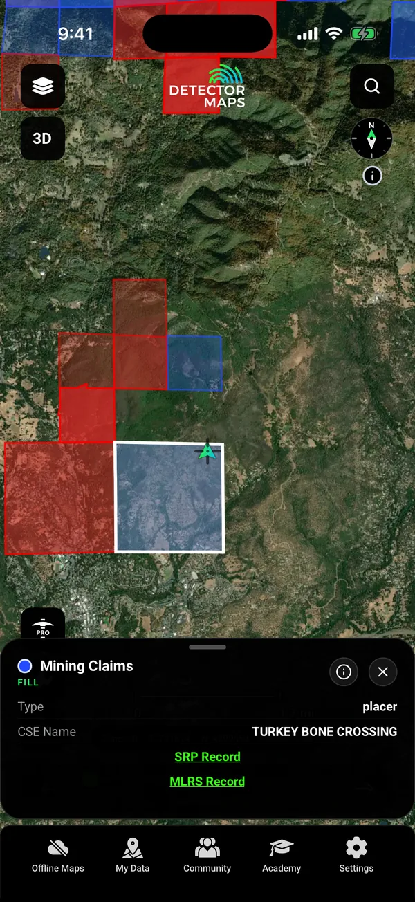
Active BLM mining claims draw on the map for free. Tap a claim to read its record and open the BLM links. Surface Management Agency areas show which agency manages the land.

Active BLM claims. Tap for the record.

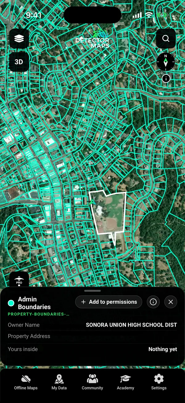
Property boundaries. Pro.
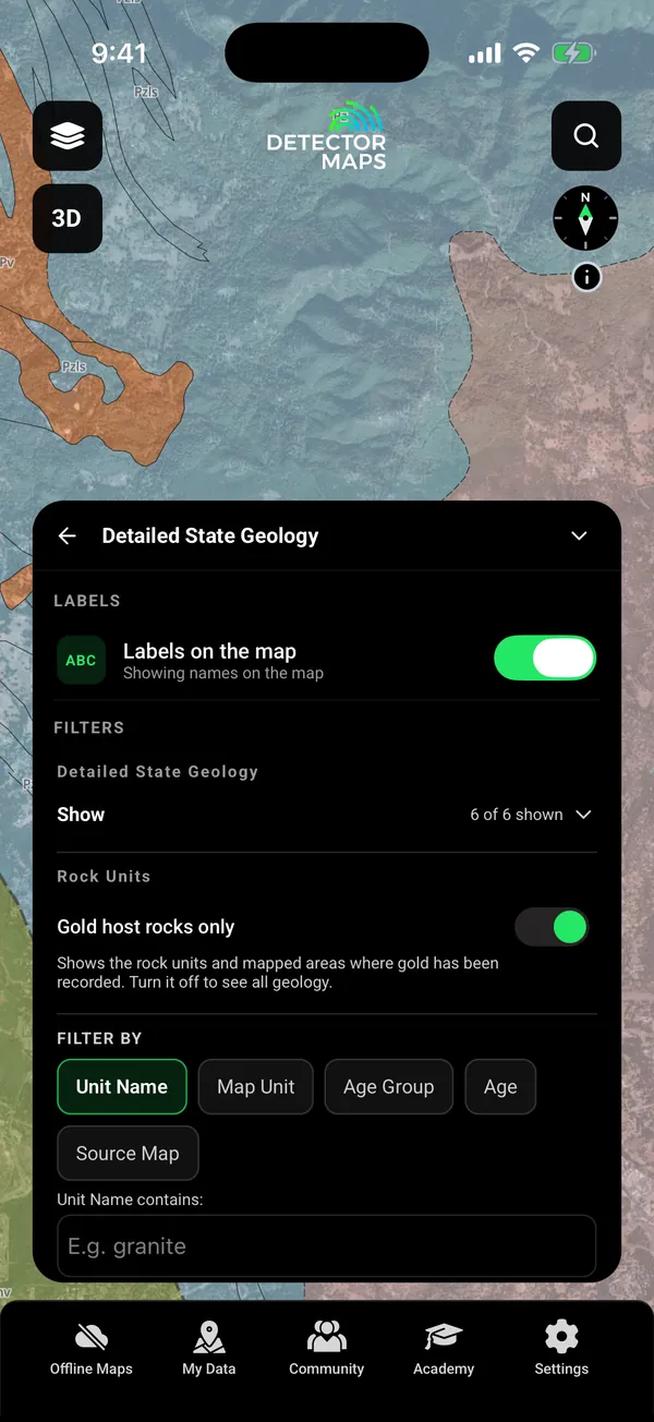
Switch on gold host rocks only to show the rock units where gold has been recorded. Switch it off to see all the geology. Search the units by name.

Gold host rocks only. One switch.
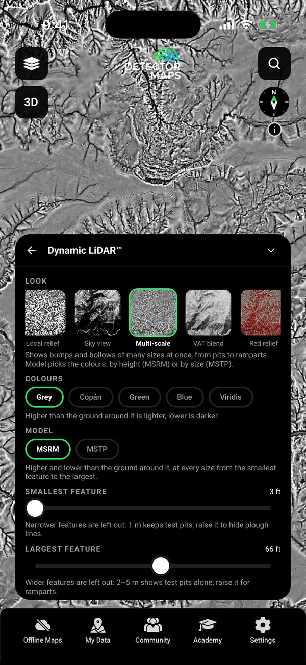
Dynamic LiDAR draws the USGS 1 m lidar over the map as you move, in nine looks. Terrain+ builds a 3D model of an area you outline and can mark Gold Workings, Downhill Dispersion and Trap Sites. Those marks are leads, not finds. Where the USGS has no 1 m lidar, the map stays clear.

Look card. Pro.
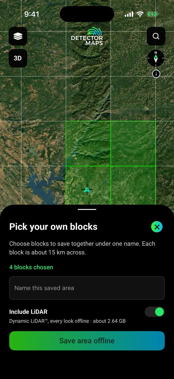
Pick the blocks you need and save them with your layers. Your records, search and waypoints keep working with no reception.

Pick your blocks. Save with your layers.

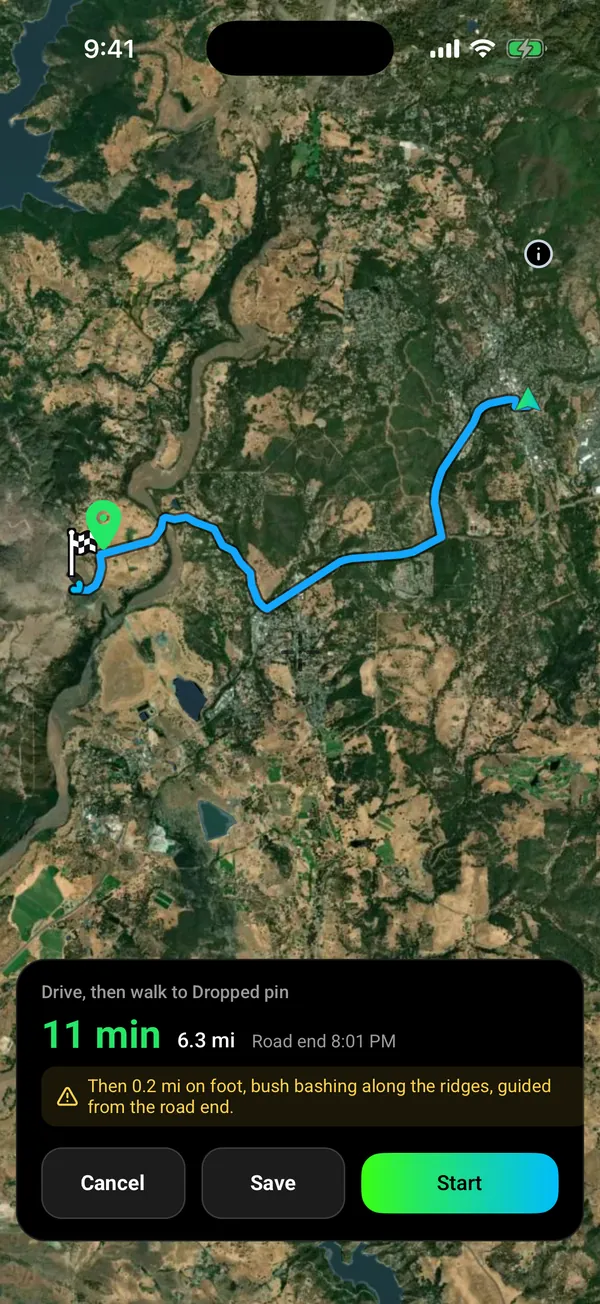
Drive, then walk. Voice on the road.
Open app.detectormaps.com in your browser and sign in with the same account.
Download free and open your state on your phone.
On iPhone? Get it on the App StoreOn Android? Get it on Google Play
Free to download on iPhone and Android.
7-day free trial on yearly plans · Nothing charged until it ends · Cancel anytime.
On your phone: App Store · Google Play
7-day free trial on yearly plans · Nothing charged until it ends · Cancel anytime.
“I use Detector Maps every time I go out prospecting. Puts me in the right spot every time. Worth every cent.”
“With regular updates and extra features constantly added it really makes the fee very reasonable.”
Try the map properly.
Get on the ground.
7-day free trial on the yearly plan.
The full toolkit, unlocked.
7-day free trial on the yearly plan.
Prices are in US dollars.
On iPhone? Get it on the App StoreOn Android? Get it on Google Play
Free to download on iPhone and Android.
7-day free trial on yearly plans · Nothing charged until it ends · Cancel anytime.
On your phone: App Store · Google Play
7-day free trial on yearly plans · Nothing charged until it ends · Cancel anytime.
Not sure which plan? Start free. You can cancel in the app, under Settings, then Subscription.
Free is free forever. Paid plans start with a 7-day free trial on yearly plans. A card is taken up front, but nothing is charged until the trial ends. Cancel in the app under Settings, then Subscription. Cancel before the trial ends and you pay nothing. Notifications on? We remind you on day 5. Explorer $59.99 a year or $7.99 a month.
The sources are public, and we name them on every layer. You get the work: merging them into one map, keeping them current, tiling them for offline and drawing every place the same way. USGS, BLM, US Forest Service.
Yes, for the areas you save. Download them on Wi-Fi with your layers. GPS works without reception. Saving new areas needs Explorer. Your free area is saved offline on the Free plan. Dynamic LiDAR saves with your areas on Pro.
Private by default. Waypoints, Trails and finds are visible to your account only. Nothing goes to the Community unless you post it. Location sharing runs only in a session you start. Backups go to your own iCloud Drive or Google Drive.
A mapped boundary alone does not tell you whether detecting is permitted. Claims are not ground to dig on. Surface Management Agency areas show who manages the land. An unshaded area is not automatically open. Check with the land manager.
Check your place in the Library before you download. 16 gold states, Alaska included.
Start with the free layers. Tap any record to read what it is. Every layer has an (i) that says what it shows and where it falls short. Five short in-app lessons walk you through the map.
“D maps are amazingly simple to understand.”
Offline mode and a battery-saver GPS mode are built for a full day in the field on most modern phones.
Yes, for the areas you save. Download them on Wi-Fi before you go, with your layers. Your phone’s GPS works without reception, so the map, your records and your waypoints keep working. Saving new areas needs Explorer. Your one free area is saved offline on the Free plan.
Yes. Open app.detectormaps.com in your browser and sign in with the same account. The full desktop web app comes with Pro. The web map needs a connection, so save areas in the phone app for places with no signal.
Free is free forever. Explorer is $59.99 a year or $7.99 a month. Pro is $99.99 a year or $11.99 a month. Yearly plans start with a 7-day free trial. A card is taken up front, but nothing is charged until the trial ends. Cancel before then and you pay nothing. Notifications on? We remind you on day 5.
The sources are public and credited: USGS, BLM and the US Forest Service. What you get is the merging, the weekday re-check of claims, the offline tiles, and every state drawn the same way.
No app can promise that. Gold records show where gold was recorded. Claims show what is staked. Geology shows the rocks. You read them in the field.
Claims are not ground for you to dig on. They are shown so you know where to stay off. Surface Management Agency areas show whether the BLM, the Forest Service or another agency manages the land. An unshaded area is not automatically open to detecting. Check with the land manager and your state’s rules first.
Dynamic LiDAR and Terrain+ come with Pro. Explorer does not include them. Coverage depends on where the USGS has flown 1 m LiDAR. Where it has not, the map stays clear.
Sixteen gold states: Alabama, Alaska, Arizona, California, Colorado, Georgia, Idaho, Montana, Nevada, New Mexico, North Carolina, Oregon, South Carolina, Utah, Virginia and Washington. Each has its own gold records, claims and geology.

Real data, named sources.
Download free, open your state and see what is staked.
On iPhone? Get it on the App StoreOn Android? Get it on Google Play
Free to download on iPhone and Android.
7-day free trial on yearly plans · Nothing charged until it ends · Cancel anytime.
On your phone: App Store · Google Play
7-day free trial on yearly plans · Nothing charged until it ends · Cancel anytime.
The Detector Maps support inbox is staffed by Matt and Tom, the two brothers who built it. Contact us