For gold prospectors in Australia

See where gold was found near you.

Gold records for all seven states. Live tenements. LiDAR that shows the ground under the trees. Plan at home, use it with no signal.

On iPhone? Get it on the App StoreOn Android? Get it on Google Play

Free to download on iPhone and Android.

7-day free trial on yearly plans · Nothing charged until it ends · Cancel anytime.

Scan with your phone camera to get the app
Start free trialOpen the web map

On your phone: App Store · Google Play

7-day free trial on yearly plans · Nothing charged until it ends · Cancel anytime.

4.7 / 5 from 2,400+ ratings on the App Store and Google Play · 10,000+ prospectors and detectorists
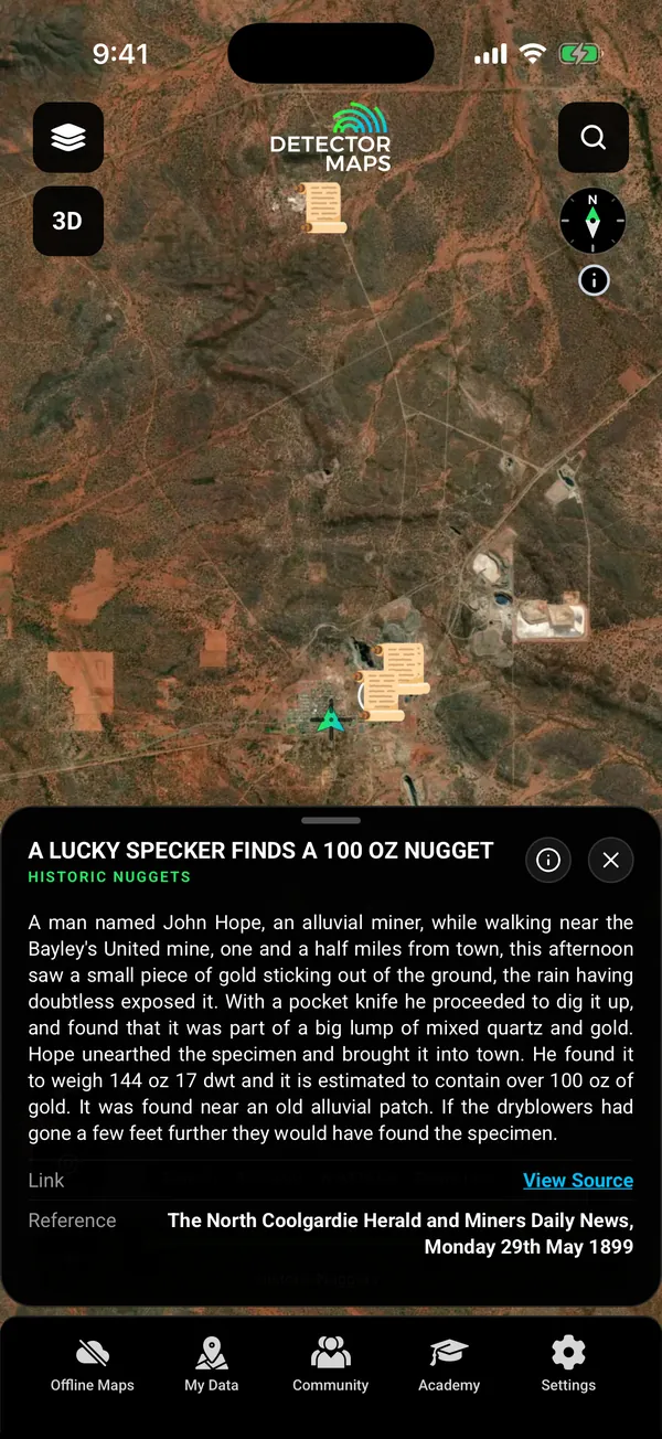
Historic Nuggets: a 1899 newspaper report of a 144 oz nugget found near Coolgardie, tapped record card

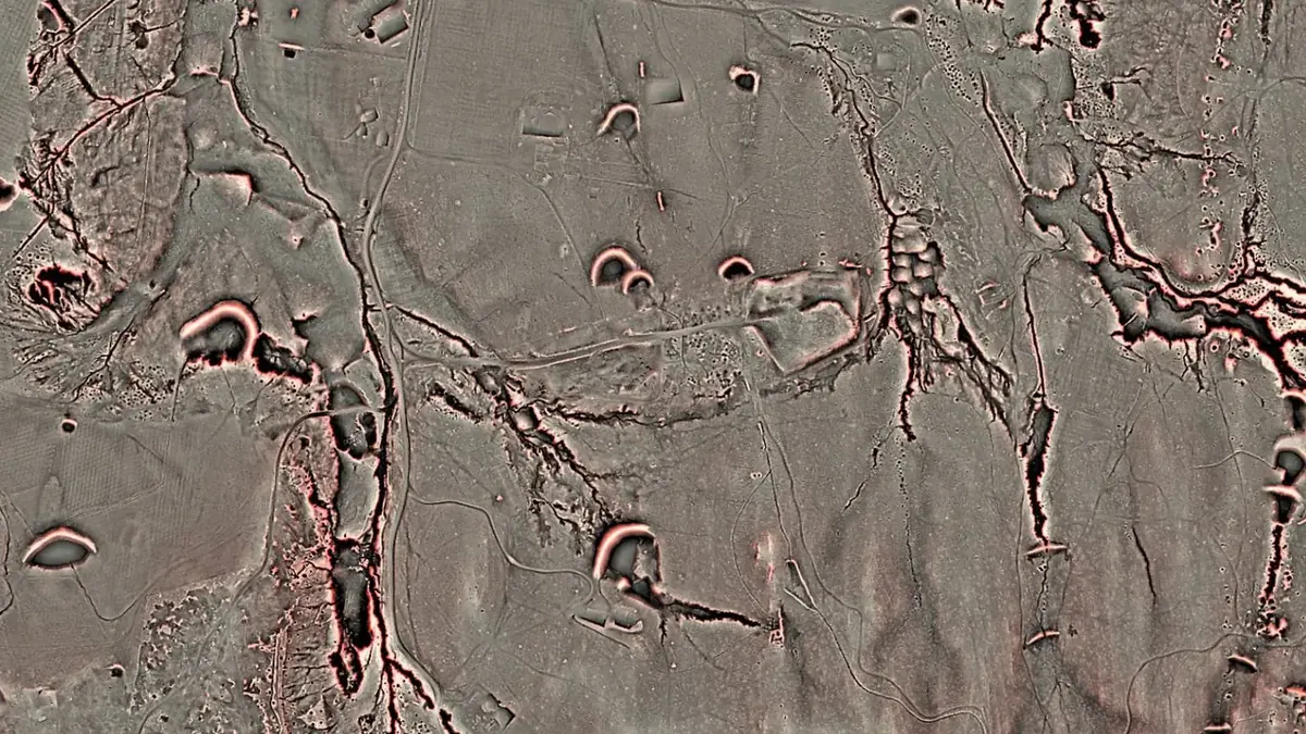
Satellite, then Dynamic LiDAR. Wattle Gully, Victoria. Satellite imagery © Mapbox, © Maxar. Layer data from the sources named on each card.

4.7 / 5from 2,400+ ratings on the App Store and Google Play
10,000+prospectors and detectorists
7 statesgold records in every one, free
Every weekdaytenements refreshed, with holder and status filters
Free first

Free on every plan, forever.

Start with the free layers. Pay only if the map earns it.

  • Gold records in every state
  • A lease or tenement layer in every state
  • One free area of 250 km², offline too
  • Palmerville Station, QLD: every layer
  • Trails, replay and backups

Inside your free area every layer works except LiDAR.

01The night before

See where gold was found.

Open the gold records for your state and tap one to read it. Historic nugget reports link to the old newspaper that printed them.

  • Gold occurrence records in every state Free
  • Historic nugget finds, each with its newspaper Explorer
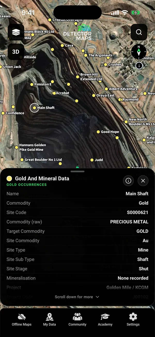
Named gold occurrences around the Kalgoorlie Super Pit with a tapped record card (Main Shaft)

Gold records. Tap one to read it.

Historic Nuggets: a 1899 newspaper report of a 144 oz nugget found near Coolgardie, tapped record card

Historic nuggets. With the old newspaper.

02Whose ground

Check the tenement before you drive.

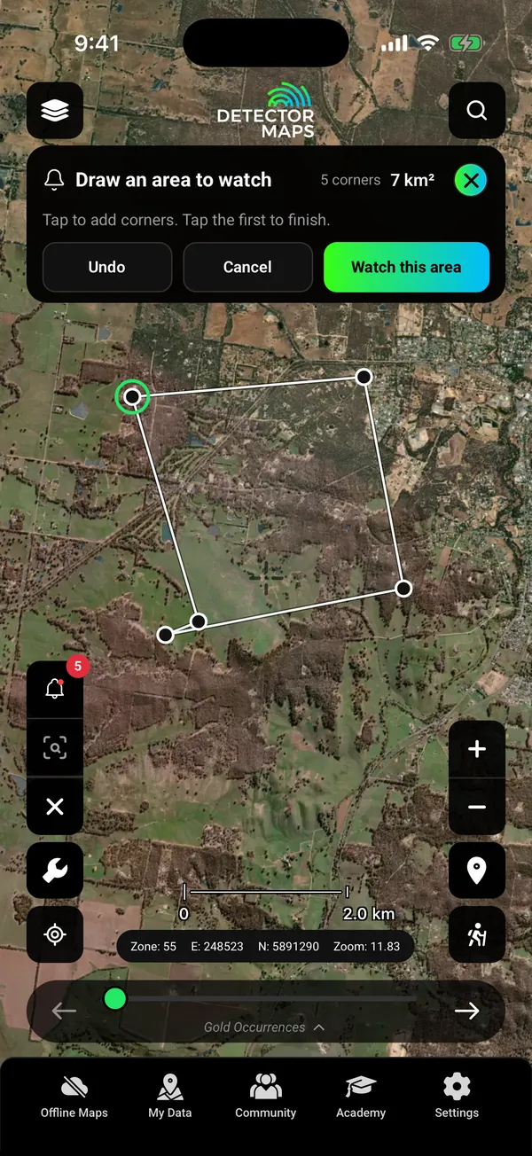
Live tenements show who holds the ground and its status. Filter by type and by when a tenement expires. Pro can watch a drawn area or a whole state.

  • A lease or tenement layer in every state Free
  • Holder, status and expiry filters Explorer
  • Tenement alerts for a drawn area or a whole state Pro
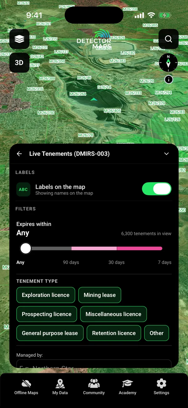
Live tenements around the Kalgoorlie Super Pit with the filter card (expiry, tenement type, managed by)

Tenement filters. Expiry, type, managed by.

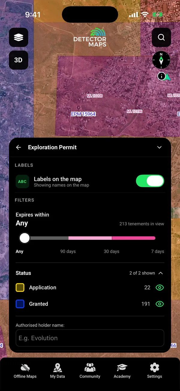
Queensland Mining Lease and Exploration Permit tenements over Charters Towers with the Exploration Permit filter card (expires within, status counts, holder search)

Queensland. Mining leases and permits.

Watch an area (Pro): the Draw an area to watch card with four corners drawn on satellite east of Castlemaine, 7 km2, Undo / Cancel / Watch this area

Watch an area. Pro.

03Read the ground

Geology, samples and prospectivity.

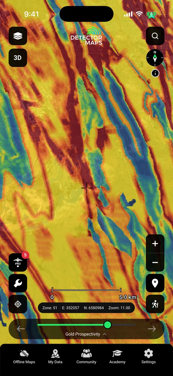
Check the rocks first, then the samples taken around them. Gold Prospectivity gives you a research lead to check against both.

From the layer info“A higher score is a research lead, not proof of gold.”
  • Geology with a gold host rocks filter Explorer
  • Millions of soil and rock samples Explorer
  • Gold Prospectivity in NSW, QLD and WA Explorer
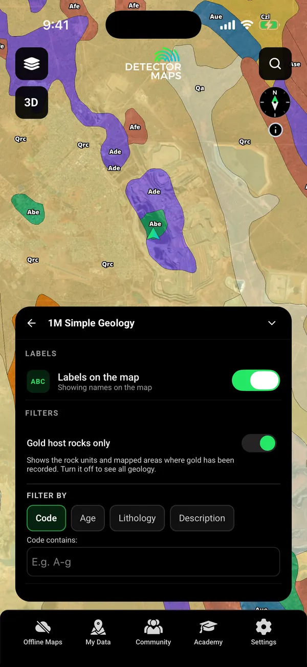
1M Simple Geology with the Gold host rocks only switch on (filter card open)

Gold host rocks. One switch.

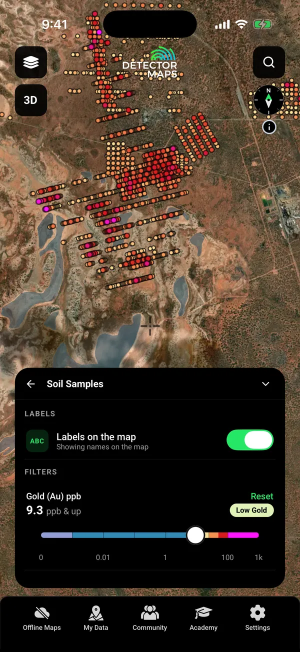
Soil geochemistry (gold ppb) near Kalgoorlie with the grade filter card set to 9.3 ppb and up

Soil samples. Grade filter.

Gold Prospectivity heat layer over satellite, goldfields south-east of Kalgoorlie

Gold Prospectivity. A research lead.

04See under the trees

Dynamic LiDAR strips the bush away.

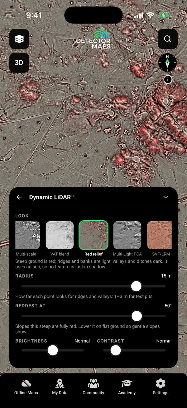
Satellite shows treetops. LiDAR shows the ground under them. Detector Maps draws it on your phone in nine looks, so you can change the look on the spot.

  • NSW and QLD Explorer
  • Tasmania Any paid plan
  • Victoria Add-on, A$39.99 a year
  • Not yet in WA, SA or NT
  • Saved with your offline areas, every look included
Dynamic LiDAR over the Charters Towers goldfield, with the Look card (nine looks, Red relief shown)

Look card. Nine looks.

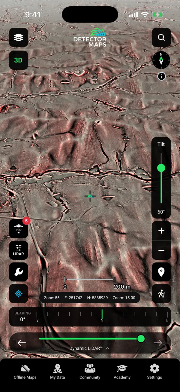
LiDAR ground tilted to 60 degrees in 3D, with gullies and old workings standing out.

3D. Tilt 60° · zoom 15

Satellite photo of Wattle Gully, Victoria: forest canopy with a few paddocks.The same ground in Dynamic LiDAR, showing shafts, races and diggings under the trees.
SatelliteLiDAR · Red reliefWattle Gully, VIC · 37.12° S 144.20° E

Satellite imagery © Mapbox, © Maxar. Layer data from the sources named on each card.

Where Dynamic LiDAR worksPlan needed
New South Wales and QueenslandExplorer
TasmaniaAny paid plan
VictoriaAdd-on, A$39.99 a year
Western Australia, South Australia and Northern TerritoryNot available yet

“I found that Detector Maps is an essential tool for the prospector and miner alike, its super easy to use and offers great prospecting and mining mapping and information Australia wide, the LiDAR function layer where applicable is a game changer.”

Brent Shannon, Aussie Gold Hunters · 1 Mar 2026 · App Store
05On the day

Check for fire, then drive in.

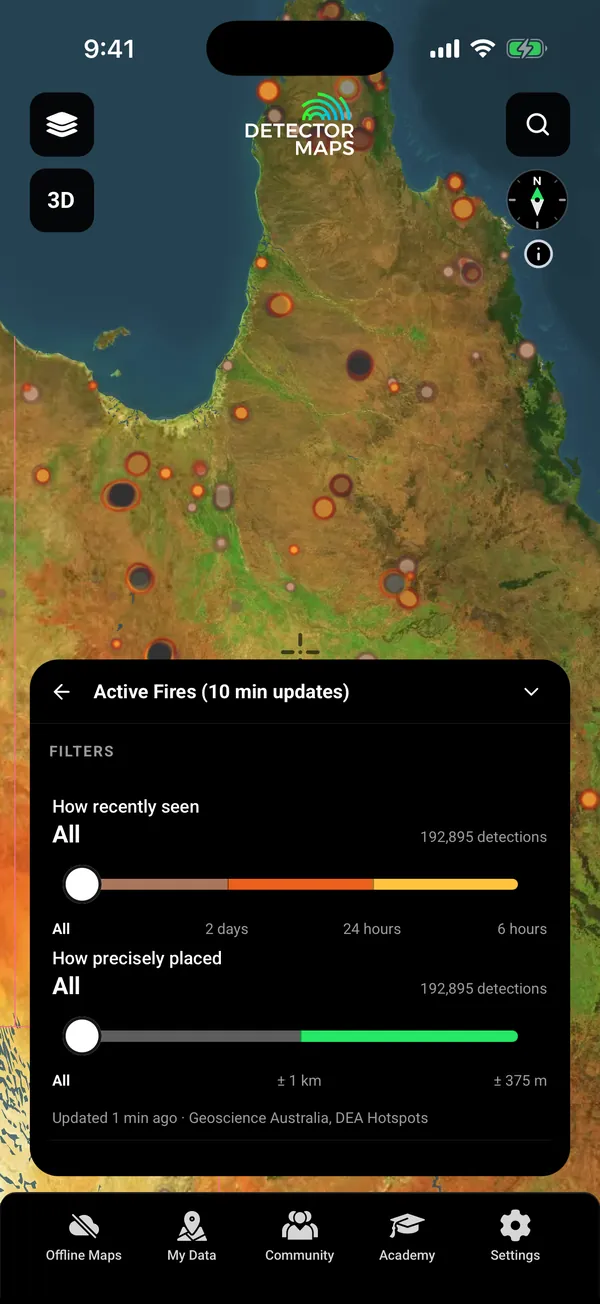
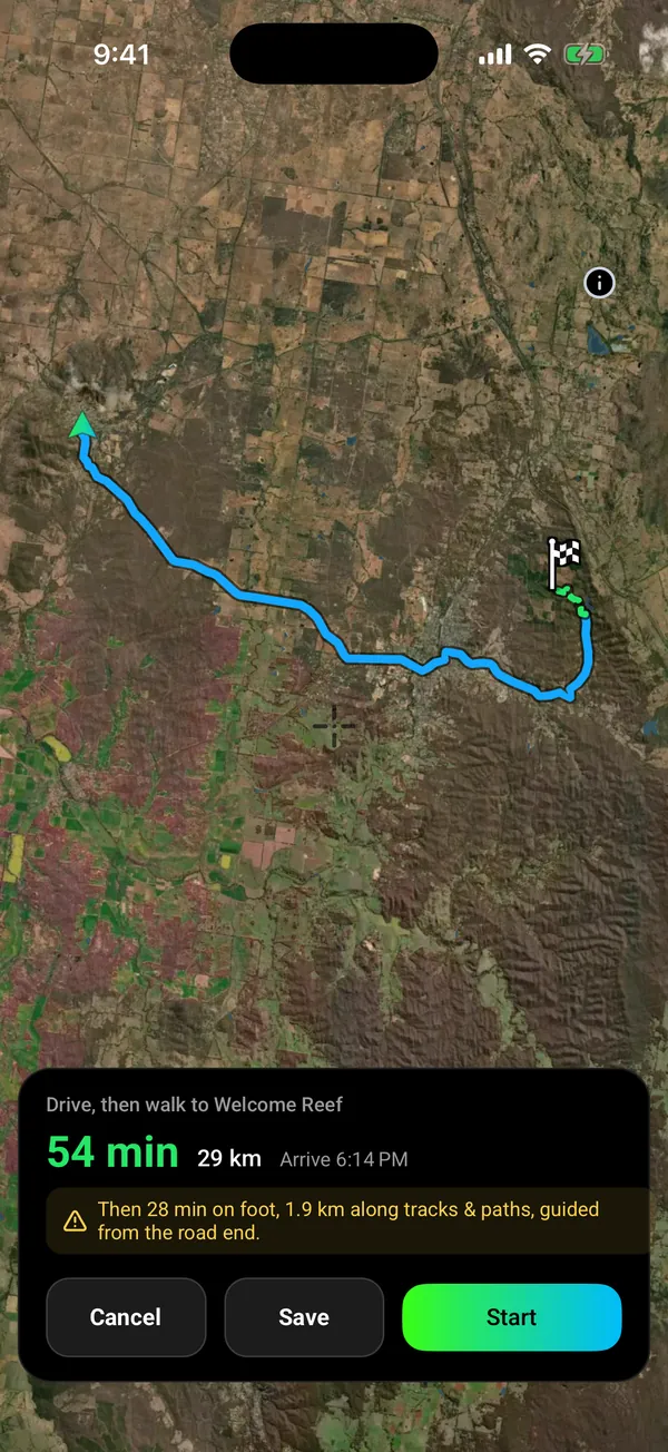
Active Fires shows satellite fire detections, coloured by how recently they were seen. Go to drives you in on sealed roads with voice, then guides the walk from where the road ends.

  • Active Fires Explorer
  • Go to: drive, then walk the last part Explorer
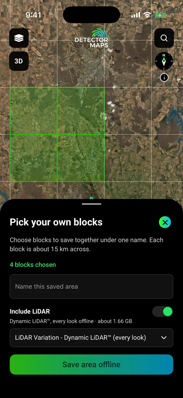
  • Offline maps for the areas you choose Explorer
  • Apple CarPlay and Android Auto, with your layers
Active Fires: live satellite hotspots over Cape York with the two filter sliders (how recently seen, how precisely placed) and live detection count

Active Fires. Two filter sliders.

Go to route, drive then walk: 54 min and 29 km by road, then 28 min on foot (1.9 km along tracks and paths) to Welcome Reef, a named gold occurrence

Drive, then walk. Voice on the road.

Offline block picker over Victorian goldfields ground: four 15 km blocks chosen, Include LiDAR switch on (Dynamic LiDAR, every look, about 1.66 GB)

Pick your blocks. Save with your layers.

06On your computer too

Plan on the big screen.

Open app.detectormaps.com in your browser and sign in with the same account. One plan covers your phone and the web.

  • The same layers on a bigger map
  • Waypoints and Trails you sync from your phone
  • Plan at home, then save the area to your phone for no signal
  • Dynamic LiDAR, on the same plans as the app
  • Terrain+ 3D models

Open the web map

Seen enough?

Download free and open your state on your phone.

On iPhone? Get it on the App StoreOn Android? Get it on Google Play

Free to download on iPhone and Android.

7-day free trial on yearly plans · Nothing charged until it ends · Cancel anytime.

Start free trialOpen the web map

On your phone: App Store · Google Play

7-day free trial on yearly plans · Nothing charged until it ends · Cancel anytime.

Don’t go detecting without it

“I use Detector Maps every time I go out prospecting. Puts me in the right spot every time. Worth every cent.”

nanny bish · 7 Jan 2026 · App Store
As seen on YouTube

Three independent creators tested it in the field.

We didn’t pay for any of them.

Plans

Start free. Upgrade when the map earns it.

“With regular updates and extra features constantly added it really makes the fee very reasonable.”

Anlopatravels, App Store, 26 May 2026
FreeForever

Try the map properly.

  • Gold occurrence records in every state
  • A lease or tenement layer in every state
  • One free area of 250 km² where every layer works, offline too (LiDAR not included)
  • Palmerville Station, QLD, every layer
  • Trails, replay and Trails+
  • Waypoints, shapes and search
  • Automatic backups
  • Read the Community
ExplorerMost popular

Everything most prospectors need.

A$99 a yearor A$9.99 a monthabout 27c a day

7-day free trial on the yearly plan.

  • Tenement holder, status and expiry filters
  • Geology with gold host rocks, historic nuggets, millions of samples, Gold Prospectivity in NSW, QLD and WA
  • Active Fires, Go to, bush basher, offline maps for the areas you choose
  • Dynamic LiDAR in NSW, QLD and Tasmania
  • Google satellite base map, location sharing, post and join events
Pro

Industry-grade data.

A$249 a yearor A$34.99 a month

7-day free trial on the yearly plan.

  • Everything in Explorer
  • Tenement alerts for a drawn area or a whole state
  • Report search across decades of exploration reports

Add-on Victorian LiDAR: A$39.99 a year. Sold on its own, not part of the free trial.

On iPhone? Get it on the App StoreOn Android? Get it on Google Play

Free to download on iPhone and Android.

7-day free trial on yearly plans · Nothing charged until it ends · Cancel anytime.

Start free trialOpen the web map

On your phone: App Store · Google Play

7-day free trial on yearly plans · Nothing charged until it ends · Cancel anytime.

Not sure which plan? Start free. You can cancel in the app, under Settings, then Subscription.

Straight answers

Before you download.

What does it cost? Am I stuck?

Free is free forever. Paid plans start with a 7-day free trial on yearly plans. A card is taken up front, but nothing is charged until the trial ends. Cancel in the app under Settings, then Subscription. Cancel before the trial ends and you pay nothing. Notifications on? We remind you on day 5. Explorer A$99 a year or A$9.99 a month.

Isn’t this free government data?

The sources are public, and we name them on every layer. You get the work: merging them into one map, keeping them current, tiling them for offline and drawing every place the same way. Geological surveys of all seven states, Geoscience Australia.

Does it work offline?

Yes, for the areas you save. Download them on Wi-Fi with your layers. GPS works without reception. Saving new areas needs Explorer. Your free area is saved offline on the Free plan. Dynamic LiDAR saves with your areas, every look included.

Are my spots private?

Private by default. Waypoints, Trails and finds are visible to your account only. Nothing goes to the Community unless you post it. Location sharing runs only in a session you start. Backups go to your own iCloud Drive or Google Drive.

Can I go there? Land access and legality

A mapped boundary alone does not tell you whether detecting is permitted. A tenement is not public land. Prospecting Access and Fossicking Areas show what each state publishes (a guide, always verify). Check your state’s rules first.

Does it cover my area?

Check your place in the Library before you download. Seven states: NSW, QLD, VIC, WA, SA, TAS, NT. LiDAR in NSW, QLD, TAS and VIC, not yet WA, SA or NT.

I’m a beginner. Is it too much?

Start with the free layers. Tap any record to read what it is. Every layer has an (i) that says what it shows and where it falls short. Five short in-app lessons walk you through the map.

“D maps are amazingly simple to understand.”

Anlopatravels, App Store, 26 May 2026

Will it flatten my battery?

Offline mode and a battery-saver GPS mode are built for a full day in the field on most modern phones.

Questions

Questions, answered.

Does it work with no signal?

Yes, for the areas you save. Download them on Wi-Fi before you go, with your layers. Your phone’s GPS works without reception, so the map, your records and your waypoints keep working. Saving new areas needs Explorer. Your one free area is saved offline on the Free plan.

Can I use it on my computer?

Yes. Open app.detectormaps.com in your browser and sign in with the same account. Your plan works there too. So do the waypoints and Trails you sync from your phone. The web map needs a connection, so save areas in the phone app for places with no signal.

What does it cost, and how does the trial work?

Free is free forever. Explorer is A$99 a year or A$9.99 a month. Pro is A$249 a year or A$34.99 a month. Yearly plans start with a 7-day free trial. A card is taken up front, but nothing is charged until the trial ends. Cancel before then and you pay nothing. Notifications on? We remind you on day 5.

Isn’t this just free government data?

The sources are public and we name them: the geological surveys of all seven states and Geoscience Australia. What you get is the merging, the weekday refresh of tenements, the offline tiles, and every state drawn the same way.

Will it tell me where the gold is?

No map can promise gold. Gold records show where gold has been recorded. LiDAR shows the ground under the trees. Tenements show who holds it. You spend your day on better ground.

Can I prospect on the tenements it shows?

A tenement is not public land, and a boundary alone does not tell you whether detecting is allowed. The map shows who holds the ground so you can stay off it. Prospecting Access and Fossicking Areas layers show what each state publishes (a guide, always verify). Check your state’s rules before you dig.

Which states have LiDAR, and what does it cost?

NSW and QLD are included with Explorer. Tasmania needs any paid plan. Victoria is an add-on, A$39.99 a year. WA, SA and NT are not available yet.

Can I bring my old waypoints and tracks?

Yes. Import KML, KMZ, GPX, GeoJSON, CSV and TCX files, and Trilobite exports. Detector Maps shows you what is in the file first and skips duplicates.

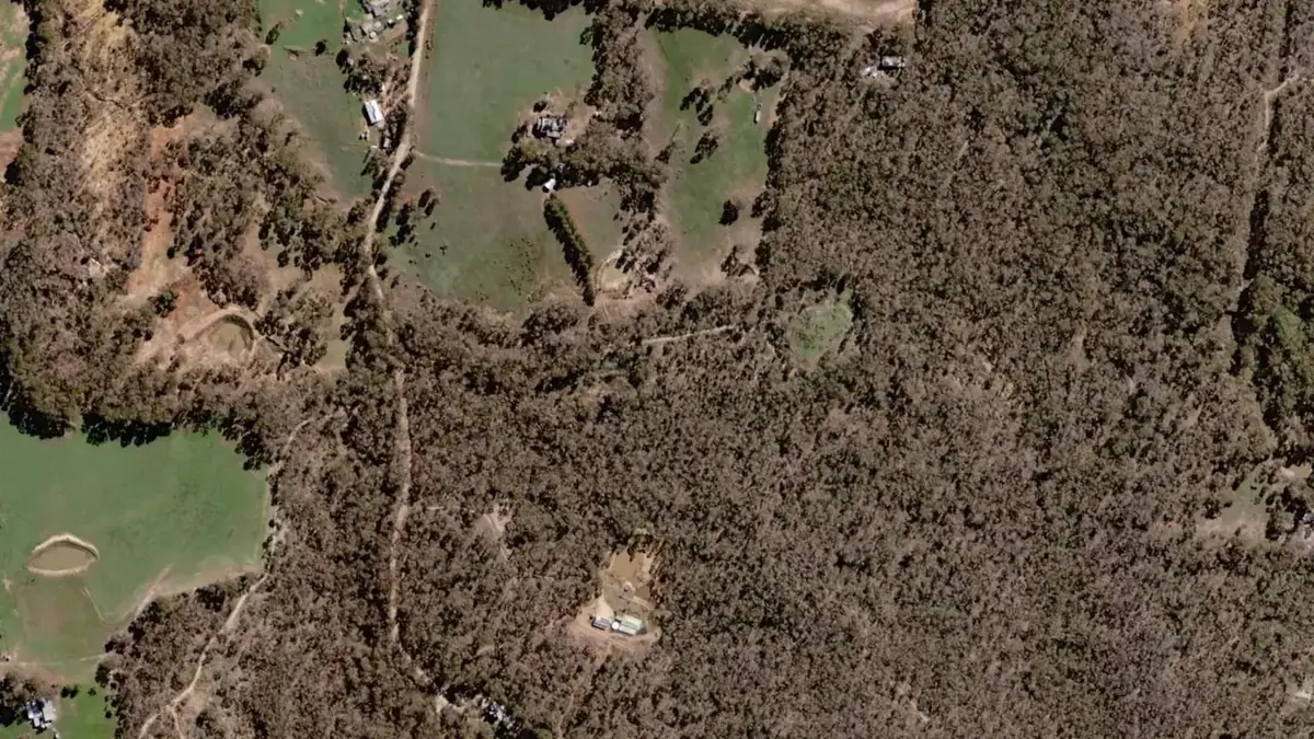
Real data, named sources.

Geological surveys of all seven Australian statesGeoscience AustraliaHistoric newspapers
Get Detector Maps

Plan Saturday’s trip tonight.

Download free, open your state and read what turned up before.

On iPhone? Get it on the App StoreOn Android? Get it on Google Play

Free to download on iPhone and Android.

7-day free trial on yearly plans · Nothing charged until it ends · Cancel anytime.

Scan with your phone camera to get the app
Start free trialOpen the web map

On your phone: App Store · Google Play

7-day free trial on yearly plans · Nothing charged until it ends · Cancel anytime.

Or open the web map

The Detector Maps support inbox is staffed by Matt and Tom, the two brothers who built it. Contact us