 Detector Maps
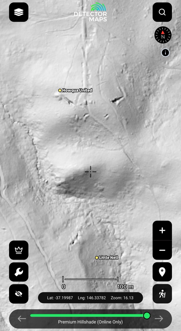
See the ground the bush is hiding
1-metre bare-earth LiDAR strips the canopy off the goldfields, so you read the old workings, plan your lines, then drive out knowing where to swing.
- Read the old workingsShaft mounds, costeans and alluvial diggings the box-ironbark grew back over.
- Plan your lines before you driveE-scout races, leads and gully systems from the couch.
- Spot the ground others walk pastSubtle costeans, old water races and dam walls the eye misses on foot.
Mining Tenement Maps for Gold Prospecting
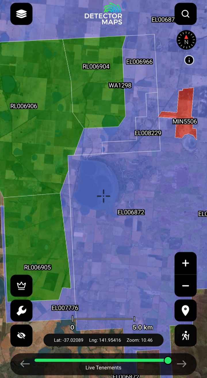
Leases, licences and applications, tap-to-check. Every polygon shows the holder, the status and a link to the official record — so you know whose ground you're standing on before you ever unpack the coil.
- Check the ground before you driveTap any polygon to read its holder, status and the official record link before you commit three hours of fuel — no more arriving to find it was pegged last Tuesday.
- Spot the open groundWith live and pending tenements colour-coded, the gaps between them read at a glance — so you can narrow in on ground that isn't already held. Always confirm a parcel's current status against the official register before you act on it.
- Stay legal, stay welcomeA tenement is someone else's title, not public land. Know the boundary and check your state's fossicking access and Miner's Right rules before you swing. A guide, not legal advice — we link the government page in-app.
Historic Gold Workings Maps (100yr+)
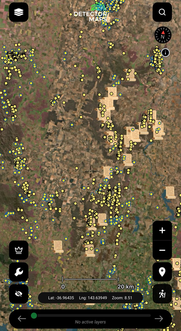
Geo-referenced shafts, alluvials and quartz reefs, every icon linked to its state geological survey record. Where the icons cluster, a goldfield reads. Stack LiDAR over the top and a worked goldfield can sharpen into a search target.
- Read a goldfieldWhere the icons cluster, a goldfield reads on the map. Spot the tight knots of old shafts and alluvial diggings and you know where the country has already given gold up.
- Open the recordTap any working to read its linked state geological survey record — the source document behind the icon, not a guess. Check what was worked, when, and what they pulled out before you walk in.
- Stack with LiDARLay the workings over a 1m bare-earth hillshade and the diggings line up with the ground that hides them. Cross-reference where-was-gold with what-the-bush-is-covering to help narrow a search target.
Dig where the chemistry says gold
Government soil, stream-sediment and rock-chip gold assays on the map — hunt mineralised ground nobody has worked.
- Filter for goldRead where gold concentrates across the surface.
- Cross-reference the stackLine geochem up with workings, geology and structure.
- Straight from the surveysThe same assay data the state geologists use.

Geology Maps for Gold Prospecting
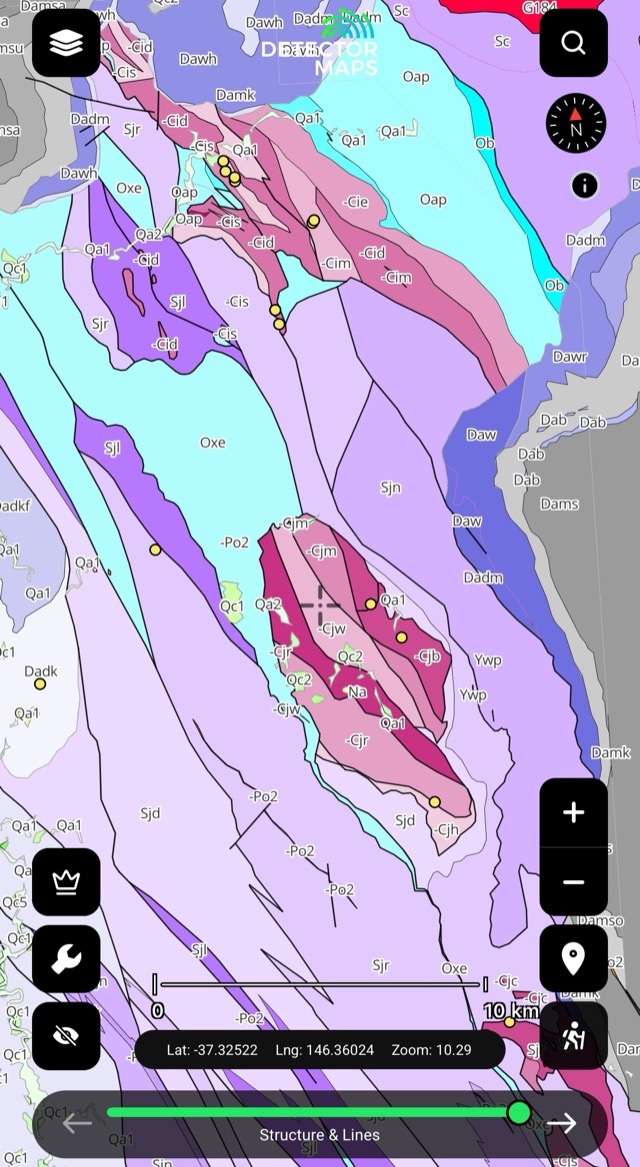
Read the country, not just the map. Seamless surface geology from the state surveys shows the host rock, the structure and the contacts that gold tends to sit near — so you understand why the ground works before you ever swing.
- Read the host rockTap any unit to see the formation name and rock type. Learn to recognise the greenstones, granites and sediment packages that gold is associated with — and the country it usually isn't in.
- Follow the structureFaults, contacts and fold axes are where fluids moved and metal concentrated. Trace those lines across the map and plan your ground around them, not just the open paddocks.
- Map reef to its host unitCross-reference a known reef or old working against the geology underneath it, then walk that same unit along strike to narrow where else it could carry.
Magnetics & Geophysics Maps — read the structure under the soil
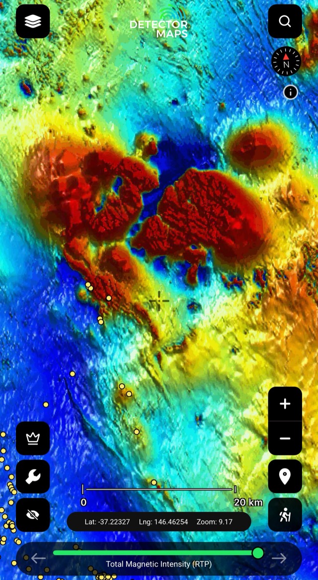
RTP and 1VD magnetics trace the faults, contacts and strike of the magnetic bedrock, so you can read the structure where surface mapping runs out — then plan your ground around it.
- Read the bedrock and its strikeRTP magnetics shows the magnetic bedrock and the direction it runs — the structure under the soil that surface mapping can't reach. Some rocks and magnetic features host gold, so read where the grain bends or breaks.
- Spot faults, contacts and breaks1VD sharpens the edges — the lines, offsets and contacts in shallow magnetics. Trace a structure across the ground and check where it crosses your historic and geochem leads.
- Keep reading where surface geology goes quietWhere surface geology runs thin, magnetics still reads the bedrock structure beneath — so you can keep following the trend instead of guessing past it.

Take it bush with zero bars — offline goldfield maps
Download your ground before you leave town. Every layer and your GPS blue-dot keep working at the bottom of a gully — then sync the moment you're back in range.
- Download before you leave townCache your patch on Wi-Fi before you go — tenements, geology, historic workings and geochem ride along, so there's nothing to load when you pull up at the gate.
- Read every layer with no signalAt the bottom of a gully with zero bars, the layers you downloaded stay on the screen — pan, zoom and check the ground without a single bar. (Offline LiDAR caching is coming soon.)
- Know where you are off-gridThe GPS blue-dot keeps tracking with no coverage, so you always know where you're standing against the tenement boundaries and the old workings — no one to call, no problem.
Explore
Open the full page on any layer.
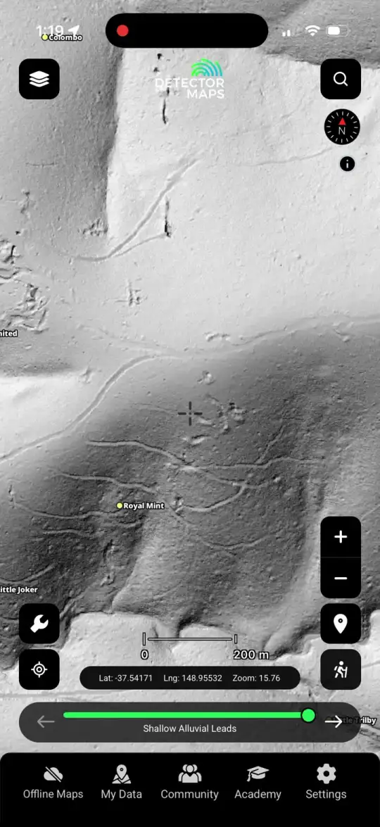
1-metre LiDAR hillshade
See the ground the bush is hiding.
Explore →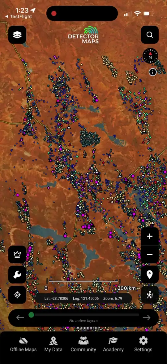
Surface geochemistry
Dig where the chemistry says gold.
Explore →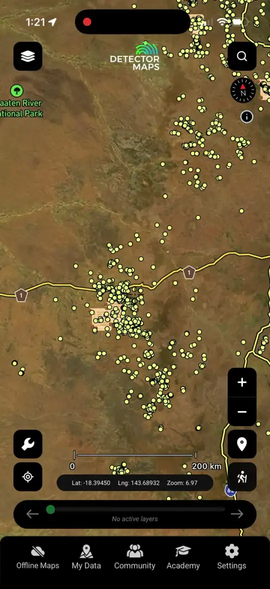
Historic workings
Start where gold's already come out.
Explore →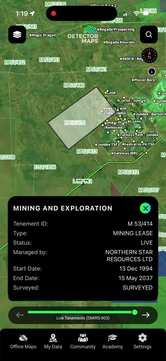
Live & historic tenements
Know whose ground you're on.
Explore →Gold maps by state
Every state & territory, one map.
Explore →Plans & pricing
One subscription, every base layer.
Explore →Stop guessing. Start prospecting.
Read the ground before you drive out — three days free on any yearly plan.



3-day free trial · Nothing charged until it ends · Cancel anytime