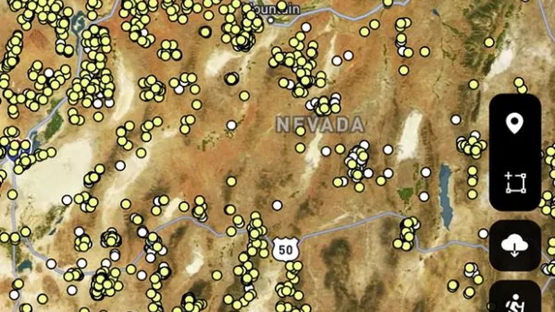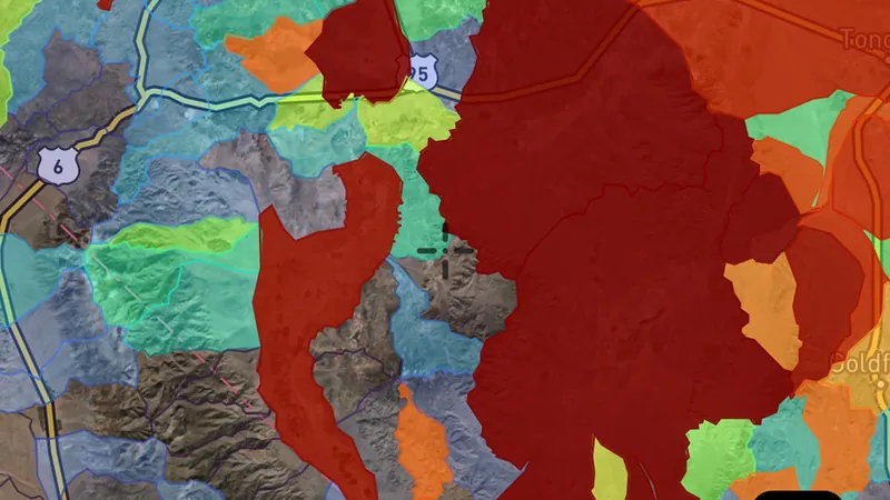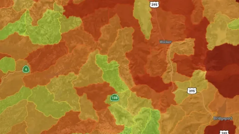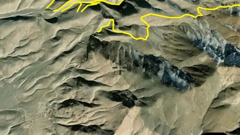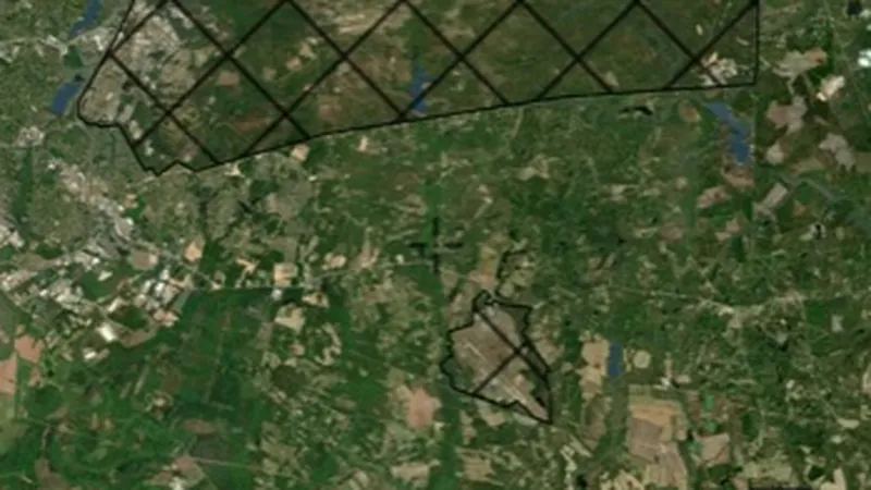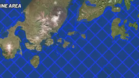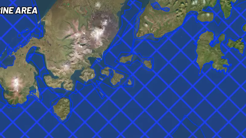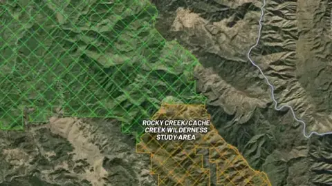
Map library · USA gold

Alaska map layers

37 layers for gold prospecting in Alaska, in 12 categories. 3 are free on every plan: Historic Gold Occurrences, Federal Mining Claims and Alaska State Mining Claims. 31 more open with Explorer. 3 need Pro.

29 of these are also in other states in USA gold. Each links to one page that lists them all.

37 layers12 categoriesFree 3Explorer 31Pro 3

Switch map

Other states

On iPhone? Get it on the App StoreOn Android? Get it on Google Play

Free to download on iPhone and Android.

7-day free trial on yearly plans · Nothing charged until it ends · Cancel anytime.

Scan with your phone camera to get the app
Start free trialOpen the web map

On your phone: App Store · Google Play

7-day free trial on yearly plans · Nothing charged until it ends · Cancel anytime.

4.7 / 5 from 2,400+ ratings on the App Store and Google Play · 10,000+ prospectors and detectorists
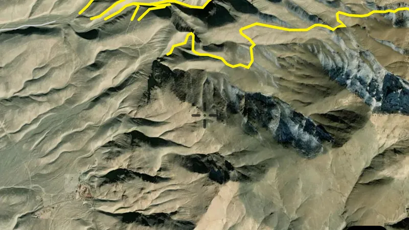
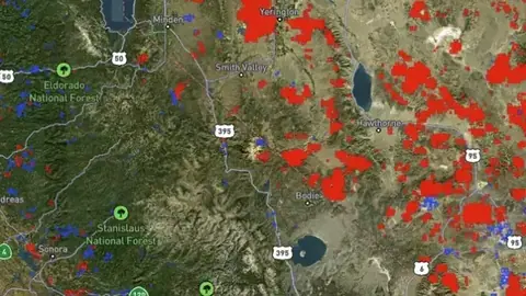
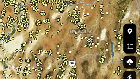
Historic Gold Occurrences in the Detector Maps app, Alaska© Mapbox, © Maxar

Satellite imagery © Mapbox, © Maxar. Layer data from the sources named on each card.

Satellite imagery © Mapbox, © Maxar. Layer data from the sources named on each card.

Historic Gold

5
  • Historic Gold Occurrences in the Detector Maps app, Alaska© Mapbox, © Maxar
    Historic GoldFree

    Historic Gold Occurrences

    USGS-recorded gold occurrence locations sourced from the Mineral Resources Data System (MRDS). Includes mines, prospects, and mineral deposits where gold was the primary commodity.

    Also in 15 other states in USA gold
    Read the write-up
    Historic Gold Occurrences in the Detector Maps app, Alaska© Mapbox, © Maxar

    A screen from the Detector Maps app. Satellite imagery © Mapbox, © Maxar.

    Free. Opens on every plan, including Free.

    Open in the app

    This layer works the same way in 16 places in USA gold, so its full write-up, legend and plan are on one page.

    Read the full write-up

    Source in Alaska

    Data provided by the U.S. Geological Survey (USGS), the Alaska Division of Geological & Geophysical Surveys (DGGS), the Alaska Department of Natural Resources (DNR), Bureau of Land Management (BLM), U.S. Forest Service (USFS), and ReportAll USA (Licensed), licensed under USGS Public Domain and other applicable licenses USGS Public Domain
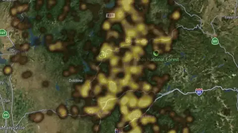
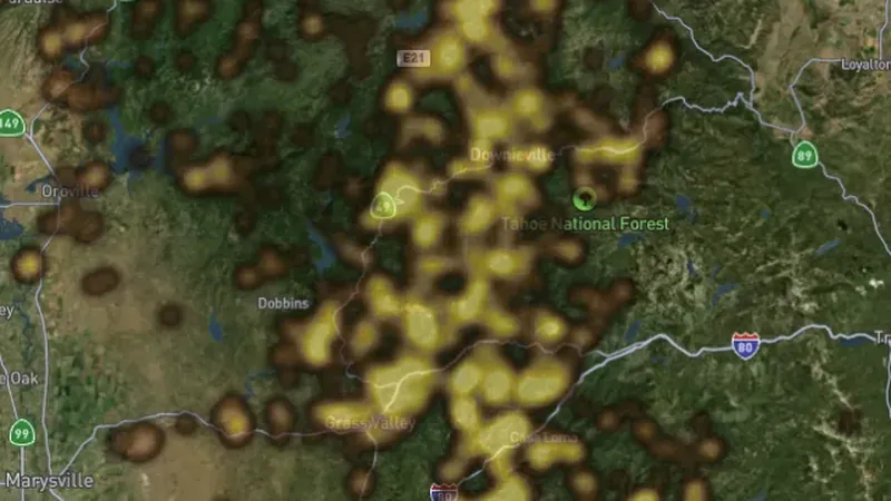
  • Placer Gold Heatmap in the Detector Maps app, Alaska© Mapbox, © Maxar
    Historic GoldExplorer

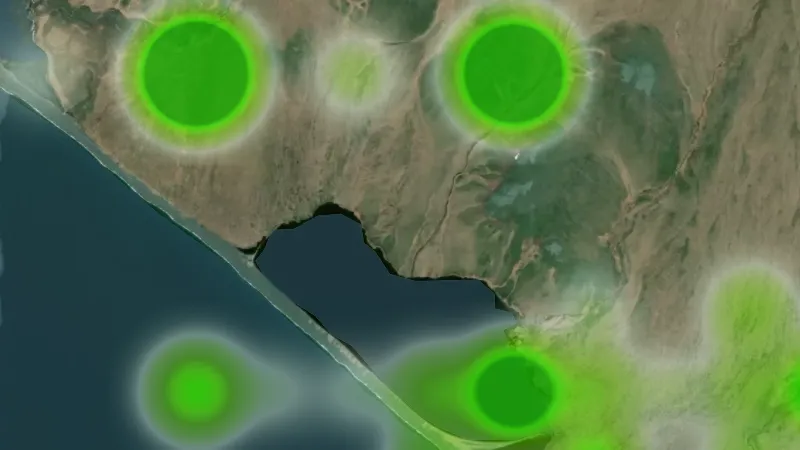
    Placer Gold Heatmap

    Heat density map of historic placer gold occurrences. Highlights concentrations of alluvial gold deposits found in rivers, streams, and bench gravels.

    Also in 15 other states in USA gold
    Read the write-up
    Placer Gold Heatmap in the Detector Maps app, Alaska© Mapbox, © Maxar

    A screen from the Detector Maps app. Satellite imagery © Mapbox, © Maxar.

    Explorer. Opens with Explorer or Pro. On the Free plan it works inside your one free area of 250 km².

    Open in the app

    This layer works the same way in 16 places in USA gold, so its full write-up, legend and plan are on one page.

    Read the full write-up

    Source in Alaska

    Data provided by the U.S. Geological Survey (USGS), the Alaska Division of Geological & Geophysical Surveys (DGGS), the Alaska Department of Natural Resources (DNR), Bureau of Land Management (BLM), U.S. Forest Service (USFS), and ReportAll USA (Licensed), licensed under USGS Public Domain and other applicable licenses USGS Public Domain
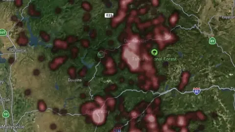
  • Lode Gold Heatmap in the Detector Maps app, Alaska© Mapbox, © Maxar
    Historic GoldExplorer

    Lode Gold Heatmap

    Heat density map of historic lode (hard rock) gold occurrences. Shows concentrations of vein and reef-hosted gold deposits.

    Also in 15 other states in USA gold
    Read the write-up
    Lode Gold Heatmap in the Detector Maps app, Alaska© Mapbox, © Maxar

    A screen from the Detector Maps app. Satellite imagery © Mapbox, © Maxar.

    Explorer. Opens with Explorer or Pro. On the Free plan it works inside your one free area of 250 km².

    Open in the app

    This layer works the same way in 16 places in USA gold, so its full write-up, legend and plan are on one page.

    Read the full write-up

    Source in Alaska

    Data provided by the U.S. Geological Survey (USGS), the Alaska Division of Geological & Geophysical Surveys (DGGS), the Alaska Department of Natural Resources (DNR), Bureau of Land Management (BLM), U.S. Forest Service (USFS), and ReportAll USA (Licensed), licensed under USGS Public Domain and other applicable licenses USGS Public Domain
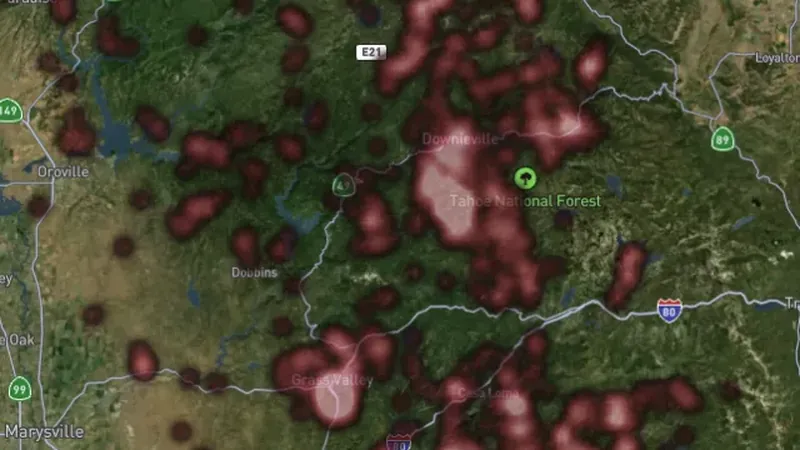
  • Historic Gold Other Occurrences in the Detector Maps app, Alaska© Mapbox, © Maxar
    Historic GoldExplorer

    Historic Gold Other Occurrences

    Additional USGS gold occurrences where gold was listed as a secondary or associated commodity. Useful for identifying overlooked prospecting areas.

    Also in 15 other states in USA gold
    Read the write-up
    Historic Gold Other Occurrences in the Detector Maps app, Alaska© Mapbox, © Maxar

    A screen from the Detector Maps app. Satellite imagery © Mapbox, © Maxar.

    Explorer. Opens with Explorer or Pro. On the Free plan it works inside your one free area of 250 km².

    Open in the app

    This layer works the same way in 16 places in USA gold, so its full write-up, legend and plan are on one page.

    Read the full write-up

    Source in Alaska

    Data provided by the U.S. Geological Survey (USGS), the Alaska Division of Geological & Geophysical Surveys (DGGS), the Alaska Department of Natural Resources (DNR), Bureau of Land Management (BLM), U.S. Forest Service (USFS), and ReportAll USA (Licensed), licensed under USGS Public Domain and other applicable licenses USGS Public Domain
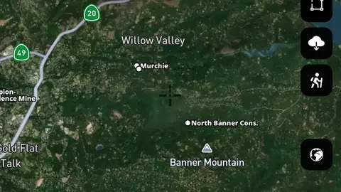
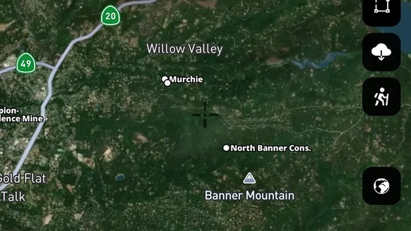
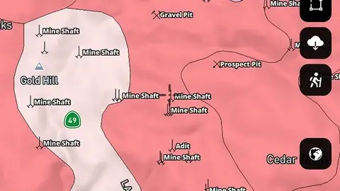
  • Historic Topographic Mine Symbols in the Detector Maps app, Alaska© Mapbox, © Maxar
    Historic GoldExplorer

    Historic Topographic Mine Symbols

    Mine symbols extracted from USGS topographic maps including prospect pits, adits, shafts, quarries, and other mining features marked on historic topo sheets.

    Also in 15 other states in USA gold
    Read the write-up
    Historic Topographic Mine Symbols in the Detector Maps app, Alaska© Mapbox, © Maxar

    A screen from the Detector Maps app. Satellite imagery © Mapbox, © Maxar.

    Explorer. Opens with Explorer or Pro. On the Free plan it works inside your one free area of 250 km².

    Open in the app

    This layer works the same way in 16 places in USA gold, so its full write-up, legend and plan are on one page.

    Read the full write-up

    Source in Alaska

    Data provided by the U.S. Geological Survey (USGS), the Alaska Division of Geological & Geophysical Surveys (DGGS), the Alaska Department of Natural Resources (DNR), Bureau of Land Management (BLM), U.S. Forest Service (USFS), and ReportAll USA (Licensed), licensed under USGS Public Domain and other applicable licenses USGS Public Domain
Active Mining Claims

2
  • Federal Mining Claims in the Detector Maps app, Alaska© Mapbox, © Maxar
    Active Mining ClaimsFree

    Federal Mining Claims

    Active federal mining claims on BLM land in Alaska, from BLM's Mineral and Land Records System, patterned by type: placer, lode or mill site. Tap one for its name, case number and type. Claims on Alaska state land are in Alaska State Mining Claims.

    Read the write-up
    Federal Mining Claims in the Detector Maps app, Alaska© Mapbox, © Maxar

    A screen from the Detector Maps app. Satellite imagery © Mapbox, © Maxar.

    Free. Opens on every plan, including Free.

    Open in the app

    About this layer

    Current mineral tenure shows mapped mining rights, licences or permits. Check the record type and status together with land-access information. A mineral boundary does not by itself establish who may enter or prospect.

    What it is for

    Check the legend, status and available record details. Confirm the current record and relevant access arrangements before visiting.

    Limits

    Applications and granted rights are different. A mapped boundary alone does not tell you whether detecting is permitted.

    Source

    Data provided by the U.S. Geological Survey (USGS), the Alaska Division of Geological & Geophysical Surveys (DGGS), the Alaska Department of Natural Resources (DNR), Bureau of Land Management (BLM), U.S. Forest Service (USFS), and ReportAll USA (Licensed), licensed under USGS Public Domain and other applicable licenses USGS Public Domain
    Legend

    Mining Claims
    • Placer
    • Lode
    • Tunnel
    • Mill
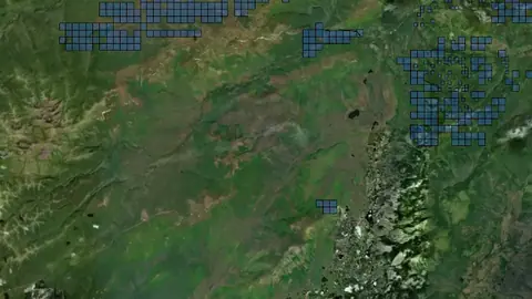
  • Alaska State Mining Claims in Alaska, drawn over satellite imagery© Mapbox, © Maxar
    Active Mining ClaimsFree

    Alaska State Mining Claims

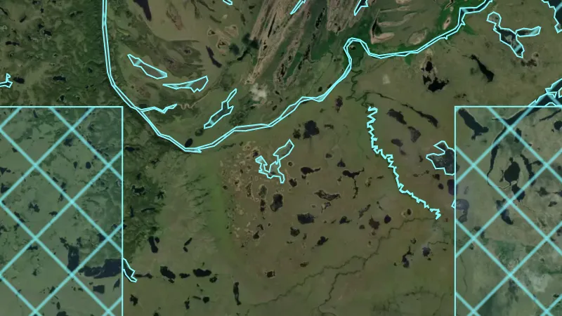
    Active mining claims on Alaska state land, from the Alaska Department of Natural Resources. Every claim is drawn in blue, whatever its type: tap one to see its type and claimant. Federal claims on BLM land are in Federal Mining Claims.

    Read the write-up
    Alaska State Mining Claims in Alaska, drawn over satellite imagery© Mapbox, © Maxar

    The layer drawn over satellite imagery. Satellite imagery © Mapbox, © Maxar.

    Free. Opens on every plan, including Free.

    Open in the app

    About this layer

    Current mineral tenure shows mapped mining rights, licences or permits. Check the record type and status together with land-access information. A mineral boundary does not by itself establish who may enter or prospect.

    What it is for

    Check the legend, status and available record details. Confirm the current record and relevant access arrangements before visiting.

    Limits

    Applications and granted rights are different. A mapped boundary alone does not tell you whether detecting is permitted.

    Source

    Data provided by the U.S. Geological Survey (USGS), the Alaska Division of Geological & Geophysical Surveys (DGGS), the Alaska Department of Natural Resources (DNR), Bureau of Land Management (BLM), U.S. Forest Service (USFS), and ReportAll USA (Licensed), licensed under USGS Public Domain and other applicable licenses USGS Public Domain
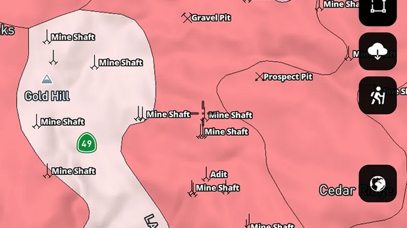
    Legend

    Mining Claims
    • Placer
    • Lode
    • Tunnel
    • Mill

Geochemistry

4
  • Soil Geochemistry in the Detector Maps app, Alaska© Mapbox, © Maxar
    GeochemistryExplorer

    Soil Geochemistry

    USGS soil sample locations analysed for gold and pathfinder elements. High gold-in-soil values can indicate nearby bedrock mineralisation or alluvial enrichment.

    Also in 15 other states in USA gold
    Read the write-up
    Soil Geochemistry in the Detector Maps app, Alaska© Mapbox, © Maxar

    A screen from the Detector Maps app. Satellite imagery © Mapbox, © Maxar.

    Explorer. Opens with Explorer or Pro. On the Free plan it works inside your one free area of 250 km².

    Open in the app

    This layer works the same way in 16 places in USA gold, so its full write-up, legend and plan are on one page.

    Read the full write-up

    Source in Alaska

    Data provided by the U.S. Geological Survey (USGS), the Alaska Division of Geological & Geophysical Surveys (DGGS), the Alaska Department of Natural Resources (DNR), Bureau of Land Management (BLM), U.S. Forest Service (USFS), and ReportAll USA (Licensed), licensed under USGS Public Domain and other applicable licenses USGS Public Domain
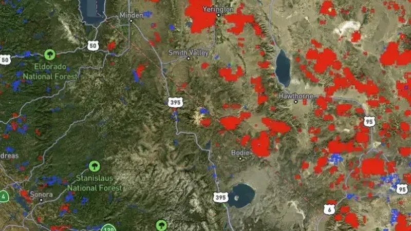
  • Stream Sediment Geochemistry in the Detector Maps app, Alaska© Mapbox, © Maxar
    GeochemistryExplorer

    Stream Sediment Geochemistry

    Stream sediment sample locations. Elevated gold values in stream sediments indicate upstream gold sources. Follow the drainage up to find the origin.

    Also in 15 other states in USA gold
    Read the write-up
    Stream Sediment Geochemistry in the Detector Maps app, Alaska© Mapbox, © Maxar

    A screen from the Detector Maps app. Satellite imagery © Mapbox, © Maxar.

    Explorer. Opens with Explorer or Pro. On the Free plan it works inside your one free area of 250 km².

    Open in the app

    This layer works the same way in 16 places in USA gold, so its full write-up, legend and plan are on one page.

    Read the full write-up

    Source in Alaska

    Data provided by the U.S. Geological Survey (USGS), the Alaska Division of Geological & Geophysical Surveys (DGGS), the Alaska Department of Natural Resources (DNR), Bureau of Land Management (BLM), U.S. Forest Service (USFS), and ReportAll USA (Licensed), licensed under USGS Public Domain and other applicable licenses USGS Public Domain
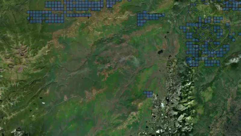
  • Stream Concentrate Geochemistry in Alaska, drawn over satellite imagery© Mapbox, © Maxar
    GeochemistryExplorer

    Stream Concentrate Geochemistry

    Heavy mineral concentrate samples from streams. Panned or concentrated samples that reveal gold and indicator minerals like magnetite, garnet, and cinnabar.

    Also in 15 other states in USA gold
    Read the write-up
    Stream Concentrate Geochemistry in Alaska, drawn over satellite imagery© Mapbox, © Maxar

    The layer drawn over satellite imagery. Satellite imagery © Mapbox, © Maxar.

    Explorer. Opens with Explorer or Pro. On the Free plan it works inside your one free area of 250 km².

    Open in the app

    This layer works the same way in 16 places in USA gold, so its full write-up, legend and plan are on one page.

    Read the full write-up

    Source in Alaska

    Data provided by the U.S. Geological Survey (USGS), the Alaska Division of Geological & Geophysical Surveys (DGGS), the Alaska Department of Natural Resources (DNR), Bureau of Land Management (BLM), U.S. Forest Service (USFS), and ReportAll USA (Licensed), licensed under USGS Public Domain and other applicable licenses USGS Public Domain
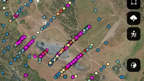
  • Rock Chip Geochemistry in the Detector Maps app, Alaska© Mapbox, © Maxar
    GeochemistryExplorer

    Rock Chip Geochemistry

    Rock chip and outcrop sample locations analysed for gold and associated elements. High values point to mineralised veins, contacts, or alteration zones.

    Also in 15 other states in USA gold
    Read the write-up
    Rock Chip Geochemistry in the Detector Maps app, Alaska© Mapbox, © Maxar

    A screen from the Detector Maps app. Satellite imagery © Mapbox, © Maxar.

    Explorer. Opens with Explorer or Pro. On the Free plan it works inside your one free area of 250 km².

    Open in the app

    This layer works the same way in 16 places in USA gold, so its full write-up, legend and plan are on one page.

    Read the full write-up

    Source in Alaska

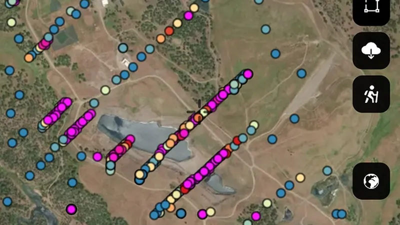
    Data provided by the U.S. Geological Survey (USGS), the Alaska Division of Geological & Geophysical Surveys (DGGS), the Alaska Department of Natural Resources (DNR), Bureau of Land Management (BLM), U.S. Forest Service (USFS), and ReportAll USA (Licensed), licensed under USGS Public Domain and other applicable licenses USGS Public Domain
Land Use & Access

5
  • PLSS Survey Grid in the Detector Maps app, Alaska© Mapbox, © Maxar
    Land Use & AccessExplorer

    PLSS Survey Grid

    Public Land Survey System (PLSS) grid showing townships, sections, and intersected areas used for locating mining claims and land descriptions.

    Also in 10 other states in USA gold
    Read the write-up
    PLSS Survey Grid in the Detector Maps app, Alaska© Mapbox, © Maxar

    A screen from the Detector Maps app. Satellite imagery © Mapbox, © Maxar.

    Explorer. Opens with Explorer or Pro. On the Free plan it works inside your one free area of 250 km².

    Open in the app

    This layer works the same way in 11 places in USA gold, so its full write-up, legend and plan are on one page.

    Read the full write-up

    Source in Alaska

    Data provided by the U.S. Geological Survey (USGS), the Alaska Division of Geological & Geophysical Surveys (DGGS), the Alaska Department of Natural Resources (DNR), Bureau of Land Management (BLM), U.S. Forest Service (USFS), and ReportAll USA (Licensed), licensed under USGS Public Domain and other applicable licenses USGS Public Domain
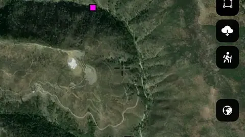
  • Surface Management Agency Areas in the Detector Maps app, Alaska© Mapbox, © Maxar
    Land Use & AccessExplorer

    Surface Management Agency Areas

    BLM Surface Management Agency boundaries showing which federal, state, or local agency manages each parcel. Colour-coded by managing agency (BLM, USFS, NPS, etc.).

    Also in 15 other states in USA gold
    Read the write-up
    Surface Management Agency Areas in the Detector Maps app, Alaska© Mapbox, © Maxar

    A screen from the Detector Maps app. Satellite imagery © Mapbox, © Maxar.

    Explorer. Opens with Explorer or Pro. On the Free plan it works inside your one free area of 250 km².

    Open in the app

    This layer works the same way in 16 places in USA gold, so its full write-up, legend and plan are on one page.

    Read the full write-up

    Source in Alaska

    Data provided by the U.S. Geological Survey (USGS), the Alaska Division of Geological & Geophysical Surveys (DGGS), the Alaska Department of Natural Resources (DNR), Bureau of Land Management (BLM), U.S. Forest Service (USFS), and ReportAll USA (Licensed), licensed under USGS Public Domain and other applicable licenses USGS Public Domain
    Filters in the app

    Category filter
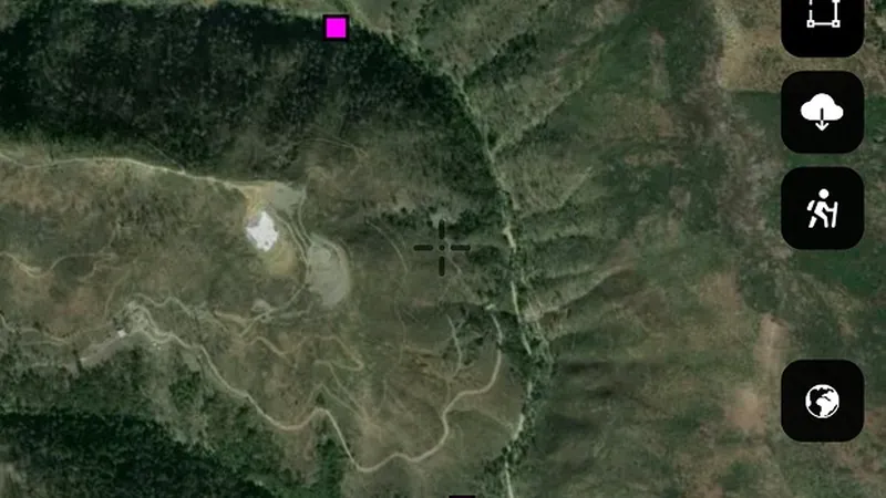
  • BLM Recreation Sites in the Detector Maps app, Alaska© Mapbox, © Maxar
    Land Use & AccessExplorer

    BLM Recreation Sites

    Bureau of Land Management recreation sites including campgrounds, trailheads, and day-use areas across Alaska.

    Read the write-up
    BLM Recreation Sites in the Detector Maps app, Alaska© Mapbox, © Maxar

    A screen from the Detector Maps app. Satellite imagery © Mapbox, © Maxar.

    Explorer. Opens with Explorer or Pro. On the Free plan it works inside your one free area of 250 km².

    Open in the app

    About this layer

    These records identify mapped recreation sites. They help you research facilities and managed places near your route. Check the site rules; a recreation site is not necessarily a permitted detecting area.

    What it is for

    Turn on the relevant layers together and read their legends and notes. Check current conditions with the land manager before planning a visit.

    Limits

    An unshaded area is not automatically available for detecting. Different permissions and restrictions can overlap.

    Source

    Data provided by the U.S. Geological Survey (USGS), the Alaska Division of Geological & Geophysical Surveys (DGGS), the Alaska Department of Natural Resources (DNR), Bureau of Land Management (BLM), U.S. Forest Service (USFS), and ReportAll USA (Licensed), licensed under USGS Public Domain and other applicable licenses USGS Public Domain
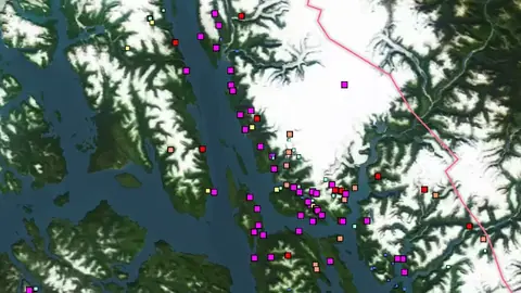
    Legend

    BLM
    • Recreation Sites
    • Campground
    • Trail Head
    • OHV Area
    • Boat Launch / Ramp
    • Info / Visitor Center
    • Picnic Area
    • Scenic / POI
    • Water Access
    • Parking / Staging
    • Facilities (Other)
    • Admin Boundaries
    • Field Office Boundary
  • BLM Administrative Units in the Detector Maps app, Alaska© Mapbox, © Maxar
    Land Use & AccessExplorer

    BLM Administrative Units

    Bureau of Land Management administrative boundaries including field offices, district offices, and recreation sites across Alaska.

    Read the write-up
    BLM Administrative Units in the Detector Maps app, Alaska© Mapbox, © Maxar

    A screen from the Detector Maps app. Satellite imagery © Mapbox, © Maxar.

    Explorer. Opens with Explorer or Pro. On the Free plan it works inside your one free area of 250 km².

    Open in the app

    About this layer

    Bureau of Land Management administrative boundaries identify the offices or management units responsible for an area. Use them to find the right source of local information. The boundary does not mean every place inside it is open to detecting.

    What it is for

    Turn on the relevant layers together and read their legends and notes. Check current conditions with the land manager before planning a visit.

    Limits

    An unshaded area is not automatically available for detecting. Different permissions and restrictions can overlap.

    Source

    Data provided by the U.S. Geological Survey (USGS), the Alaska Division of Geological & Geophysical Surveys (DGGS), the Alaska Department of Natural Resources (DNR), Bureau of Land Management (BLM), U.S. Forest Service (USFS), and ReportAll USA (Licensed), licensed under USGS Public Domain and other applicable licenses USGS Public Domain
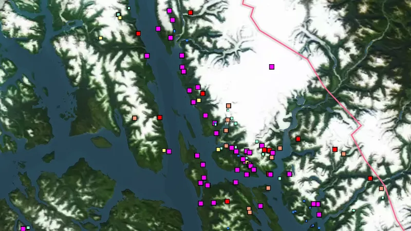
  • Property Boundaries in the Detector Maps app, Alaska© Mapbox, © Maxar
    Land Use & AccessPro

    Property Boundaries

    Property boundaries show how the land is divided into parcels.

    Also in 15 other states in USA gold
    Read the write-up
    Property Boundaries in the Detector Maps app, Alaska© Mapbox, © Maxar

    A screen from the Detector Maps app. Satellite imagery © Mapbox, © Maxar.

    Pro. Opens with Pro.

    Open in the app

    This layer works the same way in 16 places in USA gold, so its full write-up, legend and plan are on one page.

    Read the full write-up

    Source in Alaska

    Data provided by the U.S. Geological Survey (USGS), the Alaska Division of Geological & Geophysical Surveys (DGGS), the Alaska Department of Natural Resources (DNR), Bureau of Land Management (BLM), U.S. Forest Service (USFS), and ReportAll USA (Licensed), licensed under USGS Public Domain and other applicable licenses USGS Public Domain
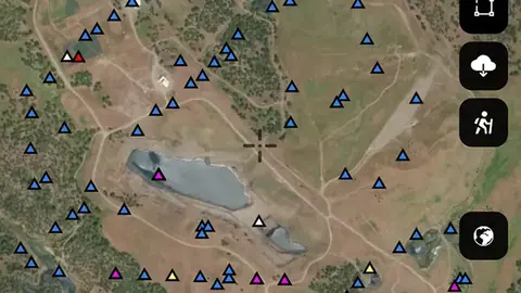
    Draws from zoom 13.

Historic Mining Hotspots

4
  • Text only
    Historic Mining HotspotsExplorer

    Closed Federal Claims

    Closed federal mining claims of every type on BLM land in Alaska, from BLM's Mineral and Land Records System: ground that has been claimed and worked before. Darker green marks larger claims. Tap one for its name, type and when it closed.

    Read the write-up
    Text only

    This layer has no picture yet. Its description is here.

    Explorer. Opens with Explorer or Pro. On the Free plan it works inside your one free area of 250 km².

    Open in the app

    About this layer

    Historic claim maps show where claims were recorded and later closed. Concentrations help you research patterns of earlier mining interest. Closed claims do not establish that land is currently unclaimed or open to detecting.

    What it is for

    Compare historic activity with current tenure, geology and access layers when researching an area.

    Limits

    An expired or closed record does not mean land is now open. Check current records and permissions separately.

    Source

    Data provided by the U.S. Geological Survey (USGS), the Alaska Division of Geological & Geophysical Surveys (DGGS), the Alaska Department of Natural Resources (DNR), Bureau of Land Management (BLM), U.S. Forest Service (USFS), and ReportAll USA (Licensed), licensed under USGS Public Domain and other applicable licenses USGS Public Domain
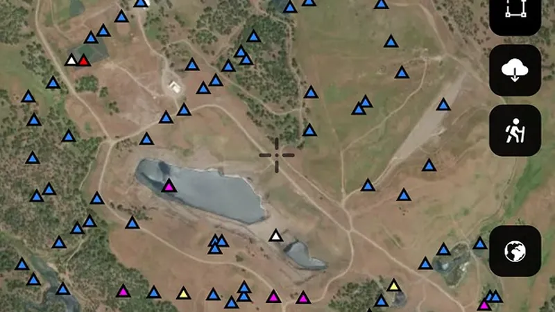
  • Historic Lode Claim Heatmap in the Detector Maps app, Alaska© Mapbox, © Maxar
    Historic Mining HotspotsExplorer

    Historic Lode Claim Heatmap

    Density heatmap of closed lode claims. Highlights historic hard rock mining districts and vein systems.

    Also in 10 other states in USA gold
    Read the write-up
    Historic Lode Claim Heatmap in the Detector Maps app, Alaska© Mapbox, © Maxar

    A screen from the Detector Maps app. Satellite imagery © Mapbox, © Maxar.

    Explorer. Opens with Explorer or Pro. On the Free plan it works inside your one free area of 250 km².

    Open in the app

    This layer works the same way in 11 places in USA gold, so its full write-up, legend and plan are on one page.

    Read the full write-up

    Source in Alaska

    Data provided by the U.S. Geological Survey (USGS), the Alaska Division of Geological & Geophysical Surveys (DGGS), the Alaska Department of Natural Resources (DNR), Bureau of Land Management (BLM), U.S. Forest Service (USFS), and ReportAll USA (Licensed), licensed under USGS Public Domain and other applicable licenses USGS Public Domain
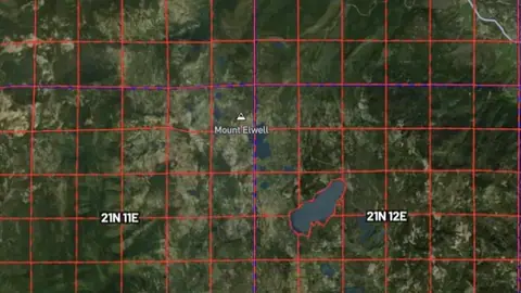
  • Historic Tunnel Claim Heatmap in Alaska, drawn over satellite imagery© Mapbox, © Maxar
    Historic Mining HotspotsExplorer

    Historic Tunnel Claim Heatmap

    Density heatmap of closed tunnel claims. Concentrations indicate areas where underground development was once pursued.

    Also in 10 other states in USA gold
    Read the write-up
    Historic Tunnel Claim Heatmap in Alaska, drawn over satellite imagery© Mapbox, © Maxar

    Same layer as in Colorado: this region's own picture was not clear enough, so the Colorado one stands in. Satellite imagery © Mapbox, © Maxar.

    Explorer. Opens with Explorer or Pro. On the Free plan it works inside your one free area of 250 km².

    Open in the app

    This layer works the same way in 11 places in USA gold, so its full write-up, legend and plan are on one page.

    Read the full write-up

    Source in Alaska

    Data provided by the U.S. Geological Survey (USGS), the Alaska Division of Geological & Geophysical Surveys (DGGS), the Alaska Department of Natural Resources (DNR), Bureau of Land Management (BLM), U.S. Forest Service (USFS), and ReportAll USA (Licensed), licensed under USGS Public Domain and other applicable licenses USGS Public Domain
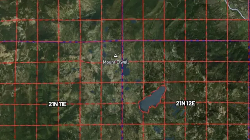
  • Historic Mill Claim Heatmap in Alaska, drawn over satellite imagery© Mapbox, © Maxar
    Historic Mining HotspotsExplorer

    Historic Mill Claim Heatmap

    Density heatmap of closed mill site claims. Clusters mark where ore processing facilities once operated.

    Also in 10 other states in USA gold
    Read the write-up
    Historic Mill Claim Heatmap in Alaska, drawn over satellite imagery© Mapbox, © Maxar

    The layer drawn over satellite imagery. Satellite imagery © Mapbox, © Maxar.

    Explorer. Opens with Explorer or Pro. On the Free plan it works inside your one free area of 250 km².

    Open in the app

    This layer works the same way in 11 places in USA gold, so its full write-up, legend and plan are on one page.

    Read the full write-up

    Source in Alaska

    Data provided by the U.S. Geological Survey (USGS), the Alaska Division of Geological & Geophysical Surveys (DGGS), the Alaska Department of Natural Resources (DNR), Bureau of Land Management (BLM), U.S. Forest Service (USFS), and ReportAll USA (Licensed), licensed under USGS Public Domain and other applicable licenses USGS Public Domain
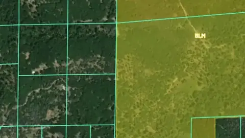
Watercourses

1
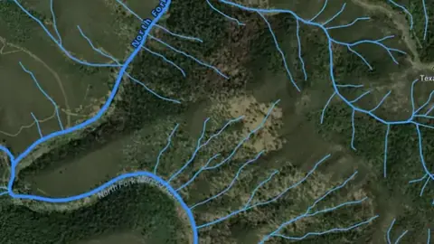
  • Rivers, Streams & Drainages in the Detector Maps app, Alaska© Mapbox, © Maxar
    WatercoursesExplorer

    Rivers, Streams & Drainages

    Waterways show the mapped routes of rivers, creeks and drainage lines.

    Also in 15 other states in USA gold
    Read the write-up
    Rivers, Streams & Drainages in the Detector Maps app, Alaska© Mapbox, © Maxar

    A screen from the Detector Maps app. Satellite imagery © Mapbox, © Maxar.

    Explorer. Opens with Explorer or Pro. On the Free plan it works inside your one free area of 250 km².

    Open in the app

    This layer works the same way in 16 places in USA gold, so its full write-up, legend and plan are on one page.

    Read the full write-up

    Source in Alaska

    Data provided by the U.S. Geological Survey (USGS), the Alaska Division of Geological & Geophysical Surveys (DGGS), the Alaska Department of Natural Resources (DNR), Bureau of Land Management (BLM), U.S. Forest Service (USFS), and ReportAll USA (Licensed), licensed under USGS Public Domain and other applicable licenses USGS Public Domain
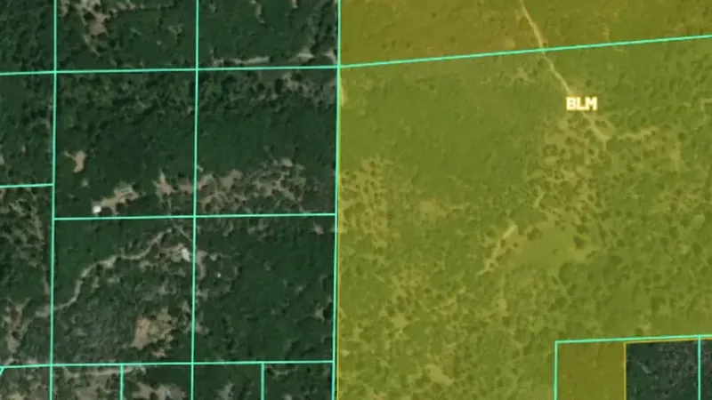
Prospectivity & Catchments

3
  • Gold Anomaly Catchments in the Detector Maps app, Alaska© Mapbox, © Maxar
    Prospectivity & CatchmentsExplorer

    Gold Anomaly Catchments

    Catchment areas showing the maximum recorded gold value based on stream geochemistry. Brighter catchments indicate higher gold potential.

    Also in 15 other states in USA gold
    Read the write-up
    Gold Anomaly Catchments in the Detector Maps app, Alaska© Mapbox, © Maxar

    A screen from the Detector Maps app. Satellite imagery © Mapbox, © Maxar.

    Explorer. Opens with Explorer or Pro. On the Free plan it works inside your one free area of 250 km².

    Open in the app

    This layer works the same way in 16 places in USA gold, so its full write-up, legend and plan are on one page.

    Read the full write-up

    Source in Alaska

    Data provided by the U.S. Geological Survey (USGS), the Alaska Division of Geological & Geophysical Surveys (DGGS), the Alaska Department of Natural Resources (DNR), Bureau of Land Management (BLM), U.S. Forest Service (USFS), and ReportAll USA (Licensed), licensed under USGS Public Domain and other applicable licenses USGS Public Domain
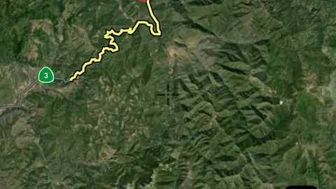
  • Placer Claims Count in the Detector Maps app, Alaska© Mapbox, © Maxar
    Prospectivity & CatchmentsExplorer

    Placer Claims Count

    Modelled placer gold prospectivity scores highlighting catchment areas with the highest potential for alluvial gold deposits based on placer gold occurrences and historical placer claims.

    Also in 10 other states in USA gold
    Read the write-up
    Placer Claims Count in the Detector Maps app, Alaska© Mapbox, © Maxar

    A screen from the Detector Maps app. Satellite imagery © Mapbox, © Maxar.

    Explorer. Opens with Explorer or Pro. On the Free plan it works inside your one free area of 250 km².

    Open in the app

    This layer works the same way in 11 places in USA gold, so its full write-up, legend and plan are on one page.

    Read the full write-up

    Source in Alaska

    Data provided by the U.S. Geological Survey (USGS), the Alaska Division of Geological & Geophysical Surveys (DGGS), the Alaska Department of Natural Resources (DNR), Bureau of Land Management (BLM), U.S. Forest Service (USFS), and ReportAll USA (Licensed), licensed under USGS Public Domain and other applicable licenses USGS Public Domain
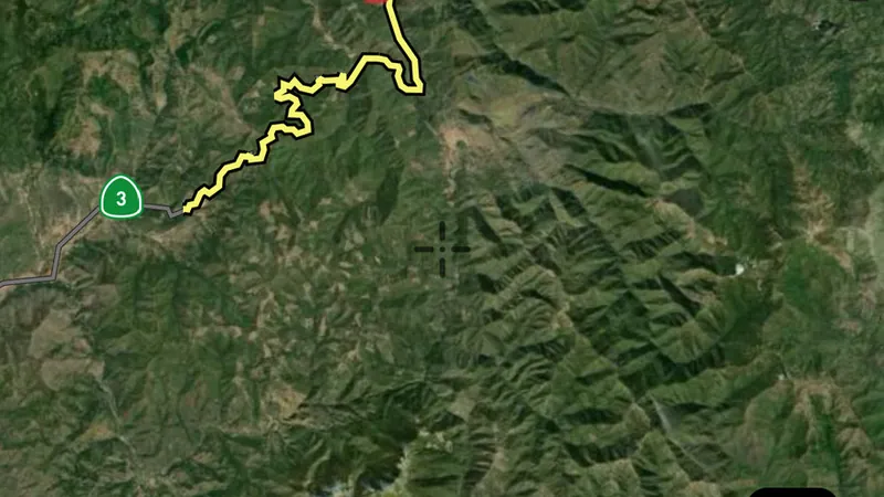
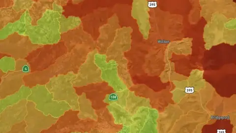
  • Gold Prospectivity Index in the Detector Maps app, Alaska© Mapbox, © Maxar
    Prospectivity & CatchmentsExplorer

    Gold Prospectivity Index

    Combined gold score based on known gold discoveries, government geochemistry results, pathfinder minerals, and historic mining activity. The higher the score, the more evidence pointing to gold in that catchment.

    Also in 15 other states in USA gold
    Read the write-up
    Gold Prospectivity Index in the Detector Maps app, Alaska© Mapbox, © Maxar

    A screen from the Detector Maps app. Satellite imagery © Mapbox, © Maxar.

    Explorer. Opens with Explorer or Pro. On the Free plan it works inside your one free area of 250 km².

    Open in the app

    This layer works the same way in 16 places in USA gold, so its full write-up, legend and plan are on one page.

    Read the full write-up

    Source in Alaska

    Data provided by the U.S. Geological Survey (USGS), the Alaska Division of Geological & Geophysical Surveys (DGGS), the Alaska Department of Natural Resources (DNR), Bureau of Land Management (BLM), U.S. Forest Service (USFS), and ReportAll USA (Licensed), licensed under USGS Public Domain and other applicable licenses USGS Public Domain
Roads & Tracks

2
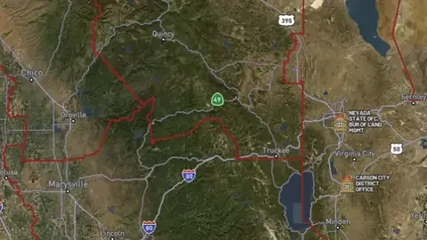
  • BLM Roads & Trails in the Detector Maps app, Alaska© Mapbox, © Maxar
    Roads & TracksExplorer

    BLM Roads & Trails

    Bureau of Land Management roads and trails in Alaska: ground transport routes, roads managed for limited public motor use, and the Iditarod National Historic Trail.

    Read the write-up
    BLM Roads & Trails in the Detector Maps app, Alaska© Mapbox, © Maxar

    A screen from the Detector Maps app. Satellite imagery © Mapbox, © Maxar.

    Explorer. Opens with Explorer or Pro. On the Free plan it works inside your one free area of 250 km².

    Open in the app

    About this layer

    Roads and tracks show mapped routes through the area. Compare them with land boundaries and terrain when planning how to reach a location. A mapped route may be closed, private or unsuitable for your vehicle.

    What it is for

    Compare routes with the terrain and land boundaries when planning how to reach an area.

    Limits

    A line on the map does not guarantee a public, open or passable route. Conditions and access can change.

    Source

    Data provided by the U.S. Geological Survey (USGS), the Alaska Division of Geological & Geophysical Surveys (DGGS), the Alaska Department of Natural Resources (DNR), Bureau of Land Management (BLM), U.S. Forest Service (USFS), and ReportAll USA (Licensed), licensed under USGS Public Domain and other applicable licenses USGS Public Domain
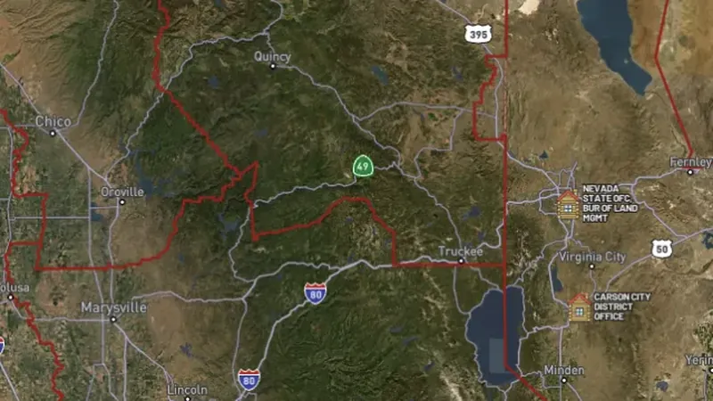
    Legend

    Roads & Trails
    • MVUM Roads
    • 4WD High Clearance
    • ATV Open
    • Motorcycle Open
    • Other Roads
    • BLM Roads
    • Scenic / Historic Trail
    • Public Motorized
    • Limited Public Motor
    • Ground Transport
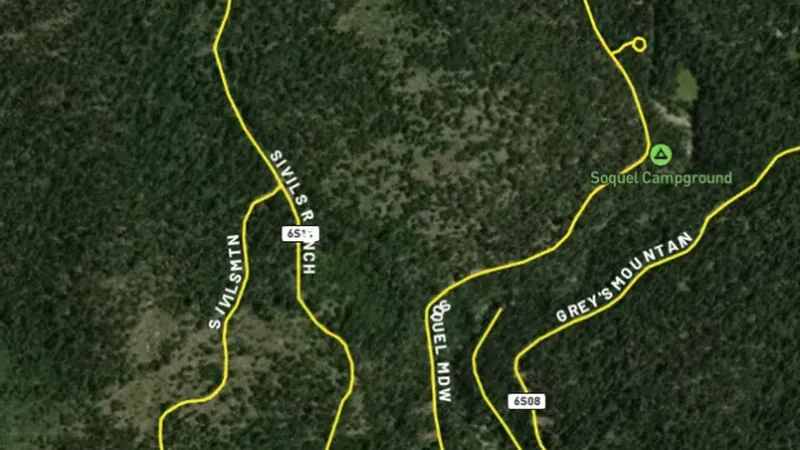
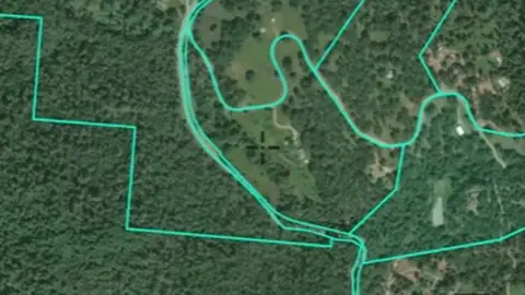
  • MVUM Roads in the Detector Maps app, Alaska© Mapbox, © Maxar
    Roads & TracksExplorer

    MVUM Roads

    Motor Vehicle Use Map (MVUM) roads from the U.S. Forest Service showing routes designated for motorised vehicle use on National Forest lands.

    Also in 15 other states in USA gold
    Read the write-up
    MVUM Roads in the Detector Maps app, Alaska© Mapbox, © Maxar

    A screen from the Detector Maps app. Satellite imagery © Mapbox, © Maxar.

    Explorer. Opens with Explorer or Pro. On the Free plan it works inside your one free area of 250 km².

    Open in the app

    This layer works the same way in 16 places in USA gold, so its full write-up, legend and plan are on one page.

    Read the full write-up

    Source in Alaska

    Data provided by the U.S. Geological Survey (USGS), the Alaska Division of Geological & Geophysical Surveys (DGGS), the Alaska Department of Natural Resources (DNR), Bureau of Land Management (BLM), U.S. Forest Service (USFS), and ReportAll USA (Licensed), licensed under USGS Public Domain and other applicable licenses USGS Public Domain
    Draws from zoom 14.

Protected Areas

5
  • Military Areas in the Detector Maps app, Alaska© Mapbox, © Maxar
    Protected AreasExplorer

    Military Areas

    Active military installations and restricted zones. No public access. Prospecting and detecting are strictly prohibited.

    Also in 15 other states in USA gold
    Read the write-up
    Military Areas in the Detector Maps app, Alaska© Mapbox, © Maxar

    A screen from the Detector Maps app. Satellite imagery © Mapbox, © Maxar.

    Explorer. Opens with Explorer or Pro. On the Free plan it works inside your one free area of 250 km².

    Open in the app

    This layer works the same way in 16 places in USA gold, so its full write-up, legend and plan are on one page.

    Read the full write-up

    Source in Alaska

    Data provided by the U.S. Geological Survey (USGS), the Alaska Division of Geological & Geophysical Surveys (DGGS), the Alaska Department of Natural Resources (DNR), Bureau of Land Management (BLM), U.S. Forest Service (USFS), and ReportAll USA (Licensed), licensed under USGS Public Domain and other applicable licenses USGS Public Domain
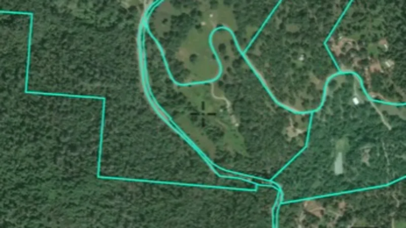
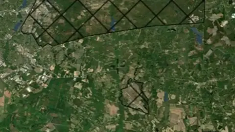
  • Critical Habitat Areas in Alaska, drawn over satellite imagery© Mapbox, © Maxar
    Protected AreasExplorer

    Critical Habitat Areas

    Areas designated as critical habitat for threatened or endangered species under the Endangered Species Act. Ground disturbance activities may be restricted.

    Also in 15 other states in USA gold
    Read the write-up
    Critical Habitat Areas in Alaska, drawn over satellite imagery© Mapbox, © Maxar

    The layer drawn over satellite imagery. Satellite imagery © Mapbox, © Maxar.

    Explorer. Opens with Explorer or Pro. On the Free plan it works inside your one free area of 250 km².

    Open in the app

    This layer works the same way in 16 places in USA gold, so its full write-up, legend and plan are on one page.

    Read the full write-up

    Source in Alaska

    Data provided by the U.S. Geological Survey (USGS), the Alaska Division of Geological & Geophysical Surveys (DGGS), the Alaska Department of Natural Resources (DNR), Bureau of Land Management (BLM), U.S. Forest Service (USFS), and ReportAll USA (Licensed), licensed under USGS Public Domain and other applicable licenses USGS Public Domain
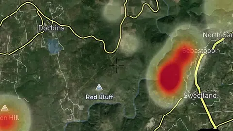
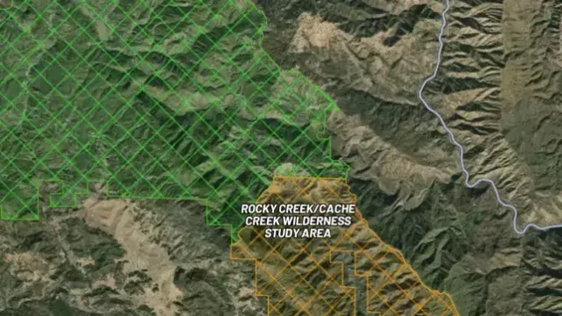
  • Wilderness Study Areas in the Detector Maps app, Alaska© Mapbox, © Maxar
    Protected AreasExplorer

    Wilderness Study Areas

    Wilderness Study Areas (WSAs) managed to preserve wilderness character while Congress decides their status. Mechanised equipment is generally prohibited.

    Also in 10 other states in USA gold
    Read the write-up
    Wilderness Study Areas in the Detector Maps app, Alaska© Mapbox, © Maxar

    A screen from the Detector Maps app. Satellite imagery © Mapbox, © Maxar.

    Explorer. Opens with Explorer or Pro. On the Free plan it works inside your one free area of 250 km².

    Open in the app

    This layer works the same way in 11 places in USA gold, so its full write-up, legend and plan are on one page.

    Read the full write-up

    Source in Alaska

    Data provided by the U.S. Geological Survey (USGS), the Alaska Division of Geological & Geophysical Surveys (DGGS), the Alaska Department of Natural Resources (DNR), Bureau of Land Management (BLM), U.S. Forest Service (USFS), and ReportAll USA (Licensed), licensed under USGS Public Domain and other applicable licenses USGS Public Domain
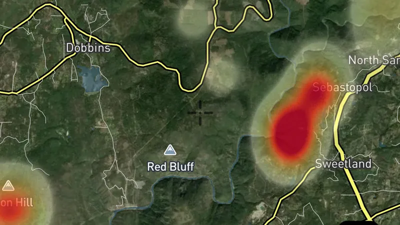
  • National Monument Areas in Alaska, drawn over satellite imagery© Mapbox, © Maxar
    Protected AreasExplorer

    National Monument Areas

    National Monuments and National Conservation Areas. Mining and mineral entry are typically withdrawn. Check specific monument proclamation for details.

    Also in 10 other states in USA gold
    Read the write-up
    National Monument Areas in Alaska, drawn over satellite imagery© Mapbox, © Maxar

    The layer drawn over satellite imagery. Satellite imagery © Mapbox, © Maxar.

    Explorer. Opens with Explorer or Pro. On the Free plan it works inside your one free area of 250 km².

    Open in the app

    This layer works the same way in 11 places in USA gold, so its full write-up, legend and plan are on one page.

    Read the full write-up

    Source in Alaska

    Data provided by the U.S. Geological Survey (USGS), the Alaska Division of Geological & Geophysical Surveys (DGGS), the Alaska Department of Natural Resources (DNR), Bureau of Land Management (BLM), U.S. Forest Service (USFS), and ReportAll USA (Licensed), licensed under USGS Public Domain and other applicable licenses USGS Public Domain
  • Fish & Wildlife Areas in Alaska, drawn over satellite imagery© Mapbox, © Maxar
    Protected AreasExplorer

    Fish & Wildlife Areas

    National Wildlife Refuges managed by U.S. Fish & Wildlife Service. Prospecting and metal detecting are generally not permitted.

    Also in 15 other states in USA gold
    Read the write-up
    Fish & Wildlife Areas in Alaska, drawn over satellite imagery© Mapbox, © Maxar

    The layer drawn over satellite imagery. Satellite imagery © Mapbox, © Maxar.

    Explorer. Opens with Explorer or Pro. On the Free plan it works inside your one free area of 250 km².

    Open in the app

    This layer works the same way in 16 places in USA gold, so its full write-up, legend and plan are on one page.

    Read the full write-up

    Source in Alaska

    Data provided by the U.S. Geological Survey (USGS), the Alaska Division of Geological & Geophysical Surveys (DGGS), the Alaska Department of Natural Resources (DNR), Bureau of Land Management (BLM), U.S. Forest Service (USFS), and ReportAll USA (Licensed), licensed under USGS Public Domain and other applicable licenses USGS Public Domain
State Geology

2
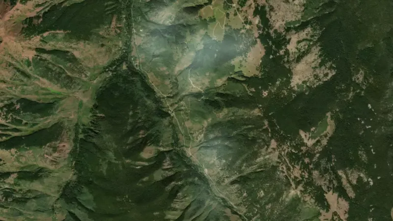
  • Geologic Map of Alaska in Alaska, drawn over satellite imagery© Mapbox, © Maxar
    State GeologyExplorer

    Geologic Map of Alaska

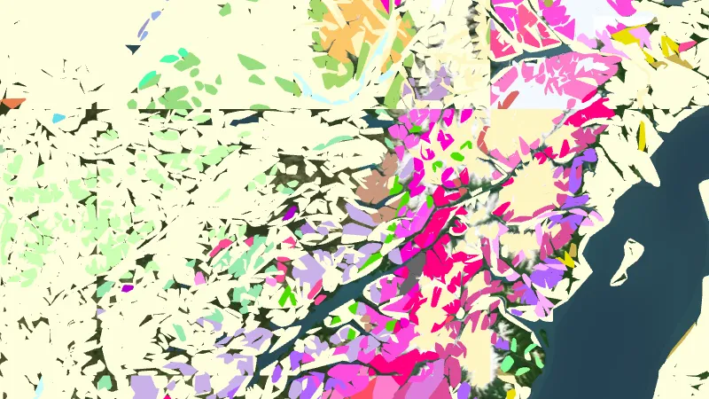
    The USGS statewide Geologic Map of Alaska at 1:1,584,000: one unit list for the whole state, with each unit's rock types and age. Coarser than the detailed state geology, it covers the ground the detailed maps have not reached. Open the filter to search the units or show only the gold host rocks.

    Read the write-up
    Geologic Map of Alaska in Alaska, drawn over satellite imagery© Mapbox, © Maxar

    The layer drawn over satellite imagery. Satellite imagery © Mapbox, © Maxar.

    Explorer. Opens with Explorer or Pro. On the Free plan it works inside your one free area of 250 km².

    Open in the app

    About this layer

    Geological maps divide the ground into rock or sediment units. Colours and patterns tell you which mapped unit is present; use the legend to read them. Compare the boundaries with mineral records, without assuming one rock type guarantees gold.

    What it is for

    Use the legend to identify colours and line symbols. Compare rock boundaries and structures with mineral records and terrain.

    Limits

    Geological maps simplify the ground at their stated scale. Boundaries are interpretations and may not match what is exposed at the surface.

    Source

    Data provided by the U.S. Geological Survey (USGS), the Alaska Division of Geological & Geophysical Surveys (DGGS), the Alaska Department of Natural Resources (DNR), Bureau of Land Management (BLM), U.S. Forest Service (USFS), and ReportAll USA (Licensed), licensed under USGS Public Domain and other applicable licenses USGS Public Domain
    Filters in the app

    Layer switchesAttribute filtersGold host rocks filter
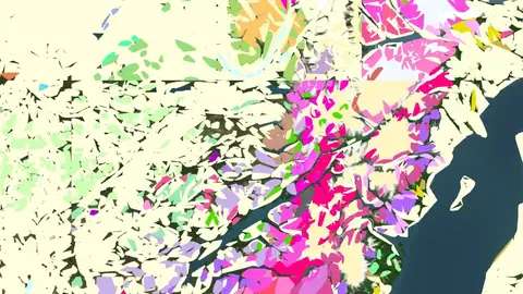
  • Detailed State Geology in Alaska, drawn over satellite imagery© Mapbox, © Maxar
    State GeologyExplorer

    Detailed State Geology

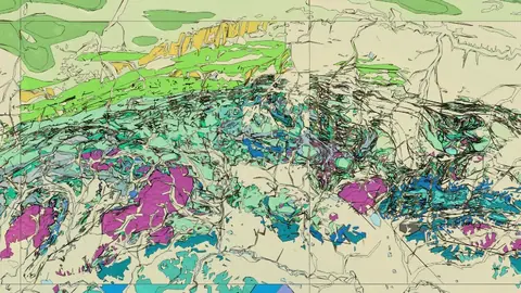
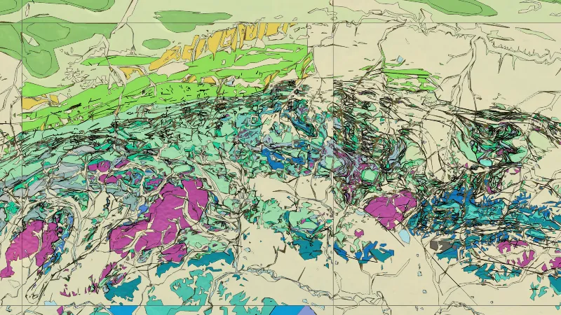
    Alaska's most detailed published geology, joined from state geological survey and USGS maps: each area shows the best map available, from 1:24,000 quadrangles to 1:1,000,000 state maps. Rock units are coloured by type and age, with contacts, faults and strike and dip. Open the filter to search the units or show only the gold host rocks.

    Read the write-up
    Detailed State Geology in Alaska, drawn over satellite imagery© Mapbox, © Maxar

    The layer drawn over satellite imagery. Satellite imagery © Mapbox, © Maxar.

    Explorer. Opens with Explorer or Pro. On the Free plan it works inside your one free area of 250 km².

    Open in the app

    About this layer

    Geological maps divide the ground into rock or sediment units. Colours and patterns tell you which mapped unit is present; use the legend to read them. Compare the boundaries with mineral records, without assuming one rock type guarantees gold.

    What it is for

    Use the legend to identify colours and line symbols. Compare rock boundaries and structures with mineral records and terrain.

    Limits

    Geological maps simplify the ground at their stated scale. Boundaries are interpretations and may not match what is exposed at the surface.

    Source

    Data provided by the U.S. Geological Survey (USGS), the Alaska Division of Geological & Geophysical Surveys (DGGS), the Alaska Department of Natural Resources (DNR), Bureau of Land Management (BLM), U.S. Forest Service (USFS), and ReportAll USA (Licensed), licensed under USGS Public Domain and other applicable licenses USGS Public Domain
    Filters in the app

    Layer switchesAttribute filtersGold host rocks filter

Overlays

2
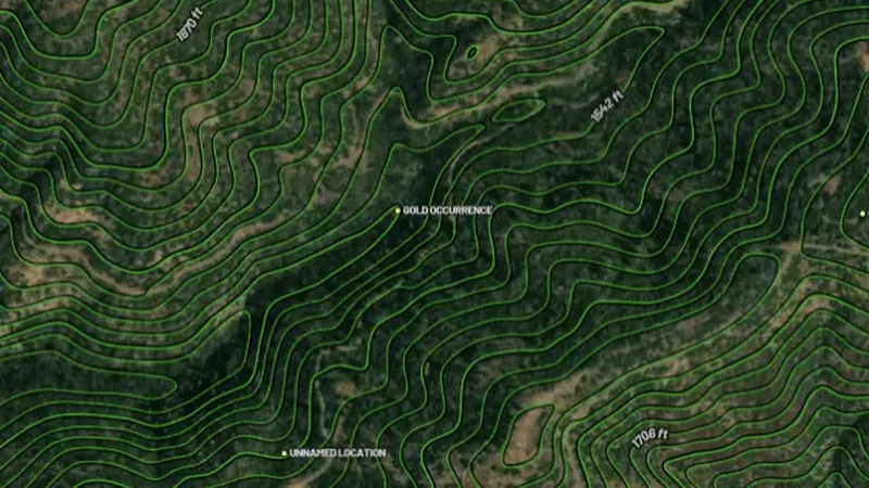
  • Contours in the Detector Maps app, Alaska© Mapbox, © Maxar
    OverlaysExplorer

    Contours

    Contour lines join places at the same height.

    Also in 15 other states in USA gold
    Read the write-up
    Contours in the Detector Maps app, Alaska© Mapbox, © Maxar

    A screen from the Detector Maps app. Satellite imagery © Mapbox, © Maxar.

    Explorer. Opens with Explorer or Pro. On the Free plan it works inside your one free area of 250 km².

    Open in the app

    This layer works the same way in 16 places in USA gold, so its full write-up, legend and plan are on one page.

    Read the full write-up

    Source in Alaska

    Data provided by the U.S. Geological Survey (USGS), the Alaska Division of Geological & Geophysical Surveys (DGGS), the Alaska Department of Natural Resources (DNR), Bureau of Land Management (BLM), U.S. Forest Service (USFS), and ReportAll USA (Licensed), licensed under USGS Public Domain and other applicable licenses USGS Public Domain
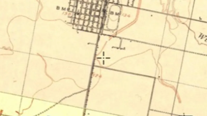
  • Historic USGS Topo Maps in the Detector Maps app, Alaska© Mapbox, © Maxar
    OverlaysExplorer

    Historic USGS Topo Maps

    Historical maps show how an area was recorded in an earlier period.

    Also in 15 other states in USA gold
    Read the write-up
    Historic USGS Topo Maps in the Detector Maps app, Alaska© Mapbox, © Maxar

    A screen from the Detector Maps app. Satellite imagery © Mapbox, © Maxar.

    Explorer. Opens with Explorer or Pro. On the Free plan it works inside your one free area of 250 km².

    Open in the app

    This layer works the same way in 16 places in USA gold, so its full write-up, legend and plan are on one page.

    Read the full write-up

    Source in Alaska

    Data provided by the U.S. Geological Survey (USGS), the Alaska Division of Geological & Geophysical Surveys (DGGS), the Alaska Department of Natural Resources (DNR), Bureau of Land Management (BLM), U.S. Forest Service (USFS), and ReportAll USA (Licensed), licensed under USGS Public Domain and other applicable licenses USGS Public Domain
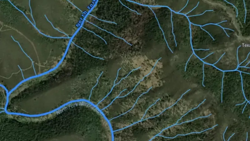
    Filters in the app

    Era filter

    Draws from zoom 0.

Terrain+™ LiDAR

2
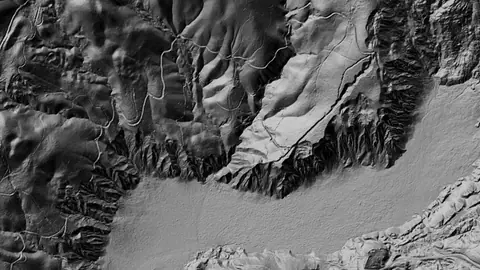
  • Terrain+™ Analysis in Alaska, drawn over satellite imagery© Mapbox, © Maxar
    Terrain+™ LiDARPro

    Terrain+™ Analysis

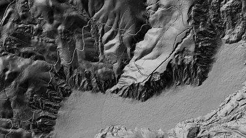
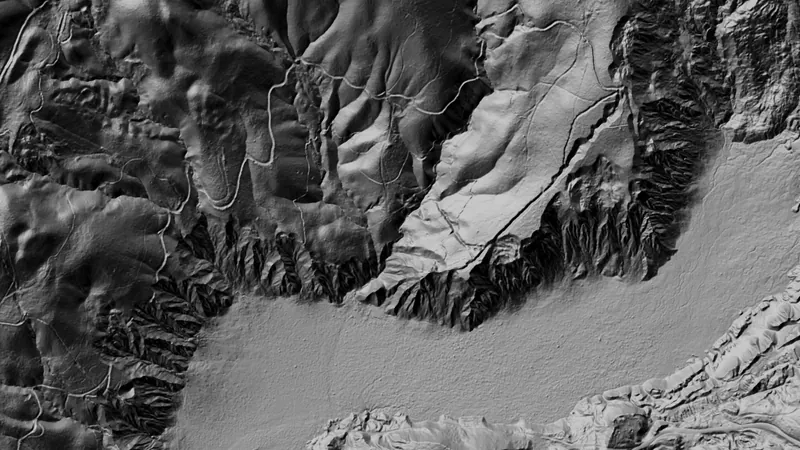
    Outline an area of any shape up to 3 miles across over USGS 1 m lidar and see the ground full screen as a 3D surface, with a VE slider to raise or flatten it. Any layer can be draped over it. It shows Dynamic LiDAR™, turned on as it is built, and its LiDAR button sets Dynamic LiDAR™'s look on the model and the map alike: hillshade, slope, local relief, sky view and openness, multi-scale relief, VAT, red relief, Multi-Light PCA or the SVF/LRM Composite, each with settings to bring out the features you are after. Save a model with the button beside the X to keep it on the phone for 30 days and open it from the Terrain+™ LiDAR menu in the field, without a connection.

    Also in 15 other states in USA gold
    Read the write-up
    Terrain+™ Analysis in Alaska, drawn over satellite imagery© Mapbox, © Maxar

    Terrain+ builds a 3D model of an outlined area and shows Dynamic LiDAR on it. This is that Dynamic LiDAR look (Malakoff Diggins, California (sample: no Alaska render, see note)), not a 3D screenshot. Satellite imagery © Mapbox, © Maxar.

    Pro. Opens with Pro.

    Open in the app

    This layer works the same way in 16 places in USA gold, so its full write-up, legend and plan are on one page.

    Read the full write-up

    Source in Alaska

    Data provided by the U.S. Geological Survey (USGS), the Alaska Division of Geological & Geophysical Surveys (DGGS), the Alaska Department of Natural Resources (DNR), Bureau of Land Management (BLM), U.S. Forest Service (USFS), and ReportAll USA (Licensed), licensed under USGS Public Domain and other applicable licenses USGS Public Domain
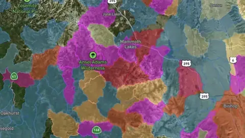
  • Dynamic LiDAR™ in Alaska, drawn over satellite imagery© Mapbox, © Maxar
    Terrain+™ LiDARPro

    Dynamic LiDAR™

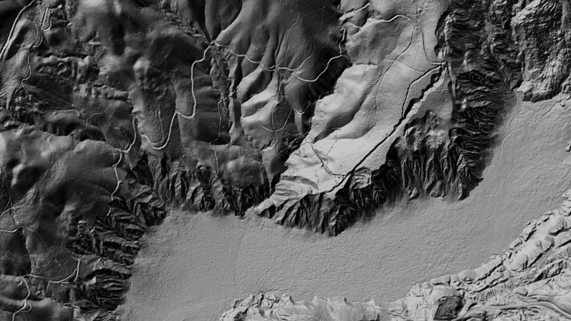
    Dynamic LiDAR™ draws the USGS's 1 m lidar over the map on the phone as you move, from zoom 11 in, in any of Terrain+™'s relief renderings (hillshade, slope, local relief, sky view and openness, multi-scale relief, VAT and red relief), Multi-Light PCA or the SVF/LRM Composite.

    Also in 15 other states in USA gold
    Read the write-up
    Dynamic LiDAR™ in Alaska, drawn over satellite imagery© Mapbox, © Maxar

    Dynamic LiDAR draws the USGS 1 m lidar. No Alaska tile drew at the eight places tried (Fairbanks, Anchorage, Hatcher Pass, Girdwood, Hope, Juneau, Sitka, Nome), so this is the same engine over California. Satellite imagery © Mapbox, © Maxar.

    Pro. Opens with Pro.

    Open in the app

    This layer works the same way in 16 places in USA gold, so its full write-up, legend and plan are on one page.

    Read the full write-up

    Source in Alaska

    Data provided by the U.S. Geological Survey (USGS), the Alaska Division of Geological & Geophysical Surveys (DGGS), the Alaska Department of Natural Resources (DNR), Bureau of Land Management (BLM), U.S. Forest Service (USFS), and ReportAll USA (Licensed), licensed under USGS Public Domain and other applicable licenses USGS Public Domain
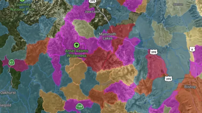
    Draws from zoom 11.

Sources

Where the data comes from.

Every card names its source. The sources named on this page are:

  • Data provided by the U.S. Geological Survey (USGS), the Alaska Division of Geological & Geophysical Surveys (DGGS), the Alaska Department of Natural Resources (DNR), Bureau of Land Management (BLM), U.S. Forest Service (USFS), and ReportAll USA (Licensed), licensed under USGS Public Domain and other applicable licenses USGS Public Domain
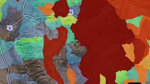
Satellite imagery © Mapbox, © Maxar. Layer data from the sources named on each card.

Plans

What the pills mean.

Every layer shows the plan that opens it. The free plan never runs out. Prices are shown once, here.

Free

Open on every plan, forever. Includes gold records.

Explorer

Opens every base layer, and offline maps for the areas you choose. $59.99 a year or $7.99 a month.

Pro

Dynamic LiDAR and Terrain+ 3D models. Property boundaries with landowner names. Claim alerts. $99.99 a year or $11.99 a month.

7-day free trial on yearly plans · Nothing charged until it ends · Cancel anytime.

Prices are in US dollars.

Satellite imagery © Mapbox, © Maxar. Layer data from the sources named on each card.

Get Detector Maps

Plan the next trip tonight.

Free to download on iPhone and Android.

On iPhone? Get it on the App StoreOn Android? Get it on Google Play

Free to download on iPhone and Android.

7-day free trial on yearly plans · Nothing charged until it ends · Cancel anytime.

Scan with your phone camera to get the app
Start free trialOpen the web map

On your phone: App Store · Google Play

7-day free trial on yearly plans · Nothing charged until it ends · Cancel anytime.

Or open the web map

The Detector Maps support inbox is staffed by Matt and Tom, the two brothers who built it. Contact us

Scan with your phone camera to get the app